This website uses cookies to ensure you get the best experience on our website. Learn more
Linggarjati Natural Park

Linggarjati Natural Park


Attraction Location
Linggarjati Natural Park Videos

Linggarjati Indah - Kuningan, Jawa Barat
#mataair #alami #gopro3

GAK MAHAL HALAL LIBURAN OBYEK WISATA LINGGARJATI INI MILIK PEMERINTAH
GAK MAHAL HALAL LIBURAN OBYEK WISATA LINGGARJATI INI MILIK PEMERINTAH
Objek wisata LInggajati ini merupakan lahan wisata yang di pihak ketigakan ataw lebih dikenal dengan pengontrakan. Melihat tatanan hukum dan ketentuan, lahan ini milik peemrintah daerah yang informasinya, di kelolakan oleh perorangan tanpa pernah membukitkan surat perjanjian terbuka kepada publik.
Pertanyaannya, Kenapa sampai Puluhan tahun kerjasama pemda dengan perorangan ini tak terbuka ???
With an area of 11.5 hectares, it is designated as Nature Tourism Park (TWA) based on the Decree of the Minister of Agriculture Number: 53 / Kpts / Um / 2/1975 dated 17-2-1975. Astronomically located between 6 degrees 47 ° '- 6 degrees 58 ° LS and 108 degrees 30 ° - 108 degrees 30 ° east.
Linggarjati Nature Park is there are several kinds of flora and fauna that would certainly be an interesting tour to visit with your family. Flora that exist among them bunbungu, pairs, kiara, lemo, jamuju and Kiacret. These types of flora grow well and most have become tall and large trees and soothing eyes that look.
The diameter of the existing tree trunk has reached half a meter or more and the height of the branch free branch has reached approximately 10 meters. This is what makes the tourists feel comfortable because the atmosphere will be more shady.
Existing Facilities In Linggarjati Nature Park
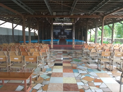
It has been provided at the Linggarjati Nature Park facility which includes a large parking area providing comfort for visitors, toilets, mosques, restaurants and meeting halls. In addition, in this area there are also facilities that will add excitement while on vacation. The facility is a swimming pool, children's playground, fishing, outbound arena, and hills and trees to relax.
If you want to relax and want to spend the night, here has also provided lodging that makes you feel comfortable. The price offered is also quite diverse, all depending on the facility you choose. Starting from the affordable price is also there.
The Beauty of Linggarjati Nature Park
Linggarjati Nature Park is one of the natural attractions located in Linggarjati, Kuningan regency, West Java, which is only around 500 meters from Linggarjati Agreement Text Building. Linggarjati Agreement itself is the result of negotiations on the Indonesian nation with the Dutch in 1946 that you must have learned in school.
Linggarjati Nature Park is a vast forest called the starting point of climbing to Mount Ciremai. Since 1924 this location is a side apart from the location of the protected forest of Mount Ciremai which was decided by the Dutch government. However, on February 17, 1975 this location was decided as a Natural Parks (TWA) by the Minister of Agriculture.
Linggarjati Nature Park has a beautiful natural scenery and beautiful, lots of tourists who visit this place as a location for bsrliburan with family. There is also an artificial lake that has been equipped with a duck boat that you can try with your family.
Photo Hunting in Linggarjati Nature Tourism Area
For those of you who love to take pictures, do not forget to bring your camera equipment. Because guaranteed you would love to capture your photos here. Beautiful scenery you can shoot using your camera lens.
You can also take pictures of selfie with an artificial lake background. Do not miss the moment when you are visiting Linggarjati Nature Park. There used to be mobile photographers who rent out photo services, but now no longer exists. Maybe because visitors now have a lot of phones that have a camera.
Lots of photo spots that you can make the object to take pictures. No wonder if a lot of young men who take pictures selfie ria in this tourist area. This place is also often used as a pre-wedding place for people who will get married.
terima kasih atas perhatian dalam menonton aksi atau video yang kami tayangan. Jangan Lupa untuk komentar dan klik subscribe

Lihat Ini Dulu Sebelum Mendaki Ke Gunung Ciremai
Gunung Ciremai yang memiliki ketinggian 3.078 meter dari permukaan laut ini merupakan atap tertinggi di Jawa Barat. Selain menjadi incaran bagi para pendaki karena keindahan panoramanya, gunung ini juga punya jalur yang menantang sehingga meninggalkan pengalaman tersendiri bagi setiap orang yang pernah menapaki kakinya di gunung ini. Namun, di balik itu semua, Gunung Ciremai yang tergolong gunung merapi ini menyimpan banyak kisah mistis yang menyelimuti gunung ini. Terutama kisah keangkerannya yang semakin santer dibicarakan karena banyaknya kaum urban yang tertarik untuk menjelajah gunung.Berikut adalah daftar gunung di pulau jawa
Gunung di jawa tengah :
gunung merapi (gunung paling aktif)
gunung merbabu
gunung prau
gunung sindoro
gunung sumbing
gunung lawu (tempat alvi hilang)
gunung ungaran
gunung andong
dll
Gunung di jawa timur :
gunung semeru (tertinggi di pulau jawa)
gunung arjuno (gunung angker)
gunung buthak
gunung piramid (tempat hilangnya thoriq)
gunung raung (gunung dengan trek tersulit)
gunung argopuro (gunung dengan jalur terpanjang)
gunung welirang
gunung pundak
gunung bromo (wisata alam indah)
gunung anjasmoro
gunung wilis
gunung atau bukit panderman
dll
Gunung di jawa barat :
Gunung ciremai
gunung gede pangrango
gunung papandayan
gunung cikurai
gunung tangkuban prahu
gunung guntur
gunung salak
gunung patuha
gunung galunggung
gunung malabar
gunung sunda
dll

Video Puncak Gunung Ciremai Dramatik Dari Udara
Video udara puncak gunung ciremai yang sangat jarang dilihat dan indah
Kepala Taman Nasional Se Indonesia Belajar Ke Ciremai

Kabupaten Kuningan Provinsi Jawa Barat #Kuningan #JawaBarat #Sunda
RESERVASI RENTAL MOBIL ONLINEThere are lots of destinations in Kuningan that worth to be visited, those destinations are divided into some categories like:
In Natural tourism, it has, Talaga Remis, Linggarjati natural park, Darma dam, Sangkanhurip, Sitonjul village, Sidomba waterfall, Cilengkrang waterfall, Palutungan & Putri waterfall, and Ngelay waterfall.
In cultural tourism, there is Linggarjati and Cipari archaeological park.
Kuningan also has forest tourism objects like, Setianegara and Jabranti village.
On pilgrimage tourism it has Cibulan, Goa Maria and Balong keramat darmaloka.
#kuningan #jawabarat
Minggu, 10 Juli 2016
RENTAL MOBIL PLUS SUPIR PALING MURAH DI INDONESIA
DALAM KOTA : RP 300.000/HARI
LUAR KOTA DALAM PROVINSI : RP 350.000/HARI
WEEKEND (JUMAT,SABTU,MINGGU)
DALAM KOTA : RP 350.000/24jam
LUAR KOTA DALAM PROVINSI:RP 400.000/24jam
CP EKA: 085868788968 / 082227594993
Whasapp 085200181358 BB 56A91945
#pekalongan #batang #pemalang #tegal #brebes #rentalmobil #sewamobil #carter #indonesia
ANNAEKATRANS
Layanan Transportasi Nyaman, Murah dan Terpercaya.
MELAYANI :
1. SEWA MOBIL + SUPIR
~ AVANZA / XENIA
~ INNOVA
~ ERTIGA
~ ELF (LONG / SHORT)
~ HIACE
~ BUS (MEDIUM / BIG)
2. SEWA SKUTER / MOTOR
3. PAKET WISATA DALAM & LUAR NEGERI
4. AGEN TRAVEL (RESERVASI BOOKING ONLINE)
5. MENERIMA TITIPAN PAKET
JL.GEBANG BLOK D NO.4 GAMER KOTA PEKALONGAN
Call/WA : 085868788968 / 085200181358 / 082227594993

MENGGAPAI PUNCAK GUNUNG CIREMAI | Atap Tertinggi Jawa Barat
#ciremai #gunungciremai #tamannasionalgunungciremaiAtap Jawa Barat, sebuah predikat yang tentu mempunyai arti bagi saujana ini. Berdiri menjulang setinggi sekitar 3.078 mdpl, Gunung Ciremai yang berada dalam kawasan pelestarian alam Taman Nasional Gunung Ciremai semakin menegaskan betapa Indonesia, memang sangat layak disebut surganya para pecinta gunung api dunia. Dan para pendaki gunung pada umumnya.
Seperti raksasa kerucut sempurna. Gunung Ciremai, megah terlihat di tengah dataran rendah kawasan pantai utara Jawa Barat bagian timur. Sang kerucut raksasa ini terlihat memesona dan selalu menjadi pusat perhatian siapapun yang melintas menuju timur Jawa atau sebaliknya. Menjadi titik sentral wilayah Kuningan, Cirebon, dan Majalengka.
Keberadaan Bandara Internasional Kertajati, Kabupaten Majalengka, Jawa Barat, yang mulai resmi melayani penerbangan reguler sejak 1 Juli 2018, semakin mendekatkan warga dunia dengan Taman Nasional Gunung Ciremai. Khususnya para pejalan, petualang dan pendaki gunung dari penjuru dunia.
Pesona Gunung Api Ciremai akan semakin terkenal di mata dunia. Jejak sejarah geologinya yang tersimpan akan menjadi potensi geowisata yang tidak ternilai. Menarik para petualang untuk menyambanginya jauh lebih lama lagi.
Berbagai potensi wisata, mulai dari sejarah, landskape alam, atraksi dan fenomena alam, sejarah bahkan nilai arkeologi serta jejak geologi yang dimilikinya harus terus digali dan diinventarisir yang kemudian memberi manfaat bagi masyarakat sekitar. Baik secara ekononomi maupun sosial budayanya.
Wisata minat khusus seperti kegiatan pendakian gunung yang telah menjadi life style atau gaya hidup di dunia, termasuk di Indonesia, tentu akan semakin berimbas dengan Taman Nasional Gunung Ciremai. Terlebih dengan semakin mudahnya akses transportasi dan informasi.
Sejak menyandang status sebagai Taman Nasional Gunung Ciremai (TNGC) tahun 2004, pesonanya kian memancar. Tutupan hutannya nyaris sempurna hingga mendekati puncak. Atraksi dan fenomena alam sisa-sisa erupsi pada masa lalu melahirkan kisah geologinya yang menarik dan menakjubkan. Sebagian diantarnya seperti kawah ganda, kawah “burung”, goa walet dan batu lawang serta dua puncak bukit lava. Termasuk bentukan beberapa menara serta relief alami di dalam kawah dan dindingnya yang seolah bercerita perjalanan panjang sang gunung api yang juga berkaitan erat dengan cerita wali songo sebagaimana dituturkan masyarakat sekitar.
Ciremai yang agung telah menjadi rumah yang nyaman bagi satwa dan subur bagi tumbuhan. Diantaranya tiga satwa kunci TNGC yaitu Macan Tutul Jawa, Surili dan Elang Jawa. Mereka terus tumbuh dan berkembang baik di sini.
Diharapkan para mitra pengelola pariwisata pendakian Gunung Ciremai sudah semakin siap dengan semakin meningkatnya kehadiran para petualang ataupun pendaki, termasuk dari mancanegara.
Pada akhirnya Ciremai sebagai gunung api pengalir peradaban di utara tatar Pasundan pun telah siap menyambut ramah para jiwa-jiwa petualang dari seluruh penjuru negeri untuk menjelajahi setiap lekuk tubuhnya. Berdiri di atap tertinggi Jawa Barat. Bagian dari Taman Nasional Gunung Ciremai yang bernilai penting bagi alam, peradaban dan manusia.
BALAI TAMAN NASIONAL GUNUNG CIREMAI
[teks © Harley B. Sastha, video © Dany Prabowo ©Ari.Ask , Pilot Drone ©Anza Suseno | 10/7/2018]

KAMAR Delegasi Indonesia dan Belanda di Gedung Perundingan Linggarjati, Mewah Zaman Itu?
KAMAR Delegasi Indonesia dan Belanda di Gedung Perundingan Linggarjati, Mewah Zaman Itu? di Desa Lingarjati Kuningan Jawa Barat.
Trip Mt. Ciremai (Atap Jawa Barat) #3078Mdpl
Hanya mengabadikan, menjadi kenangan..Sony #XperiaZ5

Wisata Air Terjun Curug Putri | Palutungan, Kuningan, Jawa Barat 2014
Putri WaterfallCereme Volcano Foothill Plateau Forest
Nature Tourism
Video At :
Palutungan Forest Tourists Area,
Kuningan Regency, West Java Province,
Republic Of Indonesia
Taken On :
Wednesday 30 July 2014
By :
Suwarto Kartasoewarto Wartonet Production
The Independent Non Commercial - No Profit Channel
For Natural Documentary Tourism Videos
With Oldies & Nostalgia Love Songs
HDMI AVCHD SDHC Blu-Ray 2DConvertedTo3D Full HDV 1080i Wide Screen 16:9 Dolby Surround Digital 5.1

TEMPAT WISATA CIREBON | MAJALENGKA | KUNINGAN
Tempat wisata trend cirebon kuningan majalengka IndramayuTempat wisata yang lagi hits kekinian
Tempat wisata baru
Wisata alam cirebon kuningan majalengka
Tempat wisata indah
Cirebon

Kukang yang Terjerat Kembali di Lepaskan di Ciremai

Wilujeung sumping di kota kuningan provinsi jawa barat !!!
Kabupaten kuningan suasana yang sejuk dan penduduknya ramai#Kuningan #Jawabarat #Ciawigebang #Profil #Sctv #Rcti #TransTv #TvOne

Gunung Ciremai via LinggarJati #3078MDPL
KAU BERI DUA SENYUM,AKAN KU LANJUTKAN PERJALANANVideo Dokumentasi Pendakian Gunung Ciremai Via Linggarjati Kuningan.. #semangatsahabat

Review Hotel Montana Kuningan Jawa Barat
Hallo Sobat Kang Basyir,Menginaplah di Montana Hotel apabila Anda ingin beristirahat di hotel yang tenang dan nyaman di Kuningan. Hotel yang berada di Jalan Raya Panawuan Nomor 128, Cigandamekar, Kuningan, Jawa Barat ini berjarak sekitar 1,5 jam berkendara dari Bandara Internasional Kertajati. Hotel ini membagi 90 kamarnya ke berbagai tipe yang dapat disesuaikan dengan kebutuhan Anda.
Hotel yang berjarak sekitar 45 menit berkendara dari Stasiun Prujakan, Cirebon ini menawarkan Anda kamar yang dilengkapi AC, TV, alat pembuat teh dan kopi, lemari es, teras, dan shower. Sejumlah fasilitas publik seperti area parkir, layanan kamar, dan akses Wi-Fi gratis juga tersedia untuk menunjang kenyamanan Anda. Hotel yang menyediakan kolam renang anak dan kolam renang outdoor ini juga dilengkapi dengan fasilitas meeting yang bisa Anda manfaatkan untuk kebutuhan bisnis.
Selama menginap di Montana Hotel, Anda juga bisa mengunjungi beragam atraksi menarik. Salah satunya adalah Gunung Ciremai National Park yang berjarak sekitar 1,5 jam berkendara. Anda juga bisa mengunjungi Telaga Cicerem yang berjarak sekitar 40 menit berkendara. Jika ingin belanja oleh-oleh, Anda bisa mampir ke Pusat Oleh-Oleh Teh Diah Kuningan yang hanya berjarak sekitar 14 menit berjalan kaki.
#surveihotelmontana
#kangbasyirtravel
#reviewhotel

The Mountain Recreation Park - 20151227134247
The Mountain Recreation Park
Pendakian Ciremai jalur Linggarjati
Mount Ciremai National Park is located in the province of West Java, Indonesia. Some endemic or endangered flora and fauna are being protected in this national park, such as Pinus merkusii, Castanopsis javanica, Fragraera blumii, Villubrunes rubescens, Macaranga denticulatan, Lithocarpus sundaicus, Elaeocarpus stipularis, Ardisia cymosa, Platea latifolia, Leopard, Javan Muntjac, Zaglossus bruijni[citation needed], Javan Surili, Javan Hawk-eagle and Python species.Mount Ceremai is adminis tratively included in the three districts, namely Kabupaten Cirebon, Kuningan and Majalengka Regency, West Java Province. The geographical position of the peak is located at 6 ° 53 '30 latitude and 108 ° 24' 00 east, with an altitude of 3078 m above sea level. This mountain is the highest mountain in West Java.
This mountain has a double crater. Western crater radius is truncated by a crater 400 m east of radius 600 m. At an altitude of about 2900 m on the southern slope there are ex-point eruption Gowa called Swallow.
The name is derived from the word mountain Ciremei (Phyllanthus acidus, a type of plant small shrubs with rada sour fruit), but it is often called Ciremei, a symptom hiperkorek due to the many place names in the region Pasundan that use the prefix 'ci-' for the naming of places.
Eruption G. Ciremei recorded since 1698 and the last time occurred in 1937 with the shortest rest interval of 3 years and the longest 112 years. Three eruptions in 1772, 1775 and 1805 occurred in the central crater, but did not cause significant damage. The eruption of sulfur steam and copy the new fumaroles at the center of the crater wall occurred in 1917 and 1924. On June 24, 1937 - January 7, 1938 freatik eruption in the central crater and radial cracks. Distribution of ash reached an area of 52.500 square km (Kusumadinata, 1971). In 1947, 1955 and 1973 tectonic earthquake that struck the southwestern G. Ciremei presumably related to the fault structure trending southeast - northwest. Genesis quake damaged several buildings in the area west of Maja and Talaga G. Ciremei occurred in 1990 and 2001. Tremors felt in the east to the Village Cilimus G. Ciremei.
The forests are still experienced at Mount Ceremai stay longer at the top. On the bottom, especially in areas which in the past managed as production forests Perhutanioffice, these forests have been converted to pine forest (Pinus), or shrubs, which are formed due to repeated fires and grazing. Now, most of the forests under the height... m above sea level. managed in the form of agro-forestry (agro forests) by the local community.
Furthermore, based on micro-climatic conditions, LIPI (2001) distinguish Ciremei environment on the plateau of wet and dry highlands. For example, land in the Resort Cigugur (Palutungan point, the southern mountains) including micro-wet climates, and at the Resort Setianegara (lane north Linggarjati) micro-dry climates.
In general, Palutungan hiking paths (in the south of Mount Ciremei), Apuy (west), and Linggarjati (east) in succession from bottom to top going through the settlement lands, fields and gardens of the population, mixed pine forest plantations with field plots in forest areas (intercropping), and the last mountain rain forest. While in line Padabeunghar (north) of vegetation were combined with shrubs that are associated with desert weeds. In the fourth route, the rain forest Mountains can be divided again into three types namely lower Montana forests, upper Montana forests and vegetation subalpine around the crater. Except subalpine vegetation that is alleged to have disturbed by fire, mountain rain forests of this condition is still relatively intact, and appeared green canopy stratification is quite clear.
The diversity of wildlife in Ciremei quite high. The research group of nature lovers Lawalata IPB in April 2005 to get 12 species of amphibians (frogs and toads), various types of reptiles such as chameleons, geckos, lizards and snakes, more than 95 species of birds, and more than 20 species of mammals.
Mount Ciremei is highpoints West Java (3078 mdpl), can seen clearly by passengers trains or vehicles other generally along lane Pantura approximately Cirebon. To toward peak Ciremei there 3 pathway can pursued namely lane Majalengka lane Palutungan and lane Linggarjati.
Path Linggarjati represents most precipitous and heaviest, but this pathway represents most frequently traveled climbers. Mount Ceremai has distinctive compared mountains else in Java. This mountain situated far apart from mountain other higher and sides is the sea Java. Trip to G. Ceremai can begins from terminals Cirebon, climbed bus toward Kuningan and alight at Cilimus.
From Cilimus we connect with vehicles colt or ojek to village Linggarjati. In villages Linggarjati, we can staying at Hotel Linggarjati. From hotels Linggarjati we continue journey through buildings Scriptwriter westward until approximately Balai Desa Linggarjati.