This website uses cookies to ensure you get the best experience on our website. Learn more
The Best Attractions In Ahsahka


Ahsahka is a small Unincorporated community located in Clearwater County, Idaho, United States, and is close to the Dworshak Dam. Ahsahka is located at 46°30′08″N 116°19′27″W.
Continue reading...
From Wikipedia, the free encyclopedia.
Continue reading...
From Wikipedia, the free encyclopedia.
The Best Attractions In Ahsahka
-
1. Dworshak Dam and Reservoir Ahsahka
Dworshak Dam is a concrete gravity dam in the western United States, on the North Fork Clearwater River in Clearwater County, Idaho. The dam is located approximately four miles northwest of Orofino and impounds the Dworshak Reservoir for flood control and hydroelectricity generation. With a height of 717 feet , Dworshak is the third tallest dam in the United States and the tallest straight-axis concrete dam in the Western Hemisphere. Construction of the dam by the U.S. Army Corps of Engineers began in 1966 and was completed in 1973.
From Wikipedia, the free encyclopedia. -
2. Hells Canyon National Recreation Area Lewiston Idaho
Hells Gate State Park is a public recreation area located on the southern edge of Lewiston, Idaho, at the Snake River's downstream entrance to Hells Canyon, the deepest canyon in North America. The state park was created by the U.S. Army Corps of Engineers to mitigate the construction of the Lower Granite Dam; the Idaho Department of Parks and Recreation began leasing the site in 1973. The park's 960 acres offer trails for hiking, mountain biking, and horseback riding as well as opportunities for camping, picnicking, fishing, boating, swimming, and taking jet boat trips into the canyon. The park sits at the lowest elevation of any Idaho state park, at 733 feet above sea level.
From Wikipedia, the free encyclopedia. -
4. Hells Gate State Park Lewiston Idaho
Hells Gate State Park is a public recreation area located on the southern edge of Lewiston, Idaho, at the Snake River's downstream entrance to Hells Canyon, the deepest canyon in North America. The state park was created by the U.S. Army Corps of Engineers to mitigate the construction of the Lower Granite Dam; the Idaho Department of Parks and Recreation began leasing the site in 1973. The park's 960 acres offer trails for hiking, mountain biking, and horseback riding as well as opportunities for camping, picnicking, fishing, boating, swimming, and taking jet boat trips into the canyon. The park sits at the lowest elevation of any Idaho state park, at 733 feet above sea level.
From Wikipedia, the free encyclopedia.


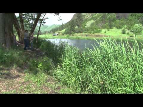
Ahsahka Videos
Welcome to Kamiah, Idaho
More info:Facebook:
The Kamiah Valley, also known as the Upper Clearwater Valley, is a vacationer's paradise for recreation, adventure, whitewater rafting and many other fun family activities. Learn about Lewis & Clark, the Nez Perce tribe, or enjoy fishing, hunting and hiking.

Best Time To Visit or Travel to Boise, Idaho
Short video slide show describing when the best time to visit this city based on weather and climate.Some photos courtesy of Wikimedia Commons and others purchased from canstockphoto.com.

The Clearwater Region of North Central Idaho | Visit Idaho
North Centrial Idaho's Clearwater Region is profiled| Follow Visit Idaho |
► Instagram:
► YouTube:
► Facebook:
► Twitter:
► Pinterest:
► Idaho is full of adventures. We ask that when you visit that you act as a good steward of the land and practice responsible recreation. For more information about Leave No Trace principles, please click here:

Salmon Falls Reservoir Idaho RV Dry Camping
RV Solar Panel Kits on Amazon:Follow me on Facebook!
Want to support this channel? Links below:
My RV Books:
My Etsy shop, with $5 digital RV Lifestyle PDF eBooks and photos of my travels:
My Cafe Press shop, RV tee shirts and more!
The big WeBoost for mobile 4G internet! Amazon:
The small WiFi Booster Amazon:
Get Woodall's RV repair book:
120W portable solar panel on Amazon:

Elk River Back Country Byway | Visit Idaho
This is an all natural, no frills, individualistic and unpretentious pathway through rural North Central Idaho. It is a 57 mile route to rugged backcountry adventure for travelers of all types. The route can be accessed from the Northwest Passage (US 12) at Orofino or from the west at Bovill, ID at the junction of State Highway (SH) 8 and SH 3.| Follow Visit Idaho |
► Instagram:
► YouTube:
► Facebook:
► Twitter:
► Pinterest:
► Idaho is full of adventures. We ask that when you visit that you act as a good steward of the land and practice responsible recreation. For more information about Leave No Trace principles, please click here:

North Central Idaho Travel Association - Lewis Clark Valley Region
Explore the Lewis Clark Valley Region of North Central Idaho
2009-05-23 #01Lewiston ID Speeder trip - Lewiston Yard to Transfer
On May 23rd through 25th Lewiston Idaho was the hub of speeder activity as Pacific Railcar Operators hosted the fourth annual Memorial Day Weekend motorcar excursion on three branches of the former Camas Prairie Railroad (CSP) on May 23, 24 and 25, 2009. This was in combination with a second excursion on the Eastern Washington Gateway Railroad on May 27 and 28.The set-on location was at the headquarters of the Great Northwest Railroad in East Lewiston, Idaho.
The following videos are of Saturday where we ran the Great Northwest Riparia branch - Lewiston to Riparia and return, for a total of 144 miles. This video begins in the Lewiston Yard, travels through the storage tracks, across the large drawbridge across the Clearwater River near the confluence of the Clearwater and the Snake Rivers, then approaching the Idaho-Washington State line.
The drawbridge was originally constructed in 1906 by the Oregon-Washington Railway and Navigation Co. (now UP). It used to be a manually operated swing bridge until just after WWII. When the dams were constructed on the Snake River, the bridge was raised in place 9 feet, the swing span converted to a fixed span, two spans in the middle were removed and the current lift span and tower spans were constructed. The lift span was replaced in the mid-70's.
After exiting the drawbridge we turn west and will arrive shortly at Transfer.
Special thanks to Jim Morefield for providing some historical and technical data printed here.

Silver Linings: The Early Days of Idaho's Silver Valley
Stretching 40 miles through the heart of northern Idaho, Silver Valley is a time capsule of the West. Deep within its valley walls, empires rose...and sometimes fell. Beyond the ribald tales, you will discover how the region's past has shaped what the Silver Valley is today...and why it still resonates with the spirit of those who sought its Silver Linings.
May 19, 2014, Felt to Tetonia, Idaho
Still going South on highway 32 and dodging as many rain showers as we can. We did get into a few of them, but no biggie. Came up on a local farmer driving his tractor down the highway talking on his damn cell phone. We got into Tetonia and got hit with a small rain shower.
North Central Idaho Travel Association - Salmon/Hells Canyon Region
Explore the Salmon Hells Canyon Region of North Central IdahoNear By Places
-
Almo
-
American Falls
-
Arco
-
Ashton
-
Athol
-
 Bancroft
-
Banks
-
Blackfoot
-
Bliss
-
Boise
-
Bonners Ferry
-
Bruneau
-
Buhl
-
Cataldo
-
Challis
-
Cocolalla
-
Coeur d'Alene
-
Coolin
-
Donnelly
-
Driggs
-
Fish Haven
-
Fort Hall
-
Garden Valley
-
Glenns Ferry
-
Grand View
-
Hagerman
-
Hailey
-
Hayden Lake
-
Idaho City
-
Idaho Falls
-
Inkom
-
Island Park
-
Ketchum
-
Kooskia
-
Kuna
-
Lava Hot Springs
-
Lewiston
-
Lowman
-
Lucile
-
Mackay
-
Marsing
-
McCall
-
Melba
-
Meridian
-
Moscow
-
Nampa
-
New Meadows
-
North Central Idaho
-
North Idaho
-
Plummer
-
Pocatello
-
Ponderay
-
Post Falls
-
Rexburg
-
Rigby
-
Riggins
-
Ririe
-
Sagle
-
Saint Maries
-
Salmon
-
Sandpoint
-
Southeast Idaho High Country
-
Southern Idaho
-
Southwest Idaho
-
Spalding
-
Stanley
-
Star
-
Sun Valley
-
Sweet
-
Thatcher
-
Twin Falls
-
Victor
-
Wallace
-
White Bird
-
Worley
-
Yellowstone Teton Territory


