This website uses cookies to ensure you get the best experience on our website. Learn more
The Best Attractions In Rohtas


Rohtas district is one of the thirty-eight districts of Bihar state, India. It came into existence when Shahabad District was bifurcated into Bhojpur & Rohtas in 1972. The Rohtas district is a part of Patna Division, and it has an area of 3850 km² , a population of 2,448,762 , and a population density of 636 persons per km². The languages spoken in this area are Bhojpuri, Hindi and English.
Continue reading...
From Wikipedia, the free encyclopedia.
Continue reading...
From Wikipedia, the free encyclopedia.
The Best Attractions In Rohtas
-
3. Maa Tara Chandi Temple Sasaram
Maa Tara Chandi Temple is a Hindu temple dedicated to Maa Shakti or Maa Durga, located in Sasaram, Bihar, India. It is one of the 52 Shakti Peetha.
From Wikipedia, the free encyclopedia. -
4. Tomb of Sher Shah Suri Sasaram
The tomb of Sher Shah Suri is in the Sasaram town of Bihar state, India. The tomb was built in memory of Emperor Sher Shah Suri, a Pathan from Bihar who defeated the Mughal Empire and founded the Suri Empire in northern India. He died in an accidental gunpowder explosion in the fort of Kalinjar on 10th day of Rabi' al-awwal, A.H. 952 or 13 May 1545 AD.
From Wikipedia, the free encyclopedia. -
5. Dhua Kund Sasaram
The Dhua Kund are a pair of waterfalls situated in the city of Sasaram. These two waterfalls have been utilised as a hydroelectricity source with the capacity to generate 50–100 MW of electricity.
From Wikipedia, the free encyclopedia.


Rohtas Videos

Rohtas | Bihar Tourism | Top Places to Visit in Bihar | Incredible India
Rohtas | Bihar Tourism | Top Places to Visit in Bihar | Incredible Indiaeabhiruchi India -
eabhiruchi -
eabhiruchi masti -
Edufun -

Bihar tourism | shershah Suri tomb | Maa Tara Chandi temple|| Rohtas fort & manjhar khund || sasaram
voice :- priyanshi rajvideo editor:- Anurag Kumar(ak_adlstrope)
please subscribe
NALANDA TOURIST
my facebook page is :-
please like and comment
and suggestions
Instagram:-
Twitter:-
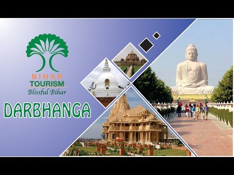
Darbhanga | Bihar Tourism | Top Places to Visit in Bihar | Incredible India
Darbhanga | Bihar Tourism | Top Places to Visit in Bihar | Incredible Indiaeabhiruchi India -
eabhiruchi -
eabhiruchi masti -
Edufun -

Gaya | Bihar Tourism | Top Places to Visit in Bihar | Incredible India
Gaya | Bihar Tourism | Top Places to Visit in Bihar | Incredible Indiaeabhiruchi India -
eabhiruchi -
eabhiruchi masti -
Edufun -

Rohtang pass | manali to rohtang pass | manali rohtang pass
Rohtang Pass – An Incredible ParadiseBest place to visit check out Here - #indiatravel
This awesome place is Rohtang Pass which is so famous that it attracts around 2 lakh tourists every year. It is a spell-binding route through which every nature lover wishes to traverse with enthusiasm. The fabulous pass is situated at a distance of 51 km from Manali and is on the Manali-Leh highway.
This path is usually open to tourists from May to October (this may vary depending on weather conditions). So, if you are planning a trip to Manali, don’t ever miss this ravishing beauty which beckons every nature lover from far and wide.
Rohtang Tunnel and snow point
Two major attractions of Rohtang pass are Rohtang tunnel and Snow point. Since this pass is very important, Indian government wanted to access it throughout the entire year. So a tunnel of 8.5 km was built in the year 2010 and it is called as Rohtang tunnel. It reduces the travel time of Rohtang pass to five hours.
Snow Point is a vast stretch of snow on the way where local vendors set up their stalls. This location is not a fixed one. As the season changes Snow Point also changes. Snow Point is the place to eat, play, have fun with yak rides, and snow mobile rides or even to stroll along.
rohtang pass permit online 2018 Link Below :-
Checkout Latest Travel Accessories of 2018 that you should Buy if You are Traveling.
G-Force Grey Travel Pillow -
Styleys Toiletry Bag Travel Organizer Cosmetic Bags Makeup Bag -
Super Smooth Sleep Mask and Blind Fold -
Sun Brand Black Folding Umbrell -
Victorinox Rally Red Swiss Army Knife -
Samsonite Black Luggage Lock -
Saco Organizer Bag for all Gadgets, Small Electronics and Accessories -
Game of Thrones, House Stark Direwolf Shape Keyring & Keychain -
Rohtang pass | rohtang pass manali | rohtang pass 2018 | rohtang pass road | manali rohtang pass | rohtang pass snowfall | rohtang pass in june | manali tourism | manali tour | manali to rohtang pass | rohtang pass permit | hill station in india | india travel | manali trip | rohtang pass highway tunnel | rohtang pass snow point | Rohtang Tunnel

Bihar Tourist Places - Top 7 Cities to See in Bihar Tour
Bihar is famous as the land of monasteries, which is well evident from its name itself, which is derivation of the word “Vihara”. This state offers a pleasant escape from the boring monotony of city life. The temples, monasteries, mosques, and mausoleums of Bihar boast of a great historic past and are the most famous tourist places as well which are related to the all major religions of India like Buddhism, Jainism, Hinduism Sikhism and Islam. The holy river Ganga flows wide and deep through the enriched plains of Bihar, and passes through the middle of the state from west to east..Here are the best cities to visit in Bihar:
1. Gaya
2. Nalanda
3. Munger
4. Vaishali
5. Patna
6. Rajnagar
7. Madhubani
Make the most of you tour with this Bihar Trip Guide. You may also be interested in:
Famous Tourist Places In Goa:
Famous Tourist Places In Delhi:
Famous Tourist Places In Manali:
Famous Tourist Places In Mumbai:
**********************************************
Song Credits-
Song Credit - Song: 3rd Prototype - Together [NCS Release] Music provided by NoCopyrightSounds.
Video Link:
Download/Stream:

Best places to visit
Best places to visit - Alwar (India) Best places to visit - Slideshows from all over the world - City trips, nature pictures, etc.
Travel VLOG: Sialkot in Pakistan
Sialkot city tour and attractions in this vLOG from Pakistan. I visited this city in December 2016 and have recorded all the activities there. Sialkot is famous for production of Sports equipment and Accessories. You can checkout all of my travel stories on my blog:
Top 40 Famous Places of Rawalpindi & Islamabad | You Should Visit
#TourismLovers #TopBestPlaces #Rawalpindi #Islamabad #PakistanRawalpindi (Punjabi, Urdu: راولپِنڈى, Rāwalpiṇḍī), commonly known as Pindi (Punjabi: پِنڈی), is a city in the Punjab province of Pakistan. Rawalpindi is adjacent to Pakistan's capital of Islamabad, and the two are jointly known as the twin cities on account strong social and economic links between the cities. Rawalpindi is the fourth-largest city in Pakistan by population, while the larger Islamabad Rawalpindi metropolitan area is the country's third-largest metropolitan area.
Rawalpindi is located on the Pothohar Plateau, known for its ancient Buddhist heritage, especially in the neighbouring town of Taxila - a UNESCO World Heritage Site. The city was destroyed during the invasion of Mahmud of Ghazni before being taken over by Gakhars in 1493. In 1765, the ruling Gakhars were defeated as the city came under Sikh rule, and eventually became a major city within the Sikh Empire based in Lahore. The city fell to the British Raj in 1849, and in 1851 became the largest garrison town for the British Indian Army. Following the partition of British India in 1947, the city became home to the headquarters of Pakistan Army hence retaining its status as a major military city.
Construction of Pakistan's new purpose-built national capital city of Islamabad in 1961 led to greater investment in the city, as well as a brief stint as the country's capital immediately before completion of Islamabad. Modern Rawalpindi is socially and economically intertwined with Islamabad, and the greater metropolitan area. The city is also home to numerous suburban housing developments that serve as bedroom-communities for workers in Islamabad. As home of Benazir Bhutto International Airport, and with connections to the M-1 and M-2 motorways, Rawalpindi is a major logistics and transportation centre for northern Pakistan. The city is also home to historic havelis and temples, and serves as a hub for tourists visiting Rohtas Fort, Azad Kashmir, Taxila and Gilgit-Baltistan
Islamabad ( Urdu: اسلام آباد ) is the capital city of Pakistan located within the federal Islamabad Capital Territory. With a population of 2.01 million, it is the 9th largest city of Pakistan, while the larger Islamabad-Rawalpindi metropolitan area is the third largest in Pakistan with a population exceeding four million. The city is the political seat of Pakistan and is administered by the Islamabad Metropolitan Corporation, supported by the Capital Development Authority (CDA).
Islamabad is located in the Pothohar Plateau in the northeastern part of the country, between Rawalpindi District and the Margalla Hills National Park to the north. The region has historically been a part of the crossroads of Punjab and Khyber Pakhtunkhwa with the Margalla Pass acting as the gateway between the two regions.
Islamabad was built during the 1960s to replace Karachi as Pakistan's capital. The city's master-plan divides the city into eight zones, including administrative, diplomatic enclave, residential areas, educational sectors, industrial sectors, commercial areas, and rural and green areas. The city is known for the presence of several parks and forests, including the Margalla Hills National Park and Shakarparian Park. The city is home to several landmarks, including the Faisal Masjid, the largest masjid in South Asia and the fourth largest in the world. Other landmarks include the Pakistan's National Monument and Democracy Square.
Islamabad is a beta- world city; it is categorised as very high on the Human Development Index, the highest in the country. The city has the highest cost of living in Pakistan, and its population is dominated by middle and upper middle class citizens. The city is home to twenty universities, including the Quaid-e-Azam University, PIEAS, COMSATS Institute of Information Technology and NUST. The city is one of the safest in Pakistan, and has an expansive surveillance system with 1,900 CCTV cameras.

Nawada | Bihar Tourism | Top Places to Visit in Bihar | Incredible India
Nawada | Bihar Tourism | Top Places to Visit in Bihar | Incredible Indiaeabhiruchi India -
eabhiruchi -
eabhiruchi masti -
Edufun -