This website uses cookies to ensure you get the best experience on our website. Learn more
The Best Attractions In Bruceton Mills

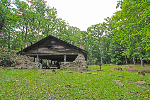

Bruceton Mills is a town in Preston County, West Virginia, United States along Big Sandy Creek. The population was 85 at the 2010 census.
Continue reading...
From Wikipedia, the free encyclopedia.
Continue reading...
From Wikipedia, the free encyclopedia.
The Best Attractions In Bruceton Mills
-
4. Ohiopyle State Park Ohiopyle
Ohiopyle State Park is a Pennsylvania state park on 19,052 acres in Dunbar, Henry Clay and Stewart Townships, Fayette County, Pennsylvania in the United States. The focal point of the park is the more than 14 miles of the Youghiogheny River Gorge that passes through the park. The river provides some of the best whitewater boating in the Eastern United States. Ohiopyle State Park is bisected by Pennsylvania Route 381 south of the Pennsylvania Turnpike. The park opened to the public in 1965, but was not officially dedicated until 1971. Ohiopyle State Park was chosen by the Pennsylvania Department of Conservation and Natural Resources and its Bureau of Parks as one of 25 Must-See Pennsylvania State Parks.
From Wikipedia, the free encyclopedia. -
6. Fallingwater Mill Run
Fallingwater is a house designed by architect Frank Lloyd Wright in 1935 in rural southwestern Pennsylvania, 43 miles southeast of Pittsburgh. The house was built partly over a waterfall on Bear Run in the Mill Run section of Stewart Township, Fayette County, Pennsylvania, located in the Laurel Highlands of the Allegheny Mountains. The house was designed as a weekend home for the family of Liliane Kaufmann and her husband, Edgar J. Kaufmann, Sr., owner of Kaufmann's Department Store. After its completion, Time called Fallingwater Wright's most beautiful job, and it is listed among Smithsonian's Life List of 28 places to visit before you die. The house was designated a National Historic Landmark in 1966. In 1991, members of the American Institute of Architects named Fallingwater the best al...
From Wikipedia, the free encyclopedia. -
7. Swallow Falls State Park Oakland Maryland
Swallow Falls State Park is a public recreation area located on the west bank of the Youghiogheny River 9 miles north of Oakland in Garrett County, Maryland, in the United States. The state park features Maryland's highest free-falling waterfall, the 53-foot Muddy Creek Falls, as well as smaller waterfalls on the Youghiogheny River and Tolivar Creek. The park is notable for its stand of old hemlock trees, some more than 300 years old, the last stand of its kind in Maryland.
From Wikipedia, the free encyclopedia. -
8. Blackwater Falls State Park Davis West Virginia
Blackwater Falls State Park is located in the Allegheny Mountains of Tucker County, West Virginia, USA. The centerpiece of the park is Blackwater Falls, a 62-foot cascade where the Blackwater River leaves its leisurely course in Canaan Valley and enters rugged Blackwater Canyon. It is among the most photographed venues in the state and appears on calendars, stationery, and advertisements. The river is named for its tannin-darkened water.
From Wikipedia, the free encyclopedia.


Bruceton Mills Videos

Incredible 400 Acre West Virginia Farm
Immaculate Farm AuctionSaturday, September 15, 2018 at Noon
Registration & Inspection will begin at 10:00 AM
600 Hileman Road Bruceton Mills, WV
A dream property featuring over 400 acres of rolling hills with a magnificent 4-bedroom, 3.5 bath home, this homestead offers country living with easy access to highways and metro areas. Just 5 minutes from the Bruceton Mills Exit of I-79, the farm also includes a large horse barn, utility and machinery barns, gently sloping pastures and wooded ground with prime hunting opportunities. Popular destinations Deep Creek Lake and Morgantown are less than 30 minutes away.
Recent Timber Appraisal of over $330,000
Extremely Well-Maintained 4 Bedrooms, 3.5 Bath Home
3,200 +/- Sq. Ft.
Master En Suite features Double Vanities, Walk in Closet, & Deck with Serene Views
All Bedrooms have Private Full Bathrooms
Newly Renovated Kitchen with Stainless Steel Appliances, Granite Countertops, Custom Built Cabinetry with Applied Carvings, Island, & Pantry
Elevated Dining Area with Spectacular Views of Foliage
Open Concept Living Room features Stone Fireplace with Tons of Natural Lighting
First Floor Laundry & Utility Room
Full Finished Walk-Up Attic
Full Partially Finished Basement with 12 Ft. Ceilings
Hardwood Floors throughout
Property to be sold fully furnished with high quality bedroom suites, living room furniture, & dining room set.
Rolling Hills & Wooded Areas
Spectacular views: views of three states (PA, MD, WV) from the highest point
The property will be offered in different combinations and as a whole.
JOE R. PYLE COMPLETE AUCTION & REALTY SERVICE
Joe R. Pyle, Broker
(888) 875-1599
5546 Benedum Drive Shinnston West Virginia 26431
joerpyleauctions.com
Joe R Pyle WV212

WV camping trip 2012
Big Bear Lake
Coopers Rock State Forest, West Virginia
Beautiful 12,000 acre Coopers Rock State Forest outside of Morgantown, WV straddles Preston and Monongalia Counties. Coopers Rock is an incredible place to mountain bike ride, rock climb, hike, look at scenic overlooks, hunt, fish, camp, and picnic and play. The north side of the park (north of I68) also includes Chestnut Ridge Park which has ponds for kids to swim, paddle boat, and fish in. The park also has camping, music shows, and playgrounds. Music by The Dave Longfellow Ensemble.
Wonder Falls West Virgina
A local hangout/swimming and diving spot in Preston County, WV on Big Sandy Creek.
The Hidden Treasures in the West Virginia Hills
A flight down the mountain at a dear friend's farm.Music credit: Bad Haggis / Rocky Road to Dublin

WV Swimming Holes Wonder Falls Devils Den
Wonder falls on Big Sandy, drove past blue hole, ended at Devils Den on the Cheat river. West Virginia swimming holes.First Song - Calvin Harris - Summer.
Second Song -Kenny Chesney - Summertime

Road Trippin - Chestnut Ridge Winery - GoToWV
Join Wild, Wonderful West Virginia and Road Trippin as they visit Chestnut Ridge Winery in Spencer, WV.Real. Mountain flavor. You'll find it here. Wild, Wonderful West Virginia.

driver view I-68 east in western Maryland approaching Cumberland, MD
This shows I-68 eastbound in western Maryland as we approach Cumberland, more particularly La Vale and exit 40, on Sunday, May 20, 2018. We started in St. Louis on the morning of May 19 and by evening Sunday had made it to La Vale where we stayed at a nice Best Western of which I will be posting video soon. This video also shows how steep a 6% grade is on a U.S. interstate highway. We are in our 2010 Toyota Camry with about 110k on it. Descending this 6% grade was amazing--I loved it. The exit where we leave I-68 is also the one for U.S. 220 Truck.
Billy Goat Trail - Section A
The Billy Goat Trail is a popular hiking trail that follows a route between the C&O Canal towpath and the Potomac River within the Chesapeake and Ohio Canal National Historical Park in Great Falls, Maryland.The YMCA Triangle Club first laid out the Billy Goat Trail in 1919. It has three sections, named Section A, B, & C, connected together by a towpath that follows along the canal.
Section A is the northernmost and longest section of the trail at 1.7 miles. It is also the most popular.
Most of Section A is on Bear Island and covers rough and rocky terrain, including a steep climb along a cliff face next to the Potomac River's Mather Gorge. At other points in the trail, hikers are required to scramble over and around huge boulders.
Section A is the most technical, strenuous, and dangerous of the three sections. The area gets about 400 rescue calls every year and about three to four people die.
The rescue calls are usually from falls, heat exhaustion, animal encounters and cardiac events, but most of the calls and deaths every year are water related.
The Billy Goat Trail meets the Potomac River and several points along its path. The water appears calm but is notoriously deceptive. No swimming is allowed.
It takes most hikers about 2.5 hours to complete the Section A loop. Hikers who access Section A usually do it from the Great Falls Tavern Visitor Center inside the park. There is $10 fee to enter the park.
Section B is 1.4 miles and considered a moderate hike. The southernmost Section C is 1.6 miles and considered an easy hike. Those sections are best accessed from Carderock, Maryland. Parking there is free, but fills up quickly.
All sections of the Billy Goat Trail are marked with light blue trail blazes on trees and boulders, but the sections do not connect directly with each other. They are connected to each other by the C&O Canal towpath. The end of Section C is about 2.75 miles southeast along the towpath from the starting point of Section A.
Chesapeake and Ohio Canal and towpath extend along the Potomac River from Georgetown, Washington, D.C., to Cumberland, Maryland, a distance of 184.5 miles. The original plans had the canal and path extending from the Chesapeake Bay to Pittsburgh, Pennsylvania.
It operated from 1831 until 1924 its principal cargo was coal from the Allegheny Mountains to Washington, D.C.
Previously the area was used by George Washington’s Potowmack Company to improve the navigability of the Potomac River. His company built five skirting canals around the Great Falls on the Virginia side of the Potomac before it was incorporated by the Chesapeake and Ohio.
The canal, path and its structures slowly fell in to disrepair after the 1870s, when the Baltimore and Ohio Railroad became a cheaper, more reliable alternative way to transport cargo. The area deteriorated even more after the major floods of 1924 and 1936.
Flooding is frequent in this watershed and can be caused by heavy rain, rapid snowmelt, and hurricanes. All water from Potomac and Shenandoah rivers passes over Great Falls before it enters the Chesapeake Bay.
The water narrows dramatically just below the Falls and creates a chokepoint that regularly floods the basin and surrounding area.
This flooding plays an important role in Great Falls’ ecosystem. Plants depend on floods to spread fertile sediment and transport seeds and without those waters, the unique cliff top ecosystems would not exist.
Plants such as sticky goldenrod and bluestem grass thrive in the harsh cliff top environment. These attract over 150 different species of birds as well as whitetail deer, fox, turtles, coyotes, bats, and snakes.
In 1961 the area was designated as a National Monument by President Dwight D. Eisenhower in order to preserve the neglected remains of the Chesapeake and Ohio Canal and many of its original structures. By 1971 it was named a National Historic Park.
Both the National Park Service and volunteer associations extensively restored the area and continue to maintain it today. Sections of the canal and path are listed on the National Register of Historic Places.
Today the canal and its towpath along with the adjacent Potomac offers activities including running, hiking, biking, fishing, boating and kayaking, as well as rock climbing in certain locations. A small portion of the towpath near Harpers Ferry National Historical Park even doubles as a section of the Appalachian Trail.
For those wanting to experience the entire path, The National Park Service maintains a number of hiker/biker campsites, about every few miles. Each site has potable water, picnic tables, fire pits, and latrines.
Some text from Wikipedia and the National Park Service
Music by Andy G. Cohen and found at the Free Music Archive
Near By Places
-
Albright
-
Ansted
-
Arthurdale
-
Beckley
-
Berkeley Springs
-
Bluefield
-
Bramwell
-
Buckhannon
-
Camp Creek
-
Cass
-
Charles Town
-
Clifftop
-
Daniels
-
Durbin
-
Eastern Panhandle
-
Elkins
-
Fairmont
-
Falling Waters
-
Flat Top
-
French Creek
-
Gauley Bridge
-
Glen Jean
-
Green Bank
-
Hacker Valley
-
Hatfield-McCoy Mountains
-
Hedgesville
-
Inwood
-
Kingwood
-
Lost River
-
Lyburn
-
Marlinton
-
Martinsburg
-
Matewan
-
Mathias
-
Maxwelton
-
Metro Valley
-
Mid-Ohio Valley
-
Moundsville
-
Mount Nebo
-
Mountain Lakes
-
Mountaineer Country
-
Mullens
-
New River and Greenbrier Valley
-
Newell
-
Nitro
-
Northern Panhandle
-
Parkersburg
-
Parsons
-
Philippi
-
Pipestem
-
Potomac Highlands
-
Romney
-
Ronceverte
-
Rowlesburg
-
Scarbro
-
Seneca Rocks
-
Shady Spring
-
Shepherdstown
-
Snowshoe
-
Sophia
-
South Charleston
-
Summersville
-
Thomas
-
Triadelphia
-
Westover