This website uses cookies to ensure you get the best experience on our website. Learn more
The Best Attractions In Highbridge


The Best Attractions In Highbridge
-
3. Stonehenge Amesbury
Stonehenge is a prehistoric monument in Wiltshire, England, 2 miles west of Amesbury. It consists of a ring of standing stones, with each standing stone around 13 feet high, 7 feet wide and weighing around 25 tons. The stones are set within earthworks in the middle of the most dense complex of Neolithic and Bronze Age monuments in England, including several hundred burial mounds.Archaeologists believe it was constructed from 3000 BC to 2000 BC. The surrounding circular earth bank and ditch, which constitute the earliest phase of the monument, have been dated to about 3100 BC. Radiocarbon dating suggests that the first bluestones were raised between 2400 and 2200 BC, although they may have been at the site as early as 3000 BC.One of the most famous landmarks in the United Kingdom, Stoneheng...
From Wikipedia, the free encyclopedia. -
 4. Hawk Conservancy Trust Weyhill
The Hawk Conservancy Trust is a bird park and conservation charity that cares for and displays birds of prey. It is located in Weyhill, Hampshire, England, near to the A303 road and the town of Andover. Founded as a zoo by local farmer Reg Smith and his wife Hilary, the park was incorporated as the Hawk Conservancy Trust in 2002. It is also the site of the National Bird of Prey Hospital, a veterinary hospital that takes in injured birds of prey.
From Wikipedia, the free encyclopedia. -
5. Rhossili Bay Rhossili
Rhossili is a small village and community on the southwestern tip of the Gower Peninsula in Swansea. It is within an area designated as the first Area of Outstanding Natural Beauty in the United Kingdom. The village has a community council and is part of the Gower parliamentary constituency, and the Gower electoral ward.
From Wikipedia, the free encyclopedia. -
6. Wookey Hole Caves Wookey Hole
Wookey Hole Caves are a series of limestone caverns, a show cave and tourist attraction in the village of Wookey Hole on the southern edge of the Mendip Hills near Wells in Somerset, England. The River Axe flows through the cave. It is a Site of Special Scientific Interest for both biological and geological reasons. Wookey Hole cave is a solutional cave, one that is formed by a process of weathering in which the natural acid in groundwater dissolves the rocks. Some water originates as rain that flows into streams on impervious rocks on the plateau before sinking at the limestone boundary into cave systems such as Swildon's Hole, Eastwater Cavern and St Cuthbert's Swallet; the rest is rain that percolates directly through the limestone. The temperature in the caves is a constant 11 °C . Th...
From Wikipedia, the free encyclopedia. -
7. Cheddar Gorge Cheddar
Cheddar Gorge is a limestone gorge in the Mendip Hills, near the village of Cheddar, Somerset, England. The gorge is the site of the Cheddar show caves, where Britain's oldest complete human skeleton, Cheddar Man, estimated to be over 9,000 years old, was found in 1903. Older remains from the Upper Late Palaeolithic era have been found. The caves, produced by the activity of an underground river, contain stalactites and stalagmites. The gorge is part of a Site of Special Scientific Interest called Cheddar Complex.Cheddar Gorge, including the caves and other attractions, has become a tourist destination. In a 2005 poll of Radio Times readers, following its appearance on the 2005 television programme Seven Natural Wonders, Cheddar Gorge was named as the second greatest natural wonder in Brit...
From Wikipedia, the free encyclopedia. -
8. Avebury Stone Circle Avebury
Avebury is a Neolithic henge monument containing three stone circles, around the village of Avebury in Wiltshire, in southwest England. One of the best known prehistoric sites in Britain, it contains the largest megalithic stone circle in the world. It is both a tourist attraction and a place of religious importance to contemporary pagans. Constructed over several hundred years in the Third Millennium BC, during the Neolithic, or New Stone Age, the monument comprises a large henge with a large outer stone circle and two separate smaller stone circles situated inside the centre of the monument. Its original purpose is unknown, although archaeologists believe that it was most likely used for some form of ritual or ceremony. The Avebury monument is a part of a larger prehistoric landscape con...
From Wikipedia, the free encyclopedia.
Highbridge Videos

Places to see in ( Highbridge - UK )
Places to see in ( Highbridge - UK )Highbridge is a small market town situated on the edge of the Somerset Levels near the mouth of the River Brue. It is in the County of Somerset, and is approximately 20 miles north east of Taunton, the county town of Somerset. being situated approximately 7 miles (11.3 km) north of Bridgwater, the district's administrative centre. Highbridge closely neighbours Burnham-on-Sea, forming part of the combined parish of Burnham-on-Sea and Highbridge and shares a town council with the resort town. In the 2001 census the population was 5,986. In the 2011 census the population of the town was included in the ward of Highbridge and Burnham Marine, which totalled 7,555.
There is archaeological evidence of occupation around the Highbridge area at least as far back as the Roman period. A bridged crossing over the River Brue at this location has existed since the 14th century and it has always been an important crossing on the route from Bristol to the South West. The town that sprung up around this crossing takes it name from the bridge. An older name for the local manor was Huish a contraction of the phrase Huish jaxta altum pontem (next to a high bridge). There are historical references to a wharf at this site and to usage of the river as part of the drainage plan for the Somerset Levels by the Monks of Glastonbury.
Highbridge grew in importance as a regional market and industrial town during the latter half of the 19th century and the early part of the 20th century. Important employers included the livestock and cheese market, Highbridge Wharf, Buncombe's Steamrollers, and the Somerset & Dorset Joint Railway rail works, which closed in 1930 with the loss of 400 jobs. Heavy industry and transport declined in Highbridge after the Second World War as the Wharf proved too small for the newer generation of ships, with the last cargo of timber arriving in 1948 and the wharf was closed to shipping the following year, and commercial freight moved away from the railways. Since the 1970s close proximity to the M5 motorway has driven a growth in light industry and in the town's commuter population.
Highbridge was historically a hamlet and chapelry in the large ancient parish of Burnham. It briefly became a separate civil parish in 1894, but in 1896 the civil parish was abolished and divided between the new civil parishes of North Highbridge and Burnham Without. The town had by then expanded south of the River Brue into the parish of Huntspill, and in 1896 the new parish of South Highbridge was carved out of Huntspill parish. North Highbridge and South Highbridge together formed the Highbrige Urban District. The 1931 census listed a population of 2,585. In 1933 the Urban District was abolished and merged into Burnham-on-Sea Urban District. In the 1974 local government reforms, this became a civil parish within the new District of Sedgemoor. The civil parish is now known as Burnham-on-Sea and Highbridge, with a single town council.
Highbridge was originally the seaward terminus of the Glastonbury Canal and the Somerset Central Railway. The Canal was established first and was designed to improve drainage along the River Brue. It was also designed to create a trade link between Glastonbury and the sea. A new straight channel, with a clyce (the local name for a sluice), which runs from the present day tidal gates to the location of the current station, was cut in 1801 and the original course of the river was as the site for of Highbridge Wharf. The Canal opened in 1833 and while initially successful it later suffered from financial and engineering problems. Only the 1801 clyce remains of the Glastonbury Canal at Highbridge.
Highbridge town centre clusters around the crossroads formed by Church Street and Market Street. At their meeting point is a roundabout which marks the location of the town's original three-faced town clock. A modern concrete replacement clock, also with three faces and topped with the town's coat of arms stood in nearby Jubilee Gardens until its replacement with a more traditional four-faced clock in 2012.
( Highbridge - UK ) is well know as a tourist destination because of the variety of places you can enjoy while you are visiting Highbridge . Through a series of videos we will try to show you recommended places to visit in Highbridge - UK
Join us for more :

Places to see in ( Wells - UK )
Places to see in ( Wells - UK )Wells is a cathedral city and civil parish in the Mendip district of Somerset, on the southern edge of the Mendip Hills. Wells has had city status since medieval times, because of the presence of Wells Cathedral. Often described as England's smallest city, Wells is second only to the City of London in area and population, though not part of a larger urban agglomeration.
Wells is named from three wells dedicated to Saint Andrew, one in the market place and two within the grounds of the Bishop's Palace and cathedral. A small Roman settlement surrounded them, which grew in importance and size under the Anglo-Saxons when King Ine of Wessex founded a minster church there in 704. The community became a trading centre based on cloth making and Wells is notable for its 17th century involvement in both the English Civil War and Monmouth Rebellion. In the 19th century, transport infrastructure improved with stations on three different railway lines. However, since 1964 the city has been without a railway link.
The cathedral and the associated religious and medieval architectural history provide much of the employment. The city of Wells has a variety of sporting and cultural activities and houses several schools including The Blue School, a state coeducational comprehensive school that was founded in 1641, and the independent Wells Cathedral School, that was founded possibly as early as 909 and is one of the five established musical schools for school-age children in the United Kingdom. The historic architecture of the city has also been used as a location for filming an increasing number of movies and television programmes.
Wells lies at the foot of the southern escarpment of the Mendip Hills where they meet the Somerset Levels. The hills are largely made of carboniferous limestone, which is quarried at several nearby sites. In the 1960s, the tallest mast in the region, the Mendip UHF television transmitter, was installed on Pen Hill above Wells, approximately 2 miles (3.2 km) from the centre the city.
Wells is situated at the junction of three numbered routes. The A39 goes north-east to Bath and south-west to Glastonbury and Bridgwater. The A371 goes north-west to Cheddar and east to Shepton Mallet. The B3139 goes west to Highbridge and north-east to Radstock. Wells is served by FirstGroup bus services to Bristol, Bristol Temple Meads, Bath, Frome, Shepton Mallet, Yeovil, Street, Bridgwater, Taunton, Burnham on Sea and Weston-super-Mare, as well as providing some local service. Some National Express coach services call at Wells. The bus station is in Princes Road. The Mendip Way and Monarch's Way long-distance footpaths pass through the city, as does National Cycle Route 3.
Webberbus connects Wells to Weston-super-Mare, Highbridge and Bridgwater.
Wells had two stations which were closed by the Beeching Axe in the 1960s such as Wells (Tucker Street) railway station and Wells (Priory Road) railway station. The nearest head of steel is located on the East Somerset Railway at Mendip Vale. Wells and Mendip Museum includes many historical artefacts from the city and surrounding Mendip Hills. Wells is part of the West Country Carnival circuit.
( Wells - UK ) is well know as a tourist destination because of the variety of places you can enjoy while you are visiting the city of Wells . Through a series of videos we will try to show you recommended places to visit in Wells - UK
Join us for more :
Places to see in ( Corsham - UK )
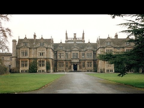
Places to see in ( Corsham - UK )Corsham is a historic market town and civil parish in west Wiltshire, England. It is at the south-western edge of the Cotswolds, just off the A4 national route, which was formerly the main turnpike road from London to Bristol, 28 miles (45 km) southwest of Swindon, 20 miles (32 km) southeast of Bristol, 8 miles (13 km) northeast of Bath and 4 miles (6 km) southwest of Chippenham. Corsham is close to the county borders with Bath and North East Somerset and South Gloucestershire.
Corsham was historically a centre for agriculture and later, the wool industry, and remains a focus for quarrying Bath Stone. It contains several notable historic buildings, such as the stately home of Corsham Court. During the Second World War and the Cold War, it became a major administrative and manufacturing centre for the Ministry of Defence, with numerous establishments both above ground and in the old quarry tunnels. The early 21st century saw growth in Corsham's role in the film industry. The parish includes the villages of Gastard and Neston, which is at the gates of the Neston Park estate.
Corsham appears to derive its name from Cosa's hām, ham being Old English for homestead, or village. The town is referred in the Domesday book as Cosseham; the letter 'R' appears to have entered the name later under Norman influence (possibly caused by the recording of local pronunciation), when the town is reported to have been in the possession of the Earl of Cornwall. Corsham is recorded as Coseham in 1001, as Cosseha in 1086, and at Cosham as late as 1611 (on John Speed's map of Wiltshire). The Corsham area belonged to the King in Saxon times, the area at the time also had a large forest which was cleared to make way for further expansion.
Corsham's small town centre includes the Martingate Centre, a late 20th-century retail development, which also houses offices and a small teaching facility for Wiltshire College, a further education institution. The stately home of Corsham Court can also be found in the town centre. Standing on a former Saxon Royal Manor, it is based on an Elizabethan manor home from 1582. Since 1745, it has been part of the Methuen estate. The house has an extensive collection of Old Masters, rooms furnished by Robert Adam and Thomas Chippendale, and parks landscaped by Capability Brown and Humphry Repton. The house is open to the public all year round excluding December and is famed locally for its peacocks, which freely wander about the streets. The owner of Corsham Court in the mid-seventeenth century was the commander of the Parliamentarian New Model Army in Wiltshire; his wife built what came to be known as the Hungerford Almshouses in the centre of town. Corsham is the site of the disused entrance to Tunnel Quarry, which used to be visible off Pockeridge Drive.
Pickwick Manor was noted by architectural historian Nikolaus Pevsner as an unusually impressive example of a late 17th century manor house, having remnants of a 14th-century wing. Beechfield is a late Georgian house in Middlewick Lane. It was extended in the early 1970s to provide additional accommodation. Gurneys House is another building of historical significance which now provides hotel accommodation and a restaurant. It also caters for special events such as weddings.
Middlewick House was occupied by Camilla Parker Bowles (now The Duchess of Cornwall) and her first husband between 1986 and 1995, when it was bought by Nick Mason of Pink Floyd. Pickwick has the Two Pigs, a real ale pub which is a Grade II listed building. Hartham Park is a Georgian estate that includes a rare stické court.
Corsham is connected to Bradford on Avon by the B3109 road, to Melksham by the B3353, and to Chippenham and Bath by the A4 Bath Road, a former turnpike from London to Bristol. Corsham is connected to Bradford on Avon by the B3109 road, to Melksham by the B3353, and to Chippenham and Bath by the A4 Bath Road, a former turnpike from London to Bristol.
( Corsham - UK ) is well know as a tourist destination because of the variety of places you can enjoy while you are visiting the city of Corsham . Through a series of videos we will try to show you recommended places to visit in Corsham - UK
Join us for more :

Places to see in ( Glastonbury - UK )
Places to see in ( Glastonbury - UK )Glastonbury is a town and civil parish in Somerset, England, situated at a dry point on the low-lying Somerset Levels, 23 miles south of Bristol. The town of Glastonbury is in the Mendip district. Glastonbury is less than 1 mile (2 km) across the River Brue from Street, which is now larger than Glastonbury.
Evidence from timber trackways such as the Sweet Track show that the town has been inhabited since Neolithic times. Glastonbury Lake Village was an Iron Age village, close to the old course of the River Brue and Sharpham Park approximately 2 miles (3 km) west of Glastonbury, that dates back to the Bronze Age. Centwine was the first Saxon patron of Glastonbury Abbey, which dominated the town for the next 700 years. One of the most important abbeys in England, it was the site of Edmund Ironside's coronation as King of England in 1016. Many of the oldest surviving buildings in the town, including the Tribunal, George Hotel and Pilgrims' Inn and the Somerset Rural Life Museum, which is based in an old tithe barn, are associated with the abbey. The Church of St John the Baptist dates from the 15th century.
The town became a centre for commerce, which led to the construction of the market cross, Glastonbury Canal and the Glastonbury and Street railway station, the largest station on the original Somerset and Dorset Joint Railway. The Brue Valley Living Landscape is a conservation project managed by the Somerset Wildlife Trust and nearby is the Ham Wall National Nature Reserve.
Glastonbury has been described as a New Age community which attracts people with New Age and Neopagan beliefs, and is notable for myths and legends often related to Glastonbury Tor, concerning Joseph of Arimathea, the Holy Grail and King Arthur. Joseph is said to have arrived in Glastonbury and stuck his staff into the ground, when it flowered miraculously into the Glastonbury Thorn. The presence of a landscape zodiac around the town has been suggested but no evidence has been discovered. The Glastonbury Festival, held in the nearby village of Pilton, takes its name from the town.
The Tribunal was a medieval merchant's house, used as the Abbey courthouse and, during the Monmouth Rebellion trials, by Judge Jeffreys. The octagonal Market Cross was built in 1846 by Benjamin Ferrey. The George Hotel and Pilgrims' Inn was built in the late 15th century to accommodate visitors to Glastonbury Abbey.
The Somerset Rural Life Museum is a museum of the social and agricultural history of Somerset, housed in buildings surrounding a 14th-century barn once belonging to Glastonbury Abbey. The Chalice Well is a holy well at the foot of the Tor, covered by a wooden well-cover with wrought-iron decoration made in 1919.
Just a short distance from the Chalice Well site, across a road known as Well House Lane, can be found the White Spring, where a temple has been created in the 21st century. The building now used as the White Spring Temple was originally a Victorian-built well house, erected by the local water board in 1872.
The Glastonbury Canal ran just over 14 miles (23 km) through two locks from Glastonbury to Highbridge where it entered the Bristol Channel in the early 19th century. The nearest railway station is at Castle Cary but there is no direct bus route linking it to Glastonbury. There are convenient bus connections between Glastonbury and the railway stations at Bristol Temple Meads (over an hour travelling time) and at Taunton. The main road in the town is the A39 which passes through Glastonbury from Wells connecting the town with Street and the M5 motorway.
( Glastonbury - UK ) is well know as a tourist destination because of the variety of places you can enjoy while you are visiting the city of Glastonbury . Through a series of videos we will try to show you recommended places to visit in Glastonbury - UK
Join us for more :
Places to see in ( Axminster - UK )
Places to see in ( Axminster - UK )Axminster is a market town and civil parish on the eastern border of the county of Devon in England, some 28 miles from the county town of Exeter. The town of Axminster is built on a hill overlooking the River Axe which heads towards the English Channel at Axmouth, and is in the East Devon local government district.
Axminster gave its name to a type of carpet. An Axminster-type power loom is capable of weaving high quality carpets with many varying colours and patterns. While Axminster carpets are made in the town by Axminster Carpets Ltd, this type of carpet is now manufactured all over the world.
Axminster railway station was opened on 19 July 1860, with the London and South Western Railway (LSWR) offering direct services between Central Station in Exeter and Yeovil. The station building was designed by the LSWR's architect Sir William Tite in mock gothic style. In 1903, the branch line from Axminster to Lyme Regis was opened. This branch line was closed with the Beeching cuts, in the 1960s. One engine has been preserved on the Bluebell Line, in Sussex, while the station was dismantled and reconstructed at New Alresford, on the Watercress Line, in Hampshire. Axminster is the southern starting point of the Taunton Stop Line, a World War II defensive line consisting of pillboxes and anti-tank obstacles, which runs north to the Somerset coast near Highbridge.
The hamlet of Abbey Gate lies to the south of the town near the A35 and A358 intersection. Other villages within 5 miles (8.0 km) of Axminster include Chardstock, Colyford, Combpyne, Dalwood, Hawkchurch, Kilmington, Membury, Musbury, Raymond's Hill, Rousdon, Shute, Smallridge, Tytherleigh, Uplyme and Whitford.
Alot to see in ( Axminster - UK ) such as :
Axminster Museum
Blackdown Hills Area of Outstanding Natural Beauty
East Devon Area of Outstanding Natural Beauty
East Devon Way
Forde Abbey
Jurassic Coast
Lambert's Castle
Loughwood Meeting House
Musbury Castle
Shute Barton
( Axminster - UK ) is well know as a tourist destination because of the variety of places you can enjoy while you are visiting the city of Axminster . Through a series of videos we will try to show you recommended places to visit in Axminster - UK
Join us for more :

Experience Cultural Lincoln
Experience cultural Lincoln: food, drink, heritage, art, music, and more.Take in the flavours of Lincolnshire, explore 2,000 years of history, enjoy a night out in the city - Lincoln is perfect for a city break.
Visit for more details of the featured things to do, places to eat and drink, and places to stay:
Bunty's Tea Room
Steep Hill
Lincoln Cathedral
Lincoln Castle
Goodies of Lincoln
The Usher Gallery
The Collection
Stokes High Bridge Cafe
DoubleTree by Hilton
The Strait and Narrow
The Rogue Saint
Brayford Waterfront
Video created by Wall Breaker Productions (

Scandinavia
Recorded July 29 - August 11, 2011My Baltic cruise on the Emerald Princess.
Video Contents:
0:00:19 Emerald Princess Embarkation (Copenhagen)
0:01:41 Copenhagen sail away
0:09:04 Sailing into Oslo, Norway
0:23:36 Akershus Castle and Fortress
0:25:39 Scandinavian Star Memorial
0:26:47 City Hall
0:34:43 Nobel Peace Prize Center
0:35:20 National Theatre
0:36:14 Ministry of Foreign Affairs
0:36:26 7th of June Square
0:38:46 The Royal Palace
0:41:10 University of Oslo
0:43:04 Norwegian Parliament
0:45:09 Old City Hall
0:47:39 Oslo Opera House
0:49:44 Karl Johans Street
0:51:10 Gustav Vigeland Sculpture Park
1:00:04 Holmenkollbakken Ski Jump
1:04:38 Viking Ship Museum
1:08:08 Oslo sail away
1:20:53 Sail into Aarhus, Denmark
1:25:20 Begin Jutland shore excursion
1:26:37 Silkeborg, Denmark
1:30:09 Sky Mountain
1:33:58 Bryrup, Denmark
1:35:38 Vintage train ride to Vrads
1:41:53 Aarhus sail away
1:47:05 Arrive Warnemünde, Germany
1:50:50 Boat ride to Schwerin Castle
1:56:03 Schwerin Castle
2:01:14 City of Schwerin, Germany
2:09:27 Arrive Rostock, Germany
2:09:52 St. Mary's Church
2:13:04 Kröpeliner Straße
2:16:09 Warnemünde sail away
2:25:55 Emerald Princess Atrium (sea day)
2:27:44 Sail into Helsinki, Finland
2:29:05 Begin Finland shore excursion
2:31:42 Market Square
2:36:02 Senate Square
2:43:46 Sibelius Monument
2:45:58 The Rock Church
2:47:48 Porvoo, Finland
2:51:44 Kiiala Manor
2:54:08 Helsinki Harbour
2:55:33 Helsinki sail away
2:56:31 Sail into Stockholm, Sweden
3:00:39 Vasa Museum
3:02:35 Diplomatic area
3:04:57 Sergel's Square
3:05:32 Gustav Adolf's Square
3:07:00 Stockholm Palace
3:09:58 Stortorget
3:13:52 City Hall
3:17:01 Stockholm sail away
3:21:22 Sea day
3:21:40 Copenhagen disembarkation
3:22:01 Radisson Blu Royal Hotel
3:23:43 City Hall Square
3:24:32 Strøget
3:27:20 High Bridge Square
3:28:37 Christianborg Palace (Danish Parliament)
3:29:11 Børsen (Stock Exchange)
3:29:46 The King's New Square
3:31:23 Tivoli Gardens
3:47:39 Frederiksborg Castle
3:55:11 Fredensborg Palace
3:56:20 Kronborg Castle
4:03:35 Elsinore, Denmark
4:04:38 Kastrup Airport departure
From:

Places to see in ( Walsall - UK )
Places to see in ( Walsall - UK )Walsall is an industrial town in the West Midlands of England. It is located 8 miles north-west of the City of Birmingham and 6 miles east of the City of Wolverhampton. Historically a part of Staffordshire, Walsall is a component area of the West Midlands conurbation, and part of the Black Country. Walsall is the administrative centre of the wider Metropolitan Borough of Walsall. Neighbouring settlements in the borough include Darlaston, Brownhills, Willenhall, Bloxwich and Aldridge.
This is a list of areas in the Metropolitan Borough of Walsall, West Midlands, England.
Aldridge
Ashmore Lake
Barr Common
Bentley
Bescot
Birchills
Blakenall Heath
Bloxwich
Brownhills
Brownhills Common
Brownhills West
Butcroft
Caldmore
Catshill
Chuckery
Clayhanger
Coal Pool
County Bridge
Daisy Bank
Darlaston
Darlaston Green
Daw End
The Delves
Druid's Heath
Dudley's Fields
Fallings Heath
Fishley
Fullbrook
Gillity Village
Goscote
Harden
Hardwick
Heath End
Highbridge
High Heath
Holly Bank
King's Hill
Lane Head
Leamore
Leighswood
Little Bloxwich
Little London
Moxley
New Invention
New Town
Old Moxley
Paddock
Palfrey
Park Hall
Pelsall
Pelsall Wood
Pheasey
Pleck
Pool Green
Rough Hay
Rushall
Ryecroft
Shelfield
Shepwell Green
Shire Oak
Short Heath
Spring Bank
Streetly
Stubbers Green
Tamebridge
Vigo
Wallington Heath
Walsall
Walsall Wood
Willenhall
Woods Bank
Walsall Bus Station is made up of two smaller bus stations, Bradford Place Bus Station and St Paul's Bus Station, one being larger than the other and providing more services. Walsall railway station is situated on Station Street in the town centre and is also accessible from the Saddlers shopping centre. Walsall is extremely well connected within the UK road network as it is served by the M6 which connects the M1 motorway towards London and M74 motorway towards Glasgow.
Walsall Arboretum was officially opened on 4 May 1874 by the wealthy Hatherton family. The New Art Gallery Walsall opened in 2000. Named, as was its predecessor, the E M Flint Gallery in memory of Ethel Mary Flint, head of art at Queen Mary's Grammar School, an exhibitor at the Royal Academy, and a former mayor of Walsall, it contains a large number of works by Jacob Epstein as well as works by Van Gogh, Monet, Turner, Renoir and Constable. The large gallery space is host to temporary exhibitions.
Walsall has two museums, Walsall Museum and Walsall Leather Museum. Walsall Museum features local history objects primarily from the manufacturing trades and also has a space for temporary exhibitions, while the leather museum displays a mixture of leather goods and has recreations of leatherworkers workshops. The refurbished Sister Dora statue stands at the crossroads of Park Street and Bridge Street. Opposite this stood a locally famous concrete hippopotamus.
( Walsall - UK ) is well know as a tourist destination because of the variety of places you can enjoy while you are visiting the city of Walsall . Through a series of videos we will try to show you recommended places to visit in Walsall - UK
Join us for more :

Burnham on Sea Seafront Somerset.
Burnham-on-Sea is a large seaside town in Somerset, England, at the mouth of the River Parrett, upon Bridgwater Bay. Burnham was a small fishing village until the late 18th century, when it began to grow because of its popularity as a seaside resort.It forms part of the parish of Burnham-on-Sea and Highbridge and shares a town council with its neighbouring small market town of Highbridge. According to the 2011 census the population of the parish (i.e. including Highbridge) was 19,576, of which the populations of the wards of Burnham Central and Burnham North, which made up most of the town, totalled 13,601.
The position of the town on the edge of the Somerset Levels and moors where they meet the Bristol Channel, has resulted in a history dominated by land reclamation and sea defences since Roman times. Burnham was seriously affected by the Bristol Channel floods of 1607, with the present curved concrete wall being completed in 1988. There have been many shipwrecks on the Gore Sands, which lie just offshore and can be exposed at low tides. Lighthouses are hence prominent landmarks in the town, with the original lighthouse known as the Round Tower built to replace the light on the top of the 14th century tower of St Andrews Church. The 110-foot (34-metre) pillar or High Lighthouse and the low wooden pile lighthouse or Lighthouse on legs on the beach were built to replace it. The town's first lifeboat was provided in 1836 by the Corporation of Bridgwater.
A stone pier was built in 1858 by the Somerset Central Railway. Soon afterwards, in 1860, a steamer service to Wales was inaugurated, but it was never a commercial success, and ended in 1888. Burnham-on-Sea railway station was the terminus of the Burnham branch of the Somerset and Dorset Joint Railway. It opened in 1858, closed to scheduled passenger traffic in 1951, and stopped being used for excursions in 1962. The former Great Western Railway station is now known as Highbridge and Burnham. A second pier, built of concrete between 1911 and 1914, is claimed to be the shortest pier in Britain.
Intro Music:-
Cinematic (Sting) by Twin Musicom is licensed under a Creative Commons Attribution license (
Artist:
Main Music:-
Friendly Day by Kevin MacLeod is licensed under a Creative Commons Attribution license (
Source:
Artist:

Historic Hastings, MN - Tour with GlobalHarbinger
Join me as we explore the city of Hastings in Minnesota. We'll discover the downtown, travel to see the site of the old Spiral Bridge, witness a reenactment of the civil war at the Historic LeDuc Mansion, and visit the Saturday Night Cruise-in.Twitter:
Consider me a forerunner for your travels. I'm your GlobalHarbinger.
Near By Places
-
Axbridge
-
Backwell
-
Banwell
-
Bath
-
Bishops Lydeard
-
Blagdon
-
Brent Knoll
-
Bridgwater
-
Broomfield
-
Bruton
-
Burnham-On-Sea
-
Castle Cary
-
Chard
-
Cheddar
-
Chew Magna
-
Chilcompton
-
Churchill
-
Claverton
-
Clevedon
-
Compton Dundon
-
Compton Martin
-
Congresbury
-
Corton Denham
-
Cranmore
-
Crewkerne
-
Cross
-
Dundry
-
East Huntspill
-
Failand
-
Farrington Gurney
-
Faulkland
-
Frome
-
Glastonbury
-
Hambridge
-
Hatch Beauchamp
-
High Littleton
-
Hinton St George
-
Holcombe
-
Ilminster
-
Keynsham
-
Kilve
-
Langport
-
Litton
-
Locking
-
Long Ashton
-
Meare
-
Midsomer Norton
-
Milborne Port
-
Minehead
-
Montacute
-
Muchelney
-
Nailsea
-
Nether Stowey
-
North Curry
-
North Petherton
-
Norton Fitzwarren
-
Portbury
-
Portishead
-
Queen Camel
-
Radstock
-
Rode
-
Saltford
-
Sandford
-
Selworthy
-
Shepton Mallet
-
Shipham
-
Somerton
-
South Cadbury
-
South Petherton
-
Sparkford
-
Stanton Drew
-
Stoke sub Hamdon
-
Stratton-on-the-Fosse
-
Street
-
Taunton
-
Templecombe
-
Watchet
-
Wedmore
-
Wells
-
Weston super Mare
-
Williton
-
Wincanton
-
Winscombe
-
Wiveliscombe
-
Wookey
-
Wookey Hole
-
Wrington
-
Yatton
-
Yeovil