This website uses cookies to ensure you get the best experience on our website. Learn more
The Best Attractions In Mirzapur District


Mirzapur pronunciation is a city in Uttar Pradesh, India, roughly 650 km from both Delhi and Kolkata, almost 87 km from Allahabad and 67 km from Varanasi. It has a population of 2,496,970 of which male and female were 1,312,302 and 1,184,668 respectively. It is known for its carpets and brassware industries. The city is surrounded by several hills and is the headquarters of Mirzapur district. It is famous for the holy shrine of Vindhyachal, Ashtbhuja and Kali khoh and also Devrahwa Baba ashram. It has many waterfalls and natural spots.
Continue reading...
From Wikipedia, the free encyclopedia.
Continue reading...
From Wikipedia, the free encyclopedia.
The Best Attractions In Mirzapur District
-
 1. Vindhyavasini Devi Temple Mirzapur
Vindhyavasini is name of a benevolent aspect of Devi Amba or Durga. Her temple is located at Vindhyachal, 8 km away from Mirzapur on the banks of river Ganges, in Uttar Pradesh.Another shrine is located in Bandla, Himachal Pradesh also called Bandla Mata Temple.The goddess gets her name from Vindhya Range and the name Vindhyavasini, literally means, she who resides in Vindhya. As it is believed that the Shaktipeeths were created on earth, where the body parts of Sati fell. But Vindhayachal is the place and a Shaktipeeth, where the Devi had chosen to reside after her birth. At the time of the birth of Krishna as 8th Child of Devaki-Vasudeva, Maha-Yogini Mahamaya has taken birth at same time at Nanda-Yashoda and as per the instruction from God Vishnu, Vasudev had replaced Krishna with this g...
From Wikipedia, the free encyclopedia. -
 2. Chunar Fort Mirzapur
Chunar, located in Mirzapur District of Uttar Pradesh state, India, is an ancient town. The railway tracks passing through Chunar railway station leads to major destinations of India, including Howrah, Delhi, Tatanagar and Varanasi. National Highway number 7 also passes through Chunar. It is connected to Varanasi, the ancient and pilgrimage city also well known as Kashi or Benaras, by roads and rails. Chunar is well known for its pottery work, especially clay toys.
From Wikipedia, the free encyclopedia. -
9. Agori Fort Mirzapur
Agori Fort is a fort located at distance of about 10 km from Chopan near Obra at riverside of Son River, in the Mirzapur district, which is 35 km from Robertsganj, on SH 5 Road in the Sonbhadra district, Uttar Pradesh India. There is a temple of Goddess Kali. This is Religious place for the Agori Baba. Agori Fort was the residential palace of the Kharwar and Chandel dynasty.
From Wikipedia, the free encyclopedia.

Mirzapur District Videos

Top 10 Places to visit in Mirzapur
Top 10 Places to visit in Mirzapur1- Sirsi Fall
2- Windom Fall
3- Siddhinath Ki Dari
4- Tanda Fall
5- Chunar Fort
6- Ittehar khan ka Maqbara
7- Vindhyanchal Temple
8- Adgadanand Ji Aashram
9- Lakhaniya Dari
10- Bhandari Devi
11- Jargo Dam
Mahadev

Top Three Visiting Place In Mirzapur Up India | मिर्जापुर
The great land of India is home to one of the most haunted place, mystery lake of Skeleton. The district Chandauli is of much importance for tourism. If you visit the region of Chakiya and Naugrarh during rainy season, you will find the real beaty is gifted by the nature. The forest of Naugarh, beautiful Dams and waterfall always attract tourists.
How exactly is mirzapur | मिर्ज़ापुर असलियत में कैसा है | Real Mirzapur
In this video you will know where is mirzapur, is mirzapur really violent area, is any tourist places in mirzapur, how’s mirzapur look like, is mirzapur look like mirzapur web series, Is mirzapur different from mirzapur web seriesAfter watching this video you will know all the above answer.
Is video me aap janenge ki mirzapur kaisa hai, mirzapur kaha hai, mizapur criminal area hai ya peaceful area hai, mirzapur me koi tourist place hai ya nahi, mirzapur web series jaisa hai ya kuch alag
hai.
Is video ko dekhne ke bad aap sabhi prashno ka uttar jan lenge.
#mirzapur #realmirzapur
Follow me on
Instagram-
FB-
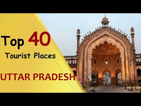
UTTAR PRADESH Top 40 Tourist Places | Uttar Pradesh Tourism
Get flat 40% off when booking OYO Rooms using coupon code: ONLYININDIAUttar Pradesh is a state in northern India. Its city of Agra is home to the iconic Taj Mahal monument, a colossal, domed, white-marble mausoleum honouring the wife of 17th-century Mughal emperor Shah Jahan. Nearby are the red-brick walls of Agra Fort, a fortified palace dating to the 16th and 17th centuries. Capital Lucknow has Muslim memorial shrines Bara Imambara and calligraphy-adorned Chota Imambara.
uttar pradesh tourism
uttar pradesh tourism places
uttar pradesh tourism package tours
uttar pradesh tourism lucknow, uttar pradesh
uttar pradesh tourism map
uttar pradesh tourism pdf
hill stations in uttar pradesh
uttar pradesh colleges and universities
tourist place in uttarakhand
Uttar Pradesh tourist spots
hill stations in uttar pradesh
uttar pradesh tourism package tours
uttar pradesh tourism map
uttar pradesh colleges and universities
uttar pradesh tourism pdf
uttar pradesh tourism lucknow, uttar pradesh
tourist place in uttarakhand
uttar pradesh history
uttar pradesh
uttar pradesh hindi news
uttar pradesh government
uttar pradesh destinations
uttar pradesh result
uttar pradesh map
districts of uttar pradesh
uttar pradesh chief minister
uttar pradesh capital

Top 10 Places To Visit In Uttar Pradesh
Uttar Pradesh is a state in northern India. Its city of Agra is home to the iconic Taj Mahal monument, a colossal, domed, white-marble mausoleum honouring the wife of 17th-century Mughal emperor Shah Jahan. Nearby are the red-brick walls of Agra Fort, a fortified palace dating to the 16th and 17th centuries. Capital Lucknow has Muslim memorial shrines Bara Imambara and calligraphy-adorned Chota Imambara.Land area: 243,286 km²
Population: 204.2 million (2012)
Districts: 75
Capitals: Lucknow, Allahabad (Judiciary)

Top 10 Places to Visit in Varanasi
Varanasi is a city in the northern Indian state of Uttar Pradesh dating to the 11th century B.C. Regarded as the spiritual capital of India, the city draws Hindu pilgrims who bathe in the Ganges River’s sacred waters and perform funeral rites. Along the city's winding streets are some 2,000 temples, including Kashi Vishwanath, the “Golden Temple,” dedicated to the Hindu god Shiva.1. Assi Ghat – A magnet for those seeking spirituality
Assi Ghat is the southernmost ghat in Varanasi. To most visitors to Varanasi, it is known for being a place where long-term foreign students, researchers, and tourists live.
2. Dashashwamedh Ghat – The most vibrant Ghat in town
The main ghat in Varanasi on the Ganges river, Dashashwamedh Ghat is a flamboyant place known for its spiritual transcendence.
3. Manikarnika Ghat – The prime cremation Ghat in Varanasi
Considered to be an auspicious place to be cremated, Manikarnika Ghat is among the pivotal places of interest in Varanasi.
4. Kashi Vishwanath Temple – The only Jyotirlinga in Uttar Pradesh
The list of places to visit in Varanasi would be incomplete without including the famed Kashi Vishwanath Temple.
5. Tulsi Manas Temple – The place where Ramcharitmanas was written
Among the many sightseeing places in Varanasi is the Tulsi Manas Temple, the place where Tulsidas wrote the Hindu epic Ramayana in an Awadhi dialect of the Hindi language.
6. Durga Temple – The fabled old world legend
Also called the monkey temple, this mandir is among the mythical places to see in Varanasi. Built in the 18th century by a Bengali Maharani, the temple is painted red with ochre.
7. Gyan Vapi Well – The well of knowledge
The Gyan Vapi well is located within the Gyanvapi Mosque, which was constructed by the Mughal emperor, Aurangzeb, on the site of the demolished Kashi Vishwanath Temple.
8. Ramnagar Fort & Museum – The Mughal era fortification
Located opposite to the Tulsi Ghat, the Ramnagar Fort is an 18th-century crumbling ruin in dire need of restoration.
9. Chunar Fort – A spooky little rampar
Situated in the Mirzapur district of Uttar Pradesh, the Chunar Fort is located approximately 23 km southwest of Varanasi. The earliest recorded history in Chunar is from the 16th century, traced to a garrison of the Mughal emperor, Babar.
10. Sarnath – The famed historical ruin
Located 13 km northeast of Varanasi, Sarnath is among the famous Buddhist pilgrimages in India. It is a popular place to visit around Varanasi for those seeking peace and solitude after jostling their way through the frazzled ghats and gullies of Kashi.

मिर्ज़ापुर के नजारे , Mirzapur City Ride , Mirzapur Bike Ride's , Mirzapur Ride , Travel vikas
नमस्कार दोस्तों आज मैं आपको इस विडियो में मिर्जापुर के नजारे दिखाने वाला हूं अच्छा लगता है तो लाइक करे शेयर करें धन्यवाद ।Follow Me
Instagram :
Facebook :
Business Inquiries/Event/Sponsorship :
= travelvikas8@gmail.com
Mirzapur Ride
मिर्ज़ापुर के नजारे , Mirzapur City Ride , Mirzapur Bike Ride's , Mirzapur Ride , Travel vikas
#Mirzapur
#MirzapurRide

अगर यहां घूमने नहीं गए तो आपने कुछ नहीं देखा|Top 5 Tourist Destinations in India|Top 5 Hill Stations
Travel GuideTop 10 Tourist Destinations in India
Dalhousie is a hill station now in Chamba district, in the northern Indian state of Himachal Pradesh. Previously it was part of Punjab. It is situated on 5 hills and has an elevation of 1,970 metres above sea level.Delhousie Town was named after The Earl of Dalhousie, who was the British Governor-General in India while establishing this place as a summer retreat.
10 Best Places to Visit in India
Top 5 Hill Stations in India
Orchha (or Urchha) is a town in Tikamgarh district of Madhya Pradesh state, India. The town was established by Rudra Pratap Singh some time after 1501, as the seat of an eponymous former princely state of central India, in the Bundelkhand region. Orchha lies on the Betwa River, 80 km from Tikamgarh & 15 km from Jhansi in Uttar Pradesh.
Manali is a valley nestled in the mountains of the Indian state of Himachal Pradesh near the northern end of the Kullu Valley, at an altitude of 2,050 m (6,726 ft) in the Beas River Valley. It is located in the Kullu district, about 270 km (168 mi) north of the state capital, Shimla, 309 km (192 miles) northeast of Chandigarh and 544 km (338 miles) northeast of Delhi, the federal capital. The small town, with a population of 8,096,[1] is the beginning of an ancient trade route to Ladakh and from there over the Karakoram Pass on to Yarkand and Khotan in the Tarim Basin. It is a popular tourist destination and serves as the gateway to Lahaul and Spiti district as well as Leh.
Shillong (English: /ʃɪˈlɔːŋ/;[2][3] Khasi: Shillong) is a hill station in the northeastern part of India and the capital of Meghalaya, which means The Abode of Clouds and is one of the smallest states in India. It is the headquarters of the East Khasi Hills district and is situated at an average altitude of 4,908 feet (1,496 m) above sea level, with the highest point being Shillong Peak at 6,449 feet (1,966 m). Shillong is the 330th most populous city in India with a population of 143,229 according to the 2011 census.[4] It is said that the rolling hills around the town reminded the European settlers of Scotland. Hence, they would also refer to it as the Scotland of the East.[5]
Shillong has steadily grown in size since it was made the civil station of the Khasi and Jaintia Hills in 1864 by the British. In 1874, on the formation of Assam as the Chief Commissioner's Province, it was chosen as the headquarters of the new administration because of its convenient location between the Brahmaputra and Surma valleys and more so because the climate of Shillong was much cooler than tropical India. Shillong remained the capital of undivided Assam until the creation of the new state of Meghalaya on 21 January 1972, when Shillong became the capital of Meghalaya, and Assam moved its capital to Dispur in Guwahati. In 2016, it was voted India's Favourite Hill Station by HolidayIQ.com.
Valley of Flowers National Park is an Indian national park, located in West Himalaya, in the state of Uttarakhand and is known for its meadows of endemic alpine flowers and the variety of flora. This richly diverse area is also home to rare and endangered animals, including the Asiatic black bear,[1] snow leopard,[1] musk deer,[1] brown bear, red fox,[1] and blue sheep. Birds found in the park include Himalayan monal pheasant and other high altitude birds.[2] At 3352 to 3658 meters above sea level, the gentle landscape of the Valley of Flowers National Park complements the rugged mountain wilderness of Nanda Devi National Park to the east.[3] Together, they encompass a unique transition zone between the mountain ranges of the Zanskar and Great Himalaya. The park stretches over an expanse of 87.50 km2 and it is about 8 km long and 2 km wide.[2] Both parks are encompassed in the Nanda Devi Biosphere Reserve (223,674 ha) which is further surrounded by a buffer zone (5,148.57 km2).[4] Nanda Devi National Park Reserve is in the UNESCO World Network of Biosphere Reserves.
Mount Abu (About this sound pronunciation (help·info)) is a popular hill station in the Aravalli Range in Sirohi district of Rajasthan state in western India, near the border with Gujarat. The mountain forms a distinct rocky plateau 22 km long by 9 km wide. The highest peak on the mountain is Guru Shikhar at 1,722 m (5,650 ft) above sea level. It is referred to as 'an oasis in the desert' as its heights are home to rivers, lakes, waterfalls and evergreen forests. The nearest train station is Abu Road railway station: 28 km away

Top 10 place at To Visit Near Banda | Banda District Tourism
Top 10 place at To Visit Near Banda | Banda District
Kaushambi Tourism
Kaushambi is a newly created district out of Allahabad. It consists of major towns such as Chail, Manjhanpur, Bharwari, Kashiya Muratganj, Sirathu, Karari and Kara.It is very easy to reach Kaushambi by road; it is approximately 45 km from Allahabad. This site is good for history lovers who have interest in ancient history.Many Kaushambi artifacts are in Allahabad Museum. It has a few excavated sites, including a Pillar of Ashoka with inscriptions in Pali; surrounding the pillar is a historic site of ruins of the Vatsa Mahajanapada and its university.There is a Jain derasar 14 km from Sarai Akil. The soil is very fertile and it is world-famous for the Surkha Guava. The Surkha region lies mainly in Allahabad.Places in Mirzapur District
Near By Places
-
Agra District
-
Aligarh District
-
Allahabad District
-
Baghpat
-
Baghpat District
-
Bahraich District
-
Banda District
-
Barabanki District
-
Bareilly District
-
Chandauli District
-
Chitrakoot District
-
Deoria
-
Dudhwa National Park
-
Faizabad District
-
Fatehpur District
-
Firozabad District
-
Gautam Buddha Nagar District
-
Ghaziabad District
-
Greater Noida
-
Hamirpur District
-
Hardoi District
-
Jaunpur District
-
Jhansi
-
Kanpur Dehat District
-
Kanpur Nagar District
-
Kasganj District
-
Kaushambi District
-
Kushi Nagar District
-
Lakhimpur Kheri District
-
Lalitpur District
-
Lucknow District
-
Mathura District
-
Meerut District
-
Moradabad District
-
Muzaffar Nagar District
-
National Chambal Wildlife Sanctuary
-
Pilibhit
-
Pilibhit District
-
Pratapgarh District
-
Raebareli District
-
Rampur District
-
Saharanpur District
-
Shravasti District
-
Sitapur District
-
Sonbhadra District
-
Sultanpur District
-
Unnao District
-
Varanasi District