This website uses cookies to ensure you get the best experience on our website. Learn more
The Best Attractions In Oxted


Oxted is a town and civil parish in the Tandridge district of Surrey, England, at the foot of the North Downs. The town is located around 9 miles south-east of Croydon in Greater London, 8.5 miles west of Sevenoaks in Kent, and 9 miles north of East Grinstead in West Sussex. Oxted is a commuter town with a railway station, with direct train services to London. Its main developed area is contiguous with the village of Limpsfield. The source of the River Eden, a tributary of the River Medway, is just north at Titsey. The settlements of Hurst Green and Holland are also within the civil parish.
Continue reading...
From Wikipedia, the free encyclopedia.
Continue reading...
From Wikipedia, the free encyclopedia.
The Best Attractions In Oxted
-
 1. Everyman Cinema Oxted
Everyman Media Group plc is a cinema company in the United Kingdom. The company was founded in 2000, when entrepreneur Daniel Broch bought the original Everyman Cinema in Hampstead, which dated to 1933, which before then was a theatre. Broch led the growth of the company with the acquisition in 2008 of Screen Cinemas to add more locations. This coincided with Broch selling a majority stake in the enlarged company, though he remains a shareholder. Following the acquisition, the group has refurbished or plans to refurbish a number of cinemas. Those already refurbished include Walton, Belsize Park, Baker Street, and The Screen On The Green in Islington. Everyman's cinemas have one to five screens, a small number of which offer 3D. Everyman Cinemas offer a programme of films and special events...
From Wikipedia, the free encyclopedia. -
4. Barn Theatre Oxted
The Barn Church, Kew, formally known as St Philip and All Saints, is the first barn church to be consecrated in England. The building, which is not listed, is on the corner of Atwood Avenue and Marksbury Avenue, in an area previously known as North Sheen and now in Kew, in the London Borough of Richmond upon Thames. It was constructed in 1929 from a 17th century barn from Oxted in Surrey. The west end was converted in 2002 into a large parish room with a gallery above looking down the length of the building. The sanctuary was refurbished and remodelled in 1998. St Philip and All Saints is part of a joint parish with St Luke's Church, Kew, under the same vicar, Peter Hart. It is a member of the Anglican Communion and Church of England and, locally, is part of Churches Together in Kew. The p...
From Wikipedia, the free encyclopedia. -
7. Hawk Conservancy Trust Weyhill
The Hawk Conservancy Trust is a bird park and conservation charity that cares for and displays birds of prey. It is located in Weyhill, Hampshire, England, near to the A303 road and the town of Andover. Founded as a zoo by local farmer Reg Smith and his wife Hilary, the park was incorporated as the Hawk Conservancy Trust in 2002. It is also the site of the National Bird of Prey Hospital, a veterinary hospital that takes in injured birds of prey.
From Wikipedia, the free encyclopedia. -
9. Woburn Safari Park Woburn
Woburn Safari Park is a safari park located in Woburn, Bedfordshire, England. Visitors to the park can drive through exhibits, which contain species such as southern white rhino, elephants, tigers and black bears. It is part of the estates of the Duke of Bedford that also includes Woburn Abbey and its 3,000-acre deer park. The Safari Park itself covers 360 acres .Woburn Safari Park is a member of the British and Irish Association of Zoos and Aquariums and the European Association of Zoos and Aquaria .
From Wikipedia, the free encyclopedia. -
10. THORPE PARK Resort Chertsey
Thorpe Park is a theme park located between the towns of Chertsey and Staines-upon-Thames in Surrey. It is operated and owned by Merlin Entertainments. After demolition of the Thorpe Park Estate in the 1930s, the site became a gravel pit. Thorpe Park Resort was built in the 1970s on the gravel pit which was partially flooded, creating a water-based theme for the park. This essentially allows guests to view the park as an island, which is where the park's current island like no other slogan originates from. It was officially opened to the public by Lord Louis Mountbatten in 1979. It has since grown into one of the major theme parks in the UK and now also features a hotel. Major attractions include a large water ride Tidal Wave, a number of rollercoasters including Colossus, Nemesis Inferno,...
From Wikipedia, the free encyclopedia. -
11. The Historic Dockyard Chatham Chatham
Chatham Dockyard was a Royal Navy Dockyard located on the River Medway in Kent. Established in Chatham in the mid-16th century, the dockyard subsequently expanded into neighbouring Gillingham . It came into existence at the time when, following the Reformation, relations with the Catholic countries of Europe had worsened, leading to a requirement for additional defences. For 414 years Chatham Royal Dockyard provided over 500 ships for the Royal Navy, and was at the forefront of shipbuilding, industrial and architectural technology. At its height, it employed over 10,000 skilled artisans and covered 400 acres . Chatham dockyard closed in 1984, and 84 acres of the Georgian dockyard is now managed as a visitor attraction by the Chatham Historic Dockyard Trust.
From Wikipedia, the free encyclopedia.


Oxted Videos
Places to see in ( Lingfield - UK )
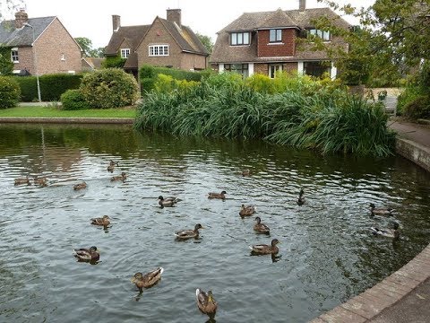
Places to see in ( Lingfield - UK )Lingfield is a village, civil parish and post town in the Tandridge district of Surrey, England. Lingfield Park is home to horse racing across a large catchment from Folkestone to Epsom. Lingfield is centred 23.4 miles (37.7 km) south of London and lies to the east of the A22 where it runs between Godstone and East Grinstead. The village has a medieval church that is Grade I listed, timber-frame architecture from the Tudor period and century before and a punishment cage, last used in 1882 to hold a poacher, made in 1773.
Lingfield's location in Tandridge District is shown above. The Prime Meridian passes close to the western border of Lingfield. London is (centred) 23.4 miles (37.7 km) north-by-northwest and Oxted, the administrative centre of Tandridge is 5.3 miles (8.5 km) north. Guildford, Surrey's county town is 24.3 miles (39.1 km) west-by-northwest.
Trains run most notably from Lingfield railway station to London Victoria station and London Bridge station. Refurbishment, finished in Spring 2013, of the Bluebell Railway made that steam tourist service accessible directly by car or modern train. East Grinstead railway station is a modern terminus of this formerly through-line to Lewes and beyond: the town of East Grinstead is just two stations south.
( Lingfield - UK ) is well know as a tourist destination because of the variety of places you can enjoy while you are visiting Lingfield . Through a series of videos we will try to show you recommended places to visit in Lingfield - UK
Join us for more :

Places to see in ( Westerham - UK )
Places to see in ( Westerham - UK )Westerham is a town and civil parish in Kent, England, 5 miles west of Sevenoaks. It is recorded as early as the 9th century, and was mentioned in the Domesday Book in a Norman form, Oistreham. (compare Ouistreham in Normandy, Oistreham in 1086). Hām is Old English for a village or homestead, and so Westerham means a westerly homestead. The River Darent flows through the town, and formerly powered three watermills.
There is evidence that the area around Westerham has been settled for thousands of years: finds such as a Celtic fortification (c 2000 BC) and a Roman road are close by, along with the remains of a Roman encampment just past the ruins of a tower south of the town at the summit of Tower Woods. The tower dates back to the 18th century, and was originally constructed by the owners of Squerryes Court as a folly for their children's amusement.
The manor was originally run by Godwin, Earl of Wessex and later by his son Harold Godwinson the last Saxon King of England. The first Norman lord of Westerham was Eustace II of Boulogne, and the town appears in the Domesday Book as Oistreham. By 1227 Henry III granted Westerham a market charter, making the new village a major player in the buying and selling of cattle in Kent, a tradition that survived to 1961 when the last cattle market was held. St Mary's Church is thought to date from the 13th century, although it is much altered in Victorian times. In 1503 the Protestant martyr John Frith was born in the town.
In 1922 Winston Churchill MP purchased Chartwell Manor on the outskirts of Westerham, which, apart from the time he spent at 10 Downing Street, was his home for the rest of his life. Chartwell is now administered by the National Trust. There is a statue of Sir Winston Churchill on the village green at Westerham. It was sculpted by Oscar Nemon and stands on a base of Yugoslavian stone, the gift of Marshal Josip Broz Tito.
Chartwell is accessible from the B2026 from either Westerham to the north or from Edenbridge to the south. From the M25-junction 6, then east along the A25 via Oxted and the B269, or M25-junction 5/M26/A21, then west along the A25 near Sevenoaks and south down the B2026; or get the 246 bus to Chartwell in the Summer.
Westerham is served by the Transport for London bus service 246 with services to Bromley via Hayes and Biggin Hill, as well as the go route 401 to Sevenoaks and Southdown 594 and 595 to Tatsfield, Limpsfield and Oxted. The nearest rail link to Westerham is at Oxted station. Westerham is on the A25 road running along the Vale of Holmesdale, slightly south of the M25 motorway. The A233 road goes north to Biggin Hill and Bromley.
( Westerham - UK ) is well know as a tourist destination because of the variety of places you can enjoy while you are visiting Westerham . Through a series of videos we will try to show you recommended places to visit in Westerham - UK
Join us for more :
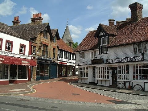
Places to see in ( Edenbridge - UK )
Places to see in ( Edenbridge - UK )Edenbridge is a town and civil parish in the Sevenoaks district of Kent, England. The town's name derives from Old English language Eadhelmsbrigge. It is located on the Kent/Surrey border on the upper floodplain of the River Medway and gives its name to the latter's tributary, the River Eden. Edenbridge has a population of around 9,000.
Owing to its position on the River Eden floodplain, the centre of the town is prone to severe flooding. The worst flood occurred in 1958, before any flood defences were built, and led to enormous damage to Edenbridge High Street. Ten years later in 1968, despite the Eden having been dredged to prevent the same occurrence, the town was once again flooded after heavy storms. Although there were no fatalities, a helicopter was needed to save a man from his flooded home. Local legend has it that he hadn't noticed the flood waters rising, having been too engrossed in The Forsyte Saga on television. More adequate flood defences have been built since then, with the local community now well prepared to deal with possible flooding.
Edenbridge has had four mills over the centuries, Haxted Mill and Honour's Mill on the River Eden, Christmas Mill on a tributary of the Eden, and a windmill to the south of the town. All four mill buildings survive, but now converted to other uses.
There are two railway stations serving Edenbridge. The earliest, on the South Eastern Railway (SER) route from Redhill to Tonbridge, was opened on 26 May 1842. The station, simply named Edenbridge, is located in Marlpit Hill. To the west of that station the route crosses what was once the London, Brighton and South Coast Railway main line from London to Tunbridge Wells and Eastbourne (via Lewes), opened on 2 January 1888. The crossing of the two lines takes place at a mid-break in the Edenbridge Tunnel on the SER line. Here lies the second station, named Edenbridge Town. The line serving it is now truncated at Uckfield. There is no connection here between the two routes: Edenbridge is not a junction; one existed four miles (6 km) to the west of Edenbridge Town at Crowhurst, but that junction no longer exists. All services at both stations are operated by Southern, which manages both stations. All services at Edenbridge Town station run to and from London Bridge, whereas services at Edenbridge station run to and from London Victoria.
Edenbridge is twinned with Mont-Saint-Aignan in France. The bypass that was built in the early 2000s to relieve traffic pressure on the old, narrow High Street is named Mont St Aignan Way. There are two banks in the town, a post office next to the church and a number of major retail chains. Despite being a relatively small town, Edenbridge boasts its own hospital - The Edenbridge War Memorial Hospital. Initially a cottage hospital built to care for soldiers returning from The First World War, a purpose built building was established to the south of the town in 1931. With an Out Patients Department, Physiotherapy facilities and a Minor Injuries Unit the hospital is a major part of the fabric of the town. In recent years the hospital has been faced with closure many times, on each occasion it has been saved by local campaigners and townspeople, who see the hospital as an essential part of the community.
( Edenbridge - UK ) is well know as a tourist destination because of the variety of places you can enjoy while you are visiting Edenbridge . Through a series of videos we will try to show you recommended places to visit in Edenbridge - UK
Join us for more :

Edenbridge City Best Places to Visit
Edenbridge is a town and civil parish in the Sevenoaks district of Kent, England. watch out the video of beautiful Edenbridge city best places to visit.
Discover England's Great Walking Trails - The Cleveland Way
With stunning moorland, fabulous views, ancient castles, characterful coastline and fishing villages tucked into coves, the Cleveland Way National Trail is one of England's most varied trails and offers a true taste of the North York Moors.Commissioned by Marketing Peak District and Visit England, a video was created to promote 7 of England's long distance walking trails. Each video aims to showcase highlights of each trail, whilst conveying some of the experience of walking the trail.
Filming the video series was fantastic. We travelled up and down the UK, visiting some beautiful areas and national parks and all the videos were filmed in 6 weeks.
Filmed and edited by Walker Creative - wlkr-creative.co.uk

The London Festival of Railway Modelling 2017 – 4K
Visit one of England’s top model railway exhibitions of 2017 at London’s Alexandra Place to see a fantastic selection of the country’s best model railways, many of them featured in Britain’s Railway Magazines. Layouts as they appear in the video (click on time to visit the layout), Donegal - Gauge O(n) - 0:22, Project Iraq 2003 - Gauge 1 to 35 - 1:33, Binns Road - Guage OO – 2:04, Woodsville NH - Gauge HO - 4:20, Lancaster (Green Ayre) - Gauge O - 4:55, Kirkmellington - Gauge EM - 6:22, Teign House Sidings - Gauge O - 7:16, Central Works - Gauge O - 7:57, Staindrop LNER 1928/30 - Gauge O - 9:02, Kettlewell -Gauge P4 - 9:52, Blackwell’s Brewery Company - Gauge EM - 10:17, North Bridge - Gauge OO - 11:13, Leysdown - Gauge P4 - 11:34, Much Murkle - Gauge OO - 11:56, Canada Street - Gauge EM - 12:51, Hope Under Dinmore - Gauge EM - 13:49, Dobris - Gauge HO - 15:22,
North Downs Way, West to East, Part 2 of 7 - Dorking to Oxted
This series of seven videos is a detailed and authoritative photographic flipbook guide to all 157 miles of the North Downs Way travelling from west to east.The North Downs Way is a long distance footpath and official National Trail, in easy reach from London, that passes through two designated Areas of Outstanding Natural Beauty: the Surrey Hills and the Kent Downs. In doing so it traverses the range of hills stretching from Farnham in western Surrey to Dover in the heel of Kent.
Links to the rest of the NDW west to east series
Part 1 Farnham to Dorking:
Part 3 Oxted to Snodland:
Part 4 Snodland to Lenham:
Part 5 Lenham to Patrixbourne:
Part 6 Patrixbourne to Wye:
Part 7 Wye to Dover:
The National Trail Web Site
Ordinance Survey Maps covering the NDW
1:50000 Map Nos. 178, 179, 186, 187, 188, 189
1:25000 Map Nos. 137, 138, 145, 146, 147, 148, 149, 150
Public Houses and Inns
00:43 Stepping Stones, Westhumble:
02:53 Smith & Western, Boxhill:
10:02 The Harrow Inn, Chaldon:
Places of Interest
00:33 Dorking Wanderers Football Club:
01:19 River Mole:
02:26 Box Hill:
04:12 Brockham Lime Works:
05:57 Colley Hill:
06:13 The Inglis Memorial:
06:26 Reigate Fort:
06:56 Gatton Park:
07:23 The Royal Alexandra and Albert School:
07:49 Reigate Hill Golf Club:
08:04 Merstham Cricket Club:
08:25 St Katherine’s Church, Merstham:
09:48 Willey Park Farm:
11:52 Marden Park:
12:58 Oxted Quarry:
13:36 The Greenwich Meridian:
Music
Alfonso Ferrabosco - Lamentations III by The Tudor Consort
Licenced under Creative Commons: By Attribution 3.0
Disclaimer
Visitors who use this guide and rely on any information within it do so at their own risk.

North Downs Way, East to West, Part 6 of 7 - Oxted to Dorking
This series of seven videos is a detailed and authoritative photographic flipbook guide to all 157 miles of the North Downs Way travelling from east to west.The North Downs Way is a long distance footpath and official National Trail, in easy reach from London, that passes through two designated Areas of Outstanding Natural Beauty: the Kent Downs and the Surrey Hills. In doing so it traverses the range of hills stretching from Dover in the heel of Kent to Farnham in western Surrey.
Links to the rest of the NDW east to west series
Part 1 Dover to Canterbury:
Part 2 Canterbury to Folkestone:
Part 3 Folkestone to Lenham:
Part 4 Lenham to Trottiscliffe:
Part 5 Trottiscliffe to Oxted:
Part 7 Dorking to Farnham:
Link to the NDW west to east series
The National Trail Web Site
Ordinance Survey Maps covering the NDW
1:50000 Map Nos. 178, 179, 186, 187, 188, 189
1:25000 Map Nos. 137, 138, 145, 146, 147, 148, 149, 150
Public Houses and Inns
03:25 The Harrow Inn, Chaldon:
10:36 Smith & Western, Boxhill:
12:53 Stepping Stones, Westhumble:
Places of Interest
00:31 Oxted Quarry:
01:26 Marden Park:
03:43 Willey Park Farm:
05:04 St Katherine’s Church, Merstham:
05:24 Merstham Cricket Club:
05:31 Reigate Hill Golf Club:
05:52 The Royal Alexandra and Albert School:
06:09 Gatton Park:
06:46 Reigate Fort:
07:10 The Inglis Memorial:
07:14 Colley Hill:
09:14 Brockham Lime Works:
10:35 Box Hill:
11:29 River Mole:
13:04 Dorking Wanderers Football Club:
13:08 Denbies Wine Estate:
14:11 St Barnabas Church, Ranmore:
Music
Fluidscape Kevin MacLeod (
Licensed under Creative Commons: By Attribution 3.0
Disclaimer
Visitors who use this guide and rely on any information within it do so at their own risk.

Kent Country Walk - Detling-North Downs Way-Pilgrim's Way-Thurnham round
Our video is a guided walk in the county of Kent from a small village called Detling near Maidstone. We start opposite the Cock Horse Inn and follow the North Downs Way along the top of the Downs, visiting Thurnham Castle on the way. The views are stunning. We return to Detling along the Pilgrim's Way, a minor road, through Broad Street and Thurnham. A moderate walk along the North Downs Way with some steep inclines and declines returning on the much easier minor road along the Pilgrim's Way. Approx 8.25 miles allow 3½ hours using OS Explorer Map 184, Maidstone & the Medway Towns.
Walking up Box Hill Surrey UK - Fabulous Sport Outdoors
Walking Tracks in Surrey UK Box Hill Surrey pathways with beautiful scenic landscape nice walks for a great day to enjoy the outdoors of the British CountrysideHiking trails picnic areas cafe' a nice windind road and beautiful views.
Near By Places
-
Addlestone
-
Albury
-
Ashtead
-
Bagshot
-
Banstead
-
Bletchingley
-
Brookwood
-
Busbridge
-
Camberley
-
Carshalton
-
Caterham
-
Chaldon
-
Chertsey
-
Chessington
-
Chobham
-
Cobham
-
Cranleigh
-
Dorking
-
Dormansland
-
Dunsfold
-
East Horsley
-
East Molesey
-
Egham
-
Englefield Green
-
Epsom
-
Esher
-
Farnham
-
Frensham
-
Frimley
-
Frimley Green
-
Godalming
-
Godstone
-
Grayshott
-
Great Bookham
-
Guildford
-
Hascombe
-
Haslemere
-
Headley
-
Hersham
-
Hindhead
-
Horley
-
Kingswood
-
Leatherhead
-
Lingfield
-
Long Ditton
-
Merstham
-
Milford
-
Mytchett
-
Newchapel
-
Norwood Hill
-
Nutfield
-
Ockley
-
Oxshott
-
Pirbright
-
Redhill
-
Reigate
-
Shepperton
-
Staines
-
Sunbury-On-Thames
-
Tadworth
-
Tatsfield
-
Thames Ditton
-
Thursley
-
Tolworth
-
Tongham
-
Virginia Water
-
Walton-On-Thames
-
Warlingham
-
West Byfleet
-
West Horsley
-
West Molesey
-
Weybridge
-
Windlesham
-
Wisley
-
Woking
-
Woldingham