This website uses cookies to ensure you get the best experience on our website. Learn more
The Best Attractions In Perth Amboy


Perth Amboy is a city in Middlesex County, New Jersey, United States. The City of Perth Amboy is part of the New York metropolitan area. As of the 2010 United States Census, the city's population was 50,814, reflecting an increase of 3,511 from the 47,303 counted in the 2000 Census, which had in turn increased by 5,336 from the 41,967 counted in the 1990 Census. Perth Amboy has a Hispanic majority population. In the 2010 census, persons of Hispanic, Latino or Spanish origin made up 78.1% of the population, second to Union City at 84.7%. Perth Amboy is known as the City by the Bay, referring to Raritan Bay.Perth Amboy was settled in 1683 by Scottish col...
Continue reading...
From Wikipedia, the free encyclopedia.
Continue reading...
From Wikipedia, the free encyclopedia.
The Best Attractions In Perth Amboy
-
1. Perth Amboy Waterfront Perth Amboy
Perth Amboy is a city in Middlesex County, New Jersey, United States. The City of Perth Amboy is part of the New York metropolitan area. As of the 2010 United States Census, the city's population was 50,814, reflecting an increase of 3,511 from the 47,303 counted in the 2000 Census, which had in turn increased by 5,336 from the 41,967 counted in the 1990 Census. Perth Amboy has a Hispanic majority population. In the 2010 census, persons of Hispanic, Latino or Spanish origin made up 78.1% of the population, second to Union City at 84.7%. Perth Amboy is known as the City by the Bay, referring to Raritan Bay.Perth Amboy was settled in 1683 by Scottish colonists. It was called New Perth after James Drummond, 4th Earl of Perth, and the Lenape Native Americans called the point on which the city ...
From Wikipedia, the free encyclopedia. -
3. Sesame Place Langhorne
Sesame Place is a children's theme park, located on the outskirts of Philadelphia in Langhorne, Pennsylvania based on the Sesame Street television program. It includes a variety of rides, shows, and water attractions suited to young children. It is one of 12 parks owned and operated by SeaWorld Entertainment with a license from Sesame Workshop .
From Wikipedia, the free encyclopedia. -
4. Harrah's Philadelphia Chester
Harrah's Philadelphia Casino & Racetrack is a racino on the Chester, Pennsylvania waterfront. The track's first harness racing season opened on September 10, 2006. Wagering on live horse races is currently available on-track from April to December on Sunday, Wednesday, Thursday, and Friday. The racing broadcast is also available for wagering via simulcast from other racetracks throughout the United States and Canada. The 5⁄8 mile racetrack has a limestone-based surface. The midpoint of 1-mile races comes on a bridge that hangs over the Delaware River and provides a view of freight ships passing by. The racing paddock at Harrah's holds up to 131 horses. Because of limited space, horses are shipped in to the paddock rather than stabled on-track. Built on the site of the former Sun Shipbuil...
From Wikipedia, the free encyclopedia. -
5. Six Flags Great Adventure Jackson New Jersey
Six Flags Great Adventure is an amusement park located in Jackson, New Jersey, owned by Six Flags Entertainment Corp. Situated between New York City and Philadelphia, the park complex also contains the Hurricane Harbor water park. The park opened in 1974 under restaurateur Warner LeRoy. Six Flags took over ownership of the park in 1977. Today, the park contains eleven themed areas. In August 30, 2012, Six Flags combined its 160-acre Great Adventure Park with its 350-acre Wild Safari animal park to form the 510-acre Six Flags Great Adventure & Safari park, making it the second-largest theme park in the world, after Disney's Animal Kingdom.
From Wikipedia, the free encyclopedia. -
6. Grounds For Sculpture Hamilton
Grounds For Sculpture is a 42-acre sculpture park and museum located in Hamilton, NJ, United States, on the former site of the New Jersey State Fairgrounds. Founded in 1992 by John Seward Johnson II, the venue is dedicated to promoting an understanding of and appreciation for contemporary sculpture by organizing exhibitions, publishing catalogues, and offering a variety of educational programs and special community events. In July 2000, GFS became a nonprofit organization open to the public. Operation revenues come from visitors, art patrons, donations, and grants. GFS maintains an ever changing collection of sculptures, with works by Seward Johnson and other artists.
From Wikipedia, the free encyclopedia. -
7. Woodbury Common Premium Outlets Central Valley
Woodbury Common Premium Outlets is an outlet center located in Central Valley, New York. The center is owned by Premium Outlets, a subsidiary of Simon Property Group, and takes its name from the town in which it is located. Opened in late 1985, expanded in 1993, and again in 1998, the center now has 220 stores occupying more than 800,000 square feet and is one of the largest contiguous outlet centers in the world. Due to its size, different areas are color-coded to help visitors orient themselves, and on weekends, trolleys are available to transport shoppers from the parking lots and around the center. Due to its proximity to New York City, Woodbury Common is a major attraction for foreign tourists visiting the region. Japanese tourists have been overtaken by Chinese tourists as the most f...
From Wikipedia, the free encyclopedia. -
8. Bushkill Falls Bushkill
Bushkill Falls is a series of eight privately owned waterfalls, the tallest of which cascades over 100 feet , located in Northeast Pennsylvania's Pocono Mountains in the United States. Beginning at the headwaters of the Little Bushkill Creek, the water descends the mountain, toward the Delaware River, forming Bushkill Falls, Bridal Veil Falls, Bridesmaid Falls, Laurel Glen Falls, Pennell Falls, and three additional, unnamed falls.Bushkill Falls is a popular spot for hiking and birdwatching. The area features a variety of trails and bridges that vary in length and difficulty.
From Wikipedia, the free encyclopedia.

Perth Amboy Videos

En el Downtown de Perth Amboy
Caminando por 5 esquinas, en la calle mas comercial de la ciudad de Perth Amboy.
Exploring Union Beach, NJ (2015)
Explore Union Beach from the ground, air and water. If you'd like to order a hi-def DVD of the video, visit:
visiting South Amboy New Jersey
i went on a mini vacation to new jersey.
Welcome to Union Beach
Union Beach calls itself the Best Little Town in New Jersey. And now, as the town prepares for the first-ever annual Union Beach Day (2015), Mayor Paul J. Smith Jr. tells us why it's a nice place to live, work and play.To order a high-definition DVD of an extended 60-minute program about Union Beach, visit:

Morgan's Bluff | South Amboy NJ Apartments | Lincoln Property Company | LPC
South Amboy Apartments For Rent | Morgan's Bluff
Lincoln Property Company | LPC
Morgan's Bluff
1101 Klimek Place
South Amboy, NJ 08897
(732) 416-8624
It’s time to check out Sayreville’s newest luxury apartments. Your new home at Morgan’s Bluff Apartments awaits you.
Resort-style amenities abound throughout our community, including an on-site clubhouse, 24-hour fitness center, sparkling saltwater pool, and convenient business center.
Inside your spacious one or two-bedroom apartment home, you’ll find amenities like designer kitchens, luxurious bathrooms, spacious closets, and private balconies with stunning views. A pet-friendly community, your furry friends are always welcome here.
Located near Cheesequake Creek and Garden State Parkway, our apartments are in the ideal location for both New York and New Jersey commuters. Surrounded by shops, restaurants, schools and more - our residents love to walk to their favorite haunts.
It’s time to feel at home in your own house, again. Come see your new apartment home at Morgan’s Bluff today.
Search for Apartments For Rent Nationwide
Google Map |
Like us on Facebook |
Check us out on Yelp |
Visit us on Instagram |
Check out our Apartment Video Tour #morgansbluff |
YouTube Channel | Lincoln Property Co TV

New Jersey (1940s)
A tour of New Jersey in the 1940s. To purchase a clean DVD of this film for personal home use or educational use contact us at questions@archivefarms.com. To license footage from this film for commercial use visit: travelfilmarchive.com
Sculptures by the Sea - Cottesloe 16th March 2013
Karen and myself went to see what was on offer this year at Sculptures by the Sea at Cottesloe. Some interesting work and some stuff that left you wondering if the artists were serious.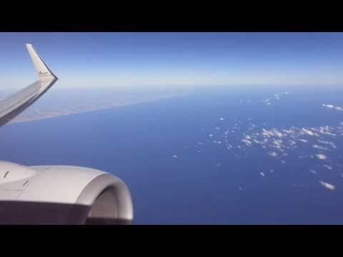
Miami-New York (LGA) flight: Takeoff, Fort Lauderdale, Statue of Liberty, Manhattan 2014-02-16
A fully annotated sightseeing-friendly inflight video of a sunny-all-the-way flight from balmy Miami to a crisp Arctic vortex winter day in New YorkTimepoints:
7:30 Takeoff run begins (to the west) on MIA runway 26L
8:47 SR 826 Palmetto Expressway
9:37 Florida's Turnpike
10:10-10:30 View of Everglades (turning right to proceed toward Atlantic coast)
13:00- 13:10 Western Broward County cities (while proceeding east)
13:10-13:45 I-595 Eastbound through southern Broward County
13:45 I-595 intersecting I-95, Fort Lauderdale FL
13:45-14:35 Fort Lauderdale-Hollywood International Airport (FLL)
14:33-14:35 Port Everglades FL
14:40-14:45 17th Street SE, Fort Lauderdale FL
14:45-15:25 Fort Lauderdale Beach
15:25-21:20 Atlantic coastline towards Palm Beach County
21:20-43:40 Atlantic Ocean from Florida to North Carolina
25:20 Reaching 38,000' cruising altitude 70 miles east of Stuart, Florida
32:08 Cockpit announcement
34:03 Cabin service announcement
34:30 Beverage service
43:40 Ocean Isle Beach North Carolina (NC)
43:50-44:20 Holden Beach NC
44:20-45:10 Oak Island NC
46:05-46:30 Brunswick River & Wilmington NC
48:15 Lake Sutton NC
49:18 Henderson Field airport on left
49:18-50:00 Wallace NC
50:35-50:50 Rose Hill NC
51:45 PB Raiford Airport, Kenansville NC
1:05:15-1:05:55 Swift Creek Reservoir, Chesterfield County, Virginia (VA)
1:06:15-1:07:00 Richmond VA
1:08:50-1:09:00 Potomac River near Quantico VA
1:09:10-1:09:20 US 301 crossing Potomac River into MD (right side of river)
1:09:30-1:09:55 Colonial Beach VA
1:10:05-1:10:20 Potomac River
1:10:30 St Clements Island, Maryland (MD)
1:10:40-1:10:55 Coltons Point MD
1:11:30 Chalk Point Generating Station, Eagle Harbor MD
1:19:00 Leaving Maryland; entering Delaware near Marydel DE/MD
1:20:50 Chesapeake Bay at mouth of Susquehanna River MD
1:21:20-1:21:40 Smyrna DE
1:22:00 Leaving Delaware; entering New Jersey (NJ)
1:22:50-1:33:00 Fort Delaware State Park, Delaware City DE
1:22:15-1:22:30 Salem & Hope Creek (nuclear) Generating Station, Lower Alloways Creek, NJ
1:23:30-1:23:40 Delaware Memorial Bridge (Delaware Turnpike & New Jersey Turnpike)
1:24:10-1:24:30 Wilmington DE
1:24:55-1:25:05 Woodstown NJ
1:25:35-1:25:45 Marcus Rock Pennsylvania (PA)
1:25:50-1:26:00 Commodore Barry Bridge NJ/PA
1:26:15-1:26:30 Philadelphia International Airport (PHL)
1:26:55-1:27:30 Downtown Philadelphia PA
1:27:30-1:27:35 Benjamin Franklin Bridge (Philadelphia PA to Camden NJ)
1:28:00-1:28:15 Camden & Pennsauken Township, NJ
1:28:30-1:28:35 New Jersey Route 73 intersecting I-295 (Exit 36A) & New Jersey Turnpike (Exit 4), Mount Laurel NJ
1:28:40-1:30:30 I-295 (above) & I-95 / New Jersey Turnpike (below) en-route to northern New Jersey
1:30:10 Landing prep announcement
1:30:48-1:31:00 Trenton NJ
1:31:13-1:31:20 Bordentown NJ
1:31:45-1:31:50 Hamilton Township NJ
1:32:00-1:32:05 Jct I-195 & I-95 New Jersey Turnpike
1:32:05-1:32:15 I-95 / New Jeresy Turnpike (Exit 6) intersecting I-195 (Exit 7), Robbinsville, NJ
1:32:15-1:33:50 I-95 / New Jersey Turnpike continuing north towards New York City NY
1:33:00 Exit 8 New Jersey Turnpike, East Windsor NJ
1:33:27 Exit 8A New Jersey Turnpike, Rossmoor, Monroe Township NJ
1:35:22-1:35:35 Old Bridge Township, NJ
1:35:50-1:36:10 Garden State Parkway & South Amboy / Governor Alfred E Driscoll Bridge
1:36:27-1:36:35 Outerbridge Crossing (Left-Perth-Amboy NJ / Right-Staten Island, New York City, New York-NY)
1:38:20 Great Kills Harbor, Staten Island, New York NY
1:39:00-1:39:10 Verrazano-Narrows Bridge
1:39:20-1:39:50 Brooklyn NY (west)
1:39:55-1:40:05 Statue of Liberty, Liberty Island, New York NY
1:40:08 Ellis Island, New York ,NY
1:40:10 Governor's Island, New York NY
1:40:15-1:41:05 Lower Manhattan (1:40:40: One World Trade Center), New York NY - with Brooklyn Bridge (L) & Manhattan Bridge (R)
1:40:48-1:41:10 Brooklyn NY in foreground
1:41:15-1:41:20 Williamsburg Bridge, New York NY
Start of LGA runway 31 Expressway Approach
1:41:30-1:41:55 Midtown Manhattan, New York NY
1:42:45-1:43:00 LaGuardia Airport just before turning final
1:43:10-1:43:15 Grand Central Parkway, Queens, New York NY
1:43:15-1:43:25 Flushing Meadows--Corona Park
1:43:20-1:43:30 Citi Field
1:43:35 Touchdown on LGA runway 31
Flightaware tracking of this flight:

Sandy Hook (Nude) Beach, New Jersey, USA
Sandy Hook Beach (Nude Beach) in New Jersey USA.Amazing beach with view of Manhattan skyline, great for summer sunbathing, swimming, watching sunset and of course dreaming someday can live in one of those great building in Manhattan.

New York Harbor near Jersey City, New Jersey.
New York Harbor, a geographic term, refers collectively to the rivers, bays, and tidal estuaries near the mouth of the Hudson River in the vicinity of New York City.
This is sometimes construed in the sense the Ports of New York and New Jersey.
More narrowly, the term occasionally refers only to Upper New York Bay.
In the broad sense, the term includes the following bodies of water and their waterfronts: Upper New York Bay, Lower New York Bay, North River (i.e. the lowest part of the Hudson River), East River, Kill Van Kull, Newark Bay, Arthur Kill, The Narrows, Jamaica Bay, Raritan Bay, and Harlem River.
This includes about 1,200 square miles (3,100 km2), with over a 1,000 miles (1,600 km) of shoreline.
At peak it contained 650 miles (1,046 km) of developed waterfront in 11 individual, active ports in Manhattan, Brooklyn, Queens, the Bronx, Staten Island, Perth Amboy, Elizabeth, Bayonne, Newark, Jersey City, Hoboken, and Weehawken.
Although the U.S. Board of Geographic Names does not include the term, New York Harbor has important historical, governmental, commercial, and ecological usages.
.
Nautically, the Harbor consists of a complex of about 240 miles (386 km) of shipping channels (requiring pilotage), as well as anchorages and port facilities, centered on the Upper New York Bay.
Larger vessels require tugboat assistance for the sharper channel turns, for example from Kill van Kull into Port Newark.
The Harbor has the main entrance from the Atlantic Ocean to the southeast, between the Rockaway Point and Sandy Hook; it has another entrance via the Long Island Sound from the northeast at the outlet of the East River.
The Harbor extends to the southwest to the mouth of the Raritan River, to the northwest at Port Newark and to the north to the George Washington Bridge.
Other vehicular routes cross the Harbor include the PATH tunnel and lower down the Verrazano Narrows Bridge.
.
Near By Places
-
Atco
-
Atlantic Highlands
-
Basking Ridge
-
Batsto
-
Bayonne
-
Berkeley Heights
-
Bernardsville
-
Blackwood
-
Blairstown
-
Bogota
-
Bordentown
-
Bradley Beach
-
Branchburg
-
Branchville
-
Brick
-
Bridgeton
-
Brielle
-
Browns Mills
-
Camden
-
Carlstadt
-
Cherry Hill
-
Cinnaminson
-
Clementon
-
Cliffwood
-
Closter
-
Collingswood
-
Cologne
-
Colts Neck
-
Cranbury
-
Cranford
-
Cream Ridge
-
Deptford
-
East Brunswick
-
East Rutherford
-
East Windsor
-
Eastampton
-
Eatontown
-
Edison
-
Egg Harbor City
-
Egg Harbor Township
-
Elmer
-
Englishtown
-
Estell Manor
-
Fair Lawn
-
Far Hills
-
Finesville
-
Flemington
-
Fort Lee
-
Franklin Lakes
-
Frenchtown
-
Garwood
-
Glassboro
-
Great Atlantic City Region
-
Green Brook
-
Hackensack
-
Hackettstown
-
Haddon Heights
-
Hainesport
-
Hamilton
-
Hammonton
-
Hewitt
-
High Bridge
-
Hillsborough
-
Hoboken
-
Holmdel
-
Jersey City
-
Jersey Shore
-
Keansburg
-
Kearny
-
Lake Hopatcong
-
Landisville
-
Lavallette
-
Leonia
-
Lincroft
-
Lopatcong
-
Mahwah
-
Manasquan
-
Mantoloking
-
Maple Shade
-
Margate City
-
Marlton
-
Matawan
-
Mays Landing
-
Merchantville
-
Metuchen
-
Middlesex
-
Millburn
-
Millville
-
Moorestown
-
Morganville
-
Morris County
-
Mount Holly
-
Mount Laurel
-
Mountainside
-
Mullica Hill
-
National Park
-
Neptune
-
New Brunswick
-
New Egypt
-
New Jersey’s Shore Region
-
New Jersey’s Skylands Region
-
New Jersey’s Southern Shore
-
Newark
-
Newfoundland
-
Northvale
-
Nutley
-
Oaklyn
-
Ocean Township
-
Oceanport
-
Oceanville
-
Old Bridge
-
Oldwick
-
Palisades Park
-
Paramus
-
Passaic
-
Peapack-Gladstone
-
Pennington
-
Pennsauken
-
Pennsville
-
Pilesgrove
-
Piscataway
-
Pitman
-
Pittstown
-
Polhemustown
-
Pompton Lakes
-
Port Norris
-
Princeton
-
Rahway
-
Red Bank
-
Ridgefield Park
-
Ridgewood
-
Ringoes
-
Ringwood
-
River Edge
-
Roebling
-
Runnemede
-
Saddle Brook
-
Sandyston
-
Sayreville
-
Scotch Plains
-
Secaucus
-
Sewell
-
Shamong
-
Short Hills
-
Sicklerville
-
Somers Point
-
South Amboy
-
South Bound Brook
-
South Orange
-
South Plainfield
-
Stanhope
-
Summit
-
Sussex
-
Swartswood
-
Swedesboro
-
Tabernacle
-
Teaneck
-
Tenafly
-
Teterboro
-
The Meadowlands
-
Thorofare
-
Tinton Falls
-
Totowa
-
Trenton
-
Tuckerton
-
Turnersville
-
Upper Montclair
-
Vauxhall
-
Vineland
-
Voorhees
-
Wall Township
-
Waretown
-
Watchung
-
Weehawken
-
West Amwell
-
West Berlin
-
West Creek
-
West Milford
-
West Orange
-
West Trenton
-
West Windsor Township
-
Westwood
-
Woodbury Heights
-
Woodcliff Lake
-
Wyckoff