This website uses cookies to ensure you get the best experience on our website. Learn more
The Best Attractions In Petersfield


Petersfield is a market town and civil parish in the East Hampshire district of Hampshire, England. It is 17 miles north of Portsmouth, via the A3 road. The town has its own railway station on the Portsmouth Direct Line, the mainline rail link connecting Portsmouth and London. Situated on the northern slopes of the South Downs, Petersfield lies wholly within the South Downs National Park.The town is on the crossroads of well-used north–south and east–west routes and it grew as a coach stop on the Portsmouth to London route. Petersfield is twinned with Barentin in France, and Warendorf in Germany.
Continue reading...
From Wikipedia, the free encyclopedia.
Continue reading...
From Wikipedia, the free encyclopedia.
The Best Attractions In Petersfield
-
2. Petersfield Physic Garden Petersfield
Petersfield is a market town and civil parish in the East Hampshire district of Hampshire, England. It is 17 miles north of Portsmouth, via the A3 road. The town has its own railway station on the Portsmouth Direct Line, the mainline rail link connecting Portsmouth and London. Situated on the northern slopes of the South Downs, Petersfield lies wholly within the South Downs National Park.The town is on the crossroads of well-used north–south and east–west routes and it grew as a coach stop on the Portsmouth to London route. Petersfield is twinned with Barentin in France, and Warendorf in Germany.
From Wikipedia, the free encyclopedia. -
3. Petersfield Golf Club Petersfield
Petersfield is a market town and civil parish in the East Hampshire district of Hampshire, England. It is 17 miles north of Portsmouth, via the A3 road. The town has its own railway station on the Portsmouth Direct Line, the mainline rail link connecting Portsmouth and London. Situated on the northern slopes of the South Downs, Petersfield lies wholly within the South Downs National Park.The town is on the crossroads of well-used north–south and east–west routes and it grew as a coach stop on the Portsmouth to London route. Petersfield is twinned with Barentin in France, and Warendorf in Germany.
From Wikipedia, the free encyclopedia. -
4. Harrow Inn Petersfield
The Harrow is a Grade II listed public house at Harrow Lane, Steep, Hampshire GU32 2DA.It is on the Campaign for Real Ale's National Inventory of Historic Pub Interiors.The Guardian calls it one of Britain's timeless, rural watering holes, on a quiet country lane that becomes a footpath as it reaches a small stream by the pub, which dates back to the 16th century. English Heritage notes that the current building was built in the 18th century.
From Wikipedia, the free encyclopedia. -
9. Flora Twort Gallery Petersfield
The Flora Twort Gallery is an art gallery in Petersfield, Hampshire, England, dedicated to the work of Flora Twort. The gallery is located beside St. Peter's Church, just off the town's market square. Flora Twort died in 1985 leaving her cottage, studio and examples of her work to Hampshire County Council. It was run as a museum and restaurant by HCC until 2008. In 2009 the gallery and its collections were transferred to the Petersfield Museum Trust. The gallery displays examples from the Bedales Historic Costume Collection dating from 1720, and pieces of work by the artist Flora Twort. There is also a temporary exhibition space which displays collections from professional artists and community groups.
From Wikipedia, the free encyclopedia. -
10. Petersfield Museum Petersfield
Petersfield is a market town and civil parish in the East Hampshire district of Hampshire, England. It is 17 miles north of Portsmouth, via the A3 road. The town has its own railway station on the Portsmouth Direct Line, the mainline rail link connecting Portsmouth and London. Situated on the northern slopes of the South Downs, Petersfield lies wholly within the South Downs National Park.The town is on the crossroads of well-used north–south and east–west routes and it grew as a coach stop on the Portsmouth to London route. Petersfield is twinned with Barentin in France, and Warendorf in Germany.
From Wikipedia, the free encyclopedia. -
11. St Peter's Church Petersfield
St Peter's Church is the Anglican parish church in Petersfield, Hampshire, England. It is within the Diocese of Portsmouth. The ancient church, a Grade I listed building, is located in the centre of the town, on the south side of the Square. A chapel of ease was originally built, and called 'St. Peter's in-the-veld' , within the manor of West Mapledurham . Although the town around the chapelry soon grew larger than that around the main church, St Peter’s remained a chapelry to Buriton until 1886, when it became a separate parish. Since 1984 the two parishes have been held in plurality, so the Vicar of Petersfield is now also Rector of Buriton. St Peter's was originally a Norman building; the north and south aisles were added at the end of the 12th century. The tower was raised to its pre...
From Wikipedia, the free encyclopedia. -
13. South Petersfield Golf Club Petersfield
Scouting in South East England is about Scouting in the official region of South East England. The largest membership is represented by the Scout Association of the United Kingdom, while there is also a presence of traditional Scouting groups, such as the Baden-Powell Scouts' Association. The Scout Association administers the region into 9 Scout Counties. There are also student associations at various universities in the region, each of which is affiliated to the Student Scout and Guide Organisation. These are centred at Oxford University , the University of Reading, the University of Surrey and the University of Southampton.
From Wikipedia, the free encyclopedia. -
15. Stonehenge Amesbury
Stonehenge is a prehistoric monument in Wiltshire, England, 2 miles west of Amesbury. It consists of a ring of standing stones, with each standing stone around 13 feet high, 7 feet wide and weighing around 25 tons. The stones are set within earthworks in the middle of the most dense complex of Neolithic and Bronze Age monuments in England, including several hundred burial mounds.Archaeologists believe it was constructed from 3000 BC to 2000 BC. The surrounding circular earth bank and ditch, which constitute the earliest phase of the monument, have been dated to about 3100 BC. Radiocarbon dating suggests that the first bluestones were raised between 2400 and 2200 BC, although they may have been at the site as early as 3000 BC.One of the most famous landmarks in the United Kingdom, Stoneheng...
From Wikipedia, the free encyclopedia.


Petersfield Videos

Places to see in ( Petersfield - UK )
Places to see in ( Petersfield - UK )Petersfield is a market town and civil parish in the East Hampshire district of Hampshire, England. Petersfield is 17 miles north of Portsmouth, via the A3 road. The town has its own railway station on the Portsmouth Direct Line, the mainline rail link connecting Portsmouth and London. Situated on the northern slopes of the South Downs, Petersfield lies wholly within the South Downs National Park.
Petersfield is on the crossroads of well-used north–south (formerly the A3 road which now bypasses the town) and east–west routes (today the A272 road) and it grew as a coach stop on the Portsmouth to London route. Petersfield is twinned with Barentin in France, and Warendorf in Germany.
Petersfield is situated in the valley of the Western Rother, on the Lower Greensand at the northern edge of the South Downs. The town lies at the western end of the Greensand Ridge, a sandstone ridge running through Hampshire, Surrey and Kent. The town is surrounded on all sides by farmed countryside, with the South Downs south of the town, the Hampshire Downs to the west, and forested hills (Durford Wood) to the north east.
On the south east side of the town is Petersfield Heath, 95 acres (38 ha) of heathland including woodland, grassland, a pond, and a picnic and recreation area. Petersfield Heath is a Site of Nature Conservation Interest (SNCI). It also contains 21 Bronze Age barrows which have resulted in the site being given Scheduled Ancient Monument status.
Petersfield's market square holds markets, and there are also monthly Farmers' markets. Stallholders and farmers from Petersfield's French twin town Barentin visit Petersfield and hold a French market. Petersfield has a small volunteer run community garden, 'The Good Life (Petersfield) Community Garden', situated on the edge of the town next to Sheet railway crossing; the garden is open to members (membership is free).
( Petersfield - UK ) is well know as a tourist destination because of the variety of places you can enjoy while you are visiting the city of Petersfield . Through a series of videos we will try to show you recommended places to visit in Petersfield - UK
Join us for more :

Hampshire Tourist Attractions: 15 Top Places to Visit
Planning to visit Hampshire? Check out our Hampshire Travel Guide video and see top most Tourist Attractions in Hampshire.Top Places to visit in Hampshire:
Portsmouth Historic Dockyard, Royal Armouries - Fort Nelson, HMS Warrior 1860, Little Woodham Living History Village, Romsey Abbey, Hospital of St Cross, Chawton House, Winchester Cathedral, Jane Austen's House Museum, Portchester Castle, Emirates Spinnaker Tower, Portsdown Hill, Mottisfont Abbey, Portsmouth Cathedral, Winchester City Mill
Visit our website:

Places to see in ( Alton - UK )
Places to see in ( Alton - UK )Alton is a market town and civil parish in the East Hampshire district of Hampshire, England. It is located across a valley on the source of the River Wey. According to the 2011 census, it has a population of 17,816. The town is famous for its connection with Sweet Fanny Adams and Jane Austen.
The town was recorded in the Domesday Survey of 1086 under the name Aoltone and was notable for having the most valuable market recorded therein. The Battle of Alton occurred in the town during the English Civil War. The town contains three secondary schools and its own railway station.
Alton is between Farnham 9 miles (14 km) to the northeast and Winchester 16 miles (26 km) to the southwest. London is 52 miles (84 km). Nearby Brockham Hill, situated 3.5 miles (5.6 kilometres) northeast of Alton, rises to 225 metres (738 feet) above sea level. The nearby village of Bentworth is the highest village in Hampshire.
There have been a number of breweries in Alton since 1763. Coors Brewing Company (among the ten largest brewers in the world) had a brewery in Alton for fifty years, which produced Carling, Grolsch and Worthington. It closed in 2015 because it lost work from Heineken. Alton was famous in the 18th century for the manufacture of paper and of dress materials including ribbed druggets, shallons, silks and serges, bombazine and figured barragons.
Alton WordFest is a celebration of the spoken and written word held in late September or early October each year. The Allen Gallery serves as Alton's art gallery. It houses a large, permanent ceramics collection as well as temporary exhibitions. Holybourne Theatre is on the site of a former Nissen hut that was converted into a theatre by German prisoners-of-war during World War II. Alton Morris was formed in 1979, and have been Morris Dancing both in the United Kingdom and abroad. They often perform at Alton street events.
The Alton Independent Cinema Project was formed in May 2011 to help secure the future of independent cinema in the town. Alton Maltings was renovated in 2004-5 and is now the home of Harvest Church and is used by community groups, charities, private users and other organisations throughout the week. The Alton Maltings claims to be the widest wooden spanned building in Hampshire.
The Curtis Museum was founded in 1856 by Dr William Curtis and houses one of the finest local history collections in Hampshire. Anstey Park, is a large open space with playing fields and a small children's playground. Alton Sports Centre is open to the public and includes a swimming pool, gym, indoor and outdoor courts.
Alton station is on the National Rail network at the end of the Alton Line with a service to London Waterloo. Alton railway station also serves as a terminus for the Mid Hants Railway commonly called 'The Watercress Line', a restored steam railway running between Alton and New Alresford, so called because it used to be used to transport fresh watercress to London.
( Alton - UK ) is well know as a tourist destination because of the variety of places you can enjoy while you are visiting Alton . Through a series of videos we will try to show you recommended places to visit in Alton - UK
Join us for more :

Places to visit in UK. A walk around Petworth, West Sussex
This is a short video we made on our visit to Petworth .Petworth is a small town and civil parish in the Chichester District of West Sussex, England
Petworth is a picturesque market town, just over an hour’s drive from London . There are loads of antique shops to browse.
Shot using Zhiyun Smooth 4 Gimbal and samsung note 9 mobile phone.
Music :
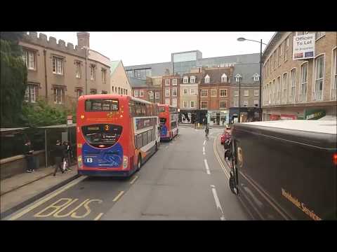
A bus trip into Cambridge City 17/10/17
A entertaining ride into Cambridge via Stagecoach and Park and Ride, on a Tuesday afternoon. We went to collect my dads car so we had to take a bus.Cambridge info:
Cambridge (/ˈkeɪmbrɪdʒ/ KAYM-brij) is a university city and the county town of Cambridgeshire, England, on the River Cam approximately 50 miles (80 km) north of London. At the United Kingdom Census 2011, its population was 123,867, including 24,488 students.
There is archaeological evidence of settlement in the area in the Bronze Age and in Roman Britain; under Viking rule, Cambridge became an important trading centre. The first town charters were granted in the 12th century, although city status was not conferred until 1951.
The University of Cambridge, founded in 1209, is one of the top five universities in the world. The university includes the Cavendish Laboratory, King's College Chapel, and the Cambridge University Library. The city's skyline is dominated by the last two buildings, along with the spire of the Our Lady and the English Martyrs Church, the chimney of Addenbrooke's Hospital and St John's College Chapel tower. Anglia Ruskin University, evolved from the Cambridge School of Art and the Cambridgeshire College of Arts and Technology, also has its main campus in the city.
Cambridge is at the heart of the high-technology Silicon Fen with industries such as software and bioscience and many start-up companies born out of the university. More than 40% of the workforce has a higher education qualification, more than twice the national average. The Cambridge Biomedical Campus, one of the largest biomedical research clusters in the world, is soon to be home to AstraZeneca, a hotel and the relocated Papworth Hospital.
Parker's Piece hosted the first ever game of Association football. The Strawberry Fair music and arts festival and Midsummer Fairs are held on Midsummer Common, and the annual Cambridge Beer Festival takes place on Jesus Green. The city is adjacent to the M11 and A14 roads, and Cambridge station is less than an hour from London King's Cross railway station.
Geography:
Cambridge is situated about 50 miles (80 km) north-by-east of London. The city is located in an area of level and relatively low-lying terrain just south of the Fens, which varies between 6 and 24 metres (20 and 79 ft) above sea level. The town was thus historically surrounded by low lying wetlands that have been drained as the town has expanded.
The underlying geology of Cambridge consists of gault clay and Chalk Marl, known locally as Cambridge Greensand, partly overlaid by terrace gravel. A layer of phosphatic nodules (coprolites) under the marl were mined in the 19th century for fertiliser. It became a major industry in the county, and its profits yielded buildings such as the Corn Exchange, Fulbourn Hospital and St. John's Chapel until the Quarries Act 1894 and competition from America ended production.
The River Cam flows through the city from the village of Grantchester, to the southwest. It is bordered by water meadows within the city such as Sheep's Green as well as residential development. Like most cities, modern-day Cambridge has many suburbs and areas of high-density housing. The city centre of Cambridge is mostly commercial, historic buildings, and large green areas such as Jesus Green, Parker's Piece and Midsummer Common. Many of the roads in the centre are pedestrianised. Population growth has seen new housing developments in the 21st century, with estates such as the CB1 and Accordia schemes near the station, and developments such as Great Kneighton, formally known as Clay Farm, and Trumpington Meadows currently under construction in the south of the city. Other major developments currently being constructed in the city are Darwin Green (formerly NIAB), and University-led developments at West Cambridge and North West Cambridge, (Eddington).
The entire city centre, as well as parts of Chesterton, Petersfield, West Cambridge, Newnham, and Abbey, are covered by an Air Quality Management Area, implemented to counter high levels of nitrogen dioxide in the atmosphere.
See more info here:

Places to see in ( Romsey - UK )
Places to see in ( Romsey - UK )Romsey is a small market town in the county of Hampshire, England. Romsey is 7 miles northwest of Southampton, 11 miles southwest of Winchester and 17 miles southeast of Salisbury. Romsey is one of the principal towns in the Test Valley Borough and lies on the River Test, which is known for fly fishing, predominantly trout. Romsey Abbey, the largest parish church in Hampshire, dominates the centre of the town.
Romsey was home of the 20th-century soldier and statesman Louis Mountbatten, 1st Earl Mountbatten of Burma, the 19th-century British prime minister Lord Palmerston, and the 17th-century philosopher and economist William Petty. Romsey is twinned with Paimpol in Brittany, France, and Battenberg, Germany.
Broadlands later became the home of Louis Mountbatten, 1st Earl Mountbatten of Burma, known locally as Lord Louis. In 1947, Mountbatten was given his earldom and the lesser title Baron Romsey, of Romsey in the County of Southampton. Queen Elizabeth II's husband, Prince Philip, was his nephew and upon Philip's marriage to Elizabeth in 1947 they departed London for their honeymoon at Broadlands.
Mountbatten was buried in Romsey Abbey after being killed in an IRA bomb explosion in Ireland on 27 August 1979. After his death his titles passed to his elder daughter, Lady Brabourne, who thus became Countess Mountbatten of Burma. Her eldest son was styled by the courtesy title Lord Romsey until he inherited the title of Lord Brabourne in 2005, and then the earldom in 2017.
Embley Park, a country estate located on the outskirts of Romsey was the home of Florence Nightingale, known for her pioneering work as a nurse and sanitary reform during the Crimean war and for laying the foundation of modern nursing. Nightingale is said to have had her calling from God whilst sitting under a giant cedar tree in the grounds of Embley Park on 7 February 1837.
Romsey Abbey is a Norman abbey, originally built during the 10th century, as part of a Benedictine foundation, housing a community of Benedictine nuns. The surviving Anglican Parish church of Romsey, now the largest parish church in the county, is the town's most outstanding feature and is open daily to visitors. King John's House & Tudor Cottage was allegedly a hunting lodge used by King John of England whilst hunting in the New Forest.
The existence of Sadler's Mill, the only mill to be developed on the main course of the River Test, is first recorded in the 16th century. The White Horse Hotel is a Grade II* listed 18th century coaching inn which now houses a 4-star hotel and brasserie owned and operated by Silks Hotels.
( Romsey - UK ) is well know as a tourist destination because of the variety of places you can enjoy while you are visiting the city of Romsey . Through a series of videos we will try to show you recommended places to visit in Romsey - UK
Join us for more :

Grace in Petersfield, the cutest town in the UK
Excuse the rambling about glitter eating..
Places to see in ( Fordingbridge - UK )
Places to see in ( Fordingbridge - UK )Fordingbridge is a town and civil parish with a population of 6,000 on the River Avon in the New Forest District of Hampshire, England, near to the Dorset and Wiltshire borders and on the edge of the New Forest. It is 81 miles (130 km) southwest of London, and 10 miles (16 km) south of the city of Salisbury. Fordingbridge is a former market town. The Avon Valley Path passes through the town.
Fordingbridge is a town and civil parish in Hampshire on the banks of the River Avon. The first Great Bridge, from which the town received its present name, was built in mediaeval times, and is upstream from the ford. The bridge is a major feature of the town with its seven graceful arches, which can be seen very easily from the town's large riverside park where one can walk along the riverbank draped with willows and waterside plants. Close by is a children's play area, secluded memorial gardens, parks and sports playing fields. A bronze statue of the painter Augustus John stands on the banks of the Avon near the Great Bridge.
Not far from the High Street is the parish church of St. Mary the Virgin which has some typical Norman characteristics. Lands in Fordingbridge and the advowson of the church were granted to King's College, Cambridge in 1447 by Henry VI, after being given to the Crown by Humphrey, Duke of Buckingham.
The Fordingbridge Museum, which houses local history exhibits, and the Visitor Information Centre are located in King's Yard. There is also a Roman villa in the nearby village of Rockbourne, which is open to visitors during the summer. The local comprehensive school is The Burgate School And Sixth Form Centre, which is situated in Burgate, a small hamlet to the north of the town. Fordingbridge Hospital is a small community hospital on the site of a Victorian workhouse. Most of the old buildings remain but the inpatient ward is a more recent addition. The town's medical centre is on the same site in Bartons Road
Since 1982 Fordingbridge has been twinned with Vimoutiers in Normandy. Fordingbridge is also home to Fordingbridge Turks FC, one of the 50 oldest football clubs in England, established circa 1868. The Turks name seems to derive from wishing to emulate the determination shown by Ottoman forces at Siege of Plevna. The recreation ground is also home to Fordingbridge Rugby Club, who have been one of the more successful Hampshire clubs in recent years.
The parish of Fordingbridge contains the hamlets of Burgate to the north, Criddlestyle to the east, Bickton to the south, and Ashford to the west. Burgate and Bickton are settlements dating back to the time of the Domesday Book, and in fact Bickton was a larger settlement than Fordingbridge in 1086. Criddlestyle is an ancient manor, also known as East Mill, with a history dating back to the 14th century. The largest hamlet today is Ashford, which was the location of an ancient watermill, and was the location of Fordingbridge railway station until it was closed in 1964.
The first bridge at Fordingbridge was built before 1252, when the bailiff and men of the town received a grant of pontage for one year towards its repairs. A custom which survived until 1840 obliged the lord of Fordingbridge during one summer month known as fence month to keep the bridge guarded and arrest anyone found taking venison from the New Forest.
( Fordingbridge - UK ) is well know as a tourist destination because of the variety of places you can enjoy while you are visiting the city of Fordingbridge . Through a series of videos we will try to show you recommended places to visit in Fordingbridge - UK
Join us for more :

Middle Littleton Tythe Barn NT 06.09.11
Middle Littleton Tythe Barn, also known as Middle Littleton Tithe Barn, is a grade I listed 12th or 13th-century tithe barn in the village of Middle Littleton, near Evesham in Worcestershire. It is one of the largest and most notable tithe barns in England. The barn is constructed of a mixture of Blue Lias and Cotswold stones, with a stone tile roof. It was originally built for Evesham Abbey, which was the third largest abbey in England. There is some uncertainty about when the barn was built. The National Trust describes it as 13th-century, whereas English Heritage describe in as 14th-century[1][2] The discrepancy may be the result of a radiocarbon date of around 1250 conflicting with evidence that the barn was built in 1376 by Abbot John Ombersley of Evesham Abbey.The barn was built to hold tithes collected for Evesham Abbey, which was the third largest abbey in England before the Dissolution of the Monasteries. The size of the barn is an indication of the importance of the abbey at this time. It is now owned and operated by the National Trust.

Places to see in ( Petworth - UK )
Places to see in ( Petworth - UK )Petworth is a small town and civil parish in the Chichester District of West Sussex, England. It is located at the junction of the A272 east-west road from Heathfield to Winchester and the A283 Milford to Shoreham-by-Sea road. Some twelve miles (21 km) to the south west of Petworth along the A285 road lies Chichester and the south-coast. The parish includes the settlements of Byworth and Hampers Green and covers an area of 2,690 hectares (6,600 acres).
The town is mentioned in Domesday Book. It is best known as the location of the stately home Petworth House, the grounds of which (known as Petworth Park) are the work of Capability Brown. The house and its grounds are now owned and maintained by the National Trust.
In the early 17th century, the question of Petworth's status as an honour or a town came up when the Attorney General charged William Levett of Petworth, Gent., son of Anthony Levett, with having unlawfully usurped divers privileges within the town of Petworth, which was parcel of the Honour of Arundel. William Levett's son Nicholas became rector of Westbourne, West Sussex.
Another historic attraction in the town, Petworth Cottage Museum in High Street, is a museum of domestic life for poor estate workers in the town in about 1910. At that time the cottage was the home of Mrs. Cummings, a seamstress, whose drunkard husband had been a farrier in the Royal Irish Hussars and on the Petworth estate. The railway line between Pulborough and Midhurst once had a station at Petworth, but the line was closed to passenger use in 1955, and finally to freight in 1966, though the station building survives as a bed and breakfast establishment.
Petworth fell victim to bombing in World War II on 29 September 1942, when a lone German Heinkel 111, approaching from the south over Hoes Farm, aimed three bombs at Petworth House. The bombs missed the house, but one bounced off a tree and landed on the Petworth Boys' School in North Street, killing 28 boys, the headmaster, Charles Stevenson, and assistant teacher Charlotte Marshall
On 20 November (St. Edmund's day) each year, the market square is closed off to traffic so that a fun fair can be held. This is the modern survival of an ancient custom. In earlier centuries the fair lasted several days and may have been wholly or partly held on a field on the south side of the town called fairfield. The London Gazette of November 1666 announced that a fair would not be held that year because of plague still infesting the county, and shows that the fair was then a nine-day event.
Local tradition tells of a lost charter for the fair, but this is myth because it was determined by travelling justices of King Edward I in 1275 that the fair, then lasting eight days, had already been in existence since time immemorial and no royal charter was needed. At that time tolls on stalls for the sale of cattle provided an income for the Lord of the Manor. The traders of Arundel claimed a right to sell their wares at the fair as Petworth was in the Honour of Arundel. In the 20th century the fair field was used for allotments, and is now housing and the Fairfield Medical Centre.
( Petworth - UK ) is well know as a tourist destination because of the variety of places you can enjoy while you are visiting Petworth . Through a series of videos we will try to show you recommended places to visit in Petworth - UK
Join us for more :
Near By Places
-
Aldershot
-
Alresford
-
Alton
-
Ampfield
-
Andover
-
Basingstoke
-
Binsted
-
Bishop's Waltham
-
Bordon
-
Calshot
-
Chalton
-
Chawton
-
Cheriton
-
Compton
-
Crondall
-
Denmead
-
Dogmersfield
-
Droxford
-
Dummer
-
Durley
-
East Meon
-
Eastleigh
-
Emsworth
-
Fareham
-
Farnborough
-
Fleet
-
Four Marks
-
Freefolk
-
Gosport
-
Hamble
-
Hambledon
-
Hannington
-
Havant
-
Hayling Island
-
Hedge End
-
Highclere
-
Hinton Ampner
-
Hook
-
Hursley
-
Hythe
-
Kingsley
-
Liphook
-
Liss
-
Marchwood
-
Mottisfont
-
Nether Wallop
-
Netley
-
New Forest National Park Hampshire
-
North Waltham
-
Northington
-
Otterbourne
-
Portchester
-
Portsmouth
-
Privett
-
Romsey
-
Rowlands Castle
-
Selborne
-
Sherfield On Loddon
-
Silchester
-
Southampton
-
Stockbridge
-
Stratfield Saye
-
Sutton Scotney
-
Swanwick
-
Tadley
-
Totton
-
Twyford
-
Vernham Dean
-
Warsash
-
Waterlooville
-
Well
-
Wickham
-
Winchester
-
Wonston
-
Yateley