This website uses cookies to ensure you get the best experience on our website. Learn more
The Best Attractions In Stevenson


Stevenson is a city in Skamania County, Washington, United States. The population was 1,465 at the 2010 census, a 22% increase over 2000. It is the county seat of Skamania County and home to the Skamania County Court House and Sheriff's Office. Stevenson is home to the Columbia Gorge Interpretive Center, which focuses on several tribes that were once located near the Columbia River.
Continue reading...
From Wikipedia, the free encyclopedia.
Continue reading...
From Wikipedia, the free encyclopedia.
The Best Attractions In Stevenson
-
1. Columbia Gorge Interpretive Center Stevenson
The Columbia River is the largest river in the Pacific Northwest region of North America. The river rises in the Rocky Mountains of British Columbia, Canada. It flows northwest and then south into the US state of Washington, then turns west to form most of the border between Washington and the state of Oregon before emptying into the Pacific Ocean. The river is 1,243 miles long, and its largest tributary is the Snake River. Its drainage basin is roughly the size of France and extends into seven US states and a Canadian province. The fourth-largest river in the United States by volume, the Columbia has the greatest flow of any North American river entering the Pacific. The Columbia and its tributaries have been central to the region's culture and economy for thousands of years. They have be...
From Wikipedia, the free encyclopedia. -
4. Lava Canyon Stevenson
Lava Beds National Monument is located in northeastern California, in Siskiyou and Modoc counties. The monument lies on the northeastern flank of Medicine Lake Volcano and has the largest total area covered by a volcano in the Cascade Range. The region in and around Lava Beds National Monument lies at the junction of the Sierra-Klamath, Cascade, and the Great Basin physiographic provinces. The monument was established as a United States National Monument on November 21, 1925, and includes more than 46,000 acres . Lava Beds National Monument has numerous lava tube caves, with 25 having marked entrances and developed trails for public access and exploration. The monument also offers trails through the high Great Basin xeric shrubland desert landscape and the volcanic field. In 1872 and 1873,...
From Wikipedia, the free encyclopedia. -
5. Mount Hood Hood River
Mount Hood, called Wy'east by the Multnomah tribe, is a potentially active stratovolcano in the Cascade Volcanic Arc of northern Oregon. It was formed by a subduction zone on the Pacific coast and rests in the Pacific Northwest region of the United States. It is located about 50 miles east-southeast of Portland, on the border between Clackamas and Hood River counties. In addition to being Oregon's highest mountain, it is one of the loftiest mountains in the nation based on its prominence. The height assigned to Mount Hood's snow-covered peak has varied over its history. Modern sources point to three different heights: 11,249 feet , a 1991 adjustment of a 1986 measurement by the U.S. National Geodetic Survey , 11,240 feet based on a 1993 scientific expedition, and 11,239 feet of slightly ol...
From Wikipedia, the free encyclopedia. -
6. Western Antique Aeroplane & Automobile Museum Hood River
The Western Antique Aeroplane and Automobile Museum is located in Hood River, Oregon, United States, adjacent to the Ken Jernstedt Memorial Airport. WAAAM is a nonprofit 501 organization committed to the preservation of, and education about aviation, automobile, and other historic transportation-related relics. WAAAM is open to the public every day 9:00-5:00 except Thanksgiving, Christmas, and New Years. WAAAM has special activities the second Saturday of every month. The museum features flying demonstrations, auto demonstrations, and restoration demonstrations, though events vary month to month. The museum's biggest event is the annual Hood River Fly-In held the first weekend after Labor Day every year, and features antique aircraft and automobiles from throughout North America. As of May...
From Wikipedia, the free encyclopedia. -
7. Multnomah Falls Bridal Veil
Multnomah Falls is a waterfall located in the Columbia River Gorge, east of Troutdale, between Corbett and Dodson, Oregon, United States. The waterfall is accessible from the Historic Columbia River Highway and Interstate 84. Spanning two tiers on basalt cliffs, it is the tallest waterfall in the state of Oregon at 620 ft in height.The land surrounding the falls was developed by Simon Benson in the early-twentieth century, with a pathway, viewing bridge, and adjacent lodge being constructed in 1925. The Multnomah Falls Lodge and the surrounding footpaths at the falls were added to the National Register of Historic Places in 1981. Contemporarily, the state of Oregon maintains a switchback trail that ascends to a talus slope 100 feet above the falls, and descends to an observation deck that ...
From Wikipedia, the free encyclopedia. -
8. Silver Falls State Park Sublimity
Silver Falls State Park is a state park in the U.S. state of Oregon, located near Silverton, about 20 miles east-southeast of Salem. It is the largest state park in Oregon with an area of more than 9,000 acres , and it includes more than 24 miles of walking trails, 14 miles of horse trails, and a 4-mile bike path. Its 8.7-mile Canyon Trail/Trail of Ten Falls runs along the banks of Silver Creek and by ten waterfalls, from which the park received its name. Four of the ten falls have an amphitheater-like surrounding that allows the trail to pass behind the flow of the falls. The Silver Falls State Park Concession Building Area and the Silver Creek Youth Camp-Silver Falls State Park are separately listed on the U.S. National Register of Historic Places. The park's most visited waterfall is So...
From Wikipedia, the free encyclopedia. -
10. Bonneville Lock & Dam Cascade Locks
Bonneville Lock and Dam consists of several run-of-the-river dam structures that together complete a span of the Columbia River between the U.S. states of Oregon and Washington at River Mile 146.1. The dam is located 40 miles east of Portland, Oregon, in the Columbia River Gorge. The primary functions of Bonneville Lock and Dam are electrical power generation and river navigation. The dam was built and is managed by the United States Army Corps of Engineers. At the time of its construction in the 1930s it was the largest water impoundment project of its type in the nation, able to withstand flooding on an unprecedented scale. Electrical power generated at Bonneville is distributed by the Bonneville Power Administration. Bonneville Lock and Dam is named for Army Capt. Benjamin Bonneville, a...
From Wikipedia, the free encyclopedia.


Stevenson Videos
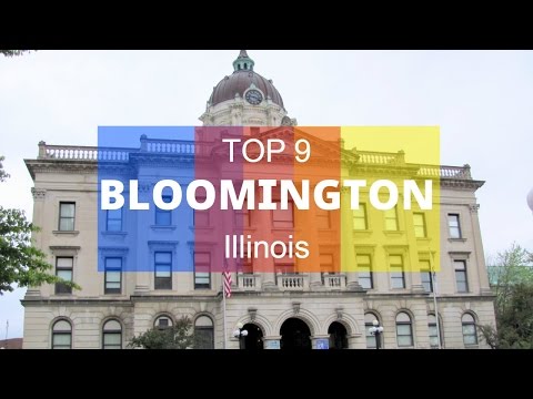
Top 9. Best Tourist Attractions in Bloomington - Illinois
Top 9. Best Tourist Attractions in Bloomington - Illinois: David Davis Mansion State Historic Site, Miller Park Zoo, Constitution Trail, McLean County Museum of History, Prairie Aviation Museum, US Cellular Coliseum, Bloomington Downtown, Eastland Mall, Ovation Carmike Theater
Amazing Camping Spots in North Dakota. TOP 17
Amazing Camping Spots in North Dakota. TOP 17: Lewis and Clark State Park, Schnell Ranch Recreation Area, Theodore Roosevelt National Park, Turtle River State Park, Fort Abraham Lincoln State Park, Beaver Lake State Park, Ft. Stevenson State Park, Icelandic State Park, Fort Ransom State Park, Lake Sakakawea State Park, Grahams Island State Park, Turtle Mountain, Cross Ranch State Park, Lake Metigoshe State Park, Harmon Lake, Pembina Gorge State Recreation Area, Lake Ashtabula
Hamilton Mountain & Rodney Falls- Hiking Washington Trails- Episode 3- Detailed Trail Review
Your video guide to the oregon outdoors.In this episode we we are headed to the Beacon Rock State Park within Washington called Hamilton Mountain. Here you will find great views of Mt Adams, Mt Hood, Columbia River Gorge, Bonneville Damn, Rodney Falls, Hardy Creek, and Hardy Falls.
This is a great place to go Camping, Backpacking, Hiking, Climbing, and much more.
Hoping each of you can get up and get out and explore this wonderful place within Washington.
Oregon Exploration is all about giving fellow hikers, fisherman, climbers, and paddlers knowledge about the variety of places within the Oregon Outdoors. We hope that with this knowledge it will allow for you to pick a place that will create a second story for years to come.

Skamania Lodge on the Columbia River Gorge
Skamania Lodge, a magnificent mountain resort nestled on 175 wooded acres, is located in the spectacular Columbia River Gorge National Scenic Area. The rustic yet elegant, grand mountain Lodge is located just 45 miles east of Portland, Oregon, on the Washington side of the Columbia River.For more information about Skamania Lodge visit

Campground Trends I've Noticed Across America
East to West. Winter v. Summer. Weekdays v. Weekends. What to expect with pricing and amenities at campgrounds across the USA.Every Sunday (WiFi permitting) Im going to be live streaming at 7:30pm PST. Come cook dinner with me and lets hang out!
Off to the next destination!
Be sure to leave a comment and tell me where you want to go next!
SUBSCRIBE AND LIKE! It helps me out a lot!!
If you’re going to dislike my videos, at least tell me how I can improve!
SOCIAL MEDIA:
Twitch Live Stream:
YouNow Live Stream:
Instagram: _vicari
Twitter: @chelseavicari
SnapChat: chelseavicari
SUPPORT THIS JOURNEY: (help keep this channel alive)
Patreon:
Cash App [Square Cash]: $ChelseaVicari
Paypal: chelseafork@gmail.com
Camera gear:
Sony a5000:
Flexible Tripod:
DJI Phantom Drone:
GoPro Hero 3:
Zhiyun Crane Stabilizing Gimble:

Colonial Estate with Amazing Lake Views in Minnetonka Beach, Minnesota
Presented by Lakes Sotheby's International RealtyFor more information go to
Spectacular Colonial estate in Minnetonka Beach on a 1.35 acre site. Amazing views with 160 ft of lakeshore. The park like landscape has a perfect elevation to maximize the panoramic views from the English Gardens and expansive bluestone patio. Custom millwork and stone craftsmanship throughout the house. This home features grand interiors with full height windows and soaring ceilings offering unparalleled lake views from each room. Memories will be made for years to come.
Property ID: 5V86MV

Hood River & Cascade Locks Oregon
Strolling Through Oregon At Sunset -- Hood River, OregonGTA Trucking Adventures
September 2016
#TeamDriving

Driving across Bridge of the Gods, Cascade Locks, Oregon
Driving across the Columbia River on the Bridge of the Gods, Cascade Locks, Oregon.
President Trump Thursday Night Prime Time Trivia!
President Trump Thursday Night Prime Time Trivia! Who had the most votes for President ever in the USA! Tell me the all time leaders in the Electoral College vote. Name the winners of the Emmy Award for best comedy series from 1978 to 2017.Here are a few items to get for the perfect cruise:
Perfect Cruise Ship Power Strip
Towel Clips for pool deck
Packing Cube Set
Waterproof Cell Phone Case
Join me live Monday to Friday at 5pm et plus Saturday at 2pm et. We talk about cruise ships and cruise vacations, deals, updates and news. It's a live Q and A fun free for all show!
Support my channel today visit Amazon from this link
Please support my channel today stop by and visit my new online store on RedBubble!
Please visit my new Travelling with Bruce Store get yourself some cool swag!
Send me a message at brucefrommert@hotmail.com
Support my Youtube channel. Buy any item or items from Amazon by using the link below. Thank you, Bruce
Amazon link
DISCLAIMER: This video and description contains an affiliate link or links, which means that if you click and purchase one of the product links, I’ll receive a small commission. This helps support the channel and allows me to continue to make videos like this. Thank you for the support! Bruce
Near By Places
-
Airway Heights
-
Allyn
-
Ashford
-
Bainbridge Island
-
Battle Ground
-
Belfair
-
Bellevue
-
Bellingham
-
Benton City
-
Bingen
-
Birch Bay
-
Blaine
-
Bothell
-
Bow
-
Bremerton
-
Brinnon
-
Burien
-
Camano Island
-
Camas
-
Carnation
-
Cashmere
-
Cathlamet
-
Chehalis
-
Chelan
-
Cheney
-
Chewelah
-
Chimacum
-
Clallam Bay
-
Clarkston
-
Cle Elum
-
Colbert
-
Colville
-
Concrete
-
Coulee City
-
Coulee Dam
-
Dallesport
-
Des Moines
-
Dupont
-
East Wenatchee
-
Easton
-
Eatonville
-
Edmonds
-
Elbe
-
Electric City
-
Ellensburg
-
Enumclaw
-
Everson
-
Fall City
-
Federal Way
-
Fidalgo Island
-
Forks
-
George
-
Gig Harbor
-
Glacier
-
Glenoma
-
Gold Bar
-
Goldendale
-
Granite Falls
-
Grayland
-
Greater Seattle
-
Hansville
-
Hoodsport
-
Hoquiam
-
Ilwaco
-
Index
-
Issaquah
-
Kalama
-
Kenmore
-
Keyport
-
Kirkland
-
La Conner
-
La Push
-
Lacey
-
Lake Forest Park
-
Lake Stevens
-
Lakebay
-
Lakewood
-
Leavenworth
-
Liberty Lake
-
Long Beach
-
Lowden
-
Lyle
-
Lynden
-
Lynnwood
-
Manson
-
Maple Valley
-
Marblemount
-
Marrowstone Island
-
Mazama
-
Mead
-
Mercer Island
-
Metaline Falls
-
Moclips
-
Monitor
-
Montesano
-
Moses Lake
-
Mossyrock
-
Mount Rainier National Park
-
Mountlake Terrace
-
Mukilteo
-
Naches
-
Naselle
-
Neah Bay
-
Nine Mile Falls
-
North Bend
-
North Bonneville
-
North Cascades
-
North Cascades National Park
-
North Central Washington
-
Northeast Washington
-
Ocean Park
-
Ocean Shores
-
Okanogan
-
Olympia
-
Olympic National Park
-
Orondo
-
Oysterville
-
Pacific Beach
-
Packwood
-
Pateros
-
Paterson
-
Peninsulas & Coast
-
Peshastin
-
Point Roberts
-
Port Angeles
-
Port Gamble
-
Port Ludlow
-
Port Orchard
-
Port Townsend
-
Poulsbo
-
Prosser
-
Pullman
-
Puyallup
-
Quinault
-
Raymond
-
Renton
-
Republic
-
Ridgefield
-
Ritzville
-
San Juan Islands
-
Seabeck
-
SeaTac
-
Seattle
-
Sequim
-
Shelton
-
Shoreline
-
Silver Creek
-
Silverdale
-
Silverlake
-
Skykomish
-
Snohomish
-
Snoqualmie
-
Snoqualmie Pass
-
Soap Lake
-
South Bend
-
Southeast Washington
-
Spokane
-
Spokane Valley
-
Sprague
-
Stanwood
-
Stehekin
-
Steptoe
-
Suquamish
-
Tacoma
-
Tenino
-
The Gorge
-
The Islands of Washington State
-
The Volcanoes
-
Thorp
-
Tokeland
-
Toppenish
-
Toutle
-
Tri-Cities
-
Trout Lake
-
Tukwila
-
Tumwater
-
Twisp
-
University Place
-
Vancouver
-
Vantage
-
Vashon
-
Walla Walla
-
Wapato
-
Washougal
-
Washtucna
-
Wenatchee
-
Whidbey Island
-
White Pass
-
White Salmon
-
Wine Country
-
Winthrop
-
Wishram
-
Woodinville
-
Yacolt
-
Yakima
-
Yakima Valley
-
Yelm
-
Zillah