This website uses cookies to ensure you get the best experience on our website. Learn more
The Best Attractions In Tadworth


Tadworth is a large suburban village in Surrey in the south-east of the Epsom Downs, part of the North Downs. It forms part of the Borough of Reigate and Banstead. At the 2001 census Tadworth had a population of 9,522.
Continue reading...
From Wikipedia, the free encyclopedia.
Continue reading...
From Wikipedia, the free encyclopedia.
The Best Attractions In Tadworth
-
1. Walton Heath Golf Club Tadworth
Walton-on-the-Hill, Surrey, is a village in England midway between the market towns of Reigate and Epsom. The village is a dispersed cluster on the North Downs centred less than one mile inside of the M25 motorway. The village hosts world-famous Walton Heath Golf Club, whose former members include King Edward VIII, Winston Churchill and David Lloyd George.
From Wikipedia, the free encyclopedia. -
3. Chessington World of Adventures Resort Chessington
Chessington World of Adventures Resort is a Theme Park, Zoo and Hotel Complex in Chessington, Greater London, England, around 12 miles southwest of Central London. The complex opened as Chessington Zoo in 1931, with the theme park being developed alongside the zoo by The Tussauds Group and opening on 7 July 1987, as one of the first themed amusement parks in Britain. The theme park, which features over 40 rides, is now owned by Merlin Entertainments, following its merger with The Tussauds Group in 2007. Under Merlin, Chessington has been increasingly developed into a resort tourist destination, including two on-site hotels, a high ropes course and camp site. Chessington Zoo has over 1,000 animals, including western lowland gorillas, sea lions, and Sumatran tigers. It is split up into sever...
From Wikipedia, the free encyclopedia. -
 4. Hawk Conservancy Trust Weyhill
The Hawk Conservancy Trust is a bird park and conservation charity that cares for and displays birds of prey. It is located in Weyhill, Hampshire, England, near to the A303 road and the town of Andover. Founded as a zoo by local farmer Reg Smith and his wife Hilary, the park was incorporated as the Hawk Conservancy Trust in 2002. It is also the site of the National Bird of Prey Hospital, a veterinary hospital that takes in injured birds of prey.
From Wikipedia, the free encyclopedia. -
5. Hampton Court Palace East Molesey
Hampton Court Palace is a royal palace in the borough of Richmond upon Thames, 11.7 miles south west and upstream of central London on the River Thames. Building of the palace began in 1515 for Cardinal Thomas Wolsey, a favourite of King Henry VIII. In 1529, as Wolsey fell from favour, the cardinal gave the palace to the King to check his disgrace; Henry VIII later enlarged it. Along with St James's Palace, it is one of only two surviving palaces out of the many owned by King Henry VIII. In the following century, King William III's massive rebuilding and expansion work, which was intended to rival Versailles, destroyed much of the Tudor palace. Work ceased in 1694, leaving the palace in two distinct contrasting architectural styles, domestic Tudor and Baroque. While the palace's styles are...
From Wikipedia, the free encyclopedia. -
6. Stonehenge Amesbury
Stonehenge is a prehistoric monument in Wiltshire, England, 2 miles west of Amesbury. It consists of a ring of standing stones, with each standing stone around 13 feet high, 7 feet wide and weighing around 25 tons. The stones are set within earthworks in the middle of the most dense complex of Neolithic and Bronze Age monuments in England, including several hundred burial mounds.Archaeologists believe it was constructed from 3000 BC to 2000 BC. The surrounding circular earth bank and ditch, which constitute the earliest phase of the monument, have been dated to about 3100 BC. Radiocarbon dating suggests that the first bluestones were raised between 2400 and 2200 BC, although they may have been at the site as early as 3000 BC.One of the most famous landmarks in the United Kingdom, Stoneheng...
From Wikipedia, the free encyclopedia. -
7. Blenheim Palace Woodstock
Blenheim & Woodstock was a railway station constructed in the neoclassical style which served the town of Woodstock and Blenheim Palace in the English county of Oxfordshire. The station, as well as the line, was constructed by the Duke of Marlborough and was privately run until 1897 when it became part of the Great Western Railway. The number of trains serving the station was cut in the late 1930s, and again in 1952 down to only six trains a day. The last train ran on 27 February 1954 adorned with a wreath. The station building was initially converted into a garage and petrol station. Then the forecourt of the site was no longer used as a petrol station, but for used car sales only with a building company using some of the land behind the station. There were proposals for demolishing the b...
From Wikipedia, the free encyclopedia. -
8. THORPE PARK Resort Chertsey
Thorpe Park is a theme park located between the towns of Chertsey and Staines-upon-Thames in Surrey. It is operated and owned by Merlin Entertainments. After demolition of the Thorpe Park Estate in the 1930s, the site became a gravel pit. Thorpe Park Resort was built in the 1970s on the gravel pit which was partially flooded, creating a water-based theme for the park. This essentially allows guests to view the park as an island, which is where the park's current island like no other slogan originates from. It was officially opened to the public by Lord Louis Mountbatten in 1979. It has since grown into one of the major theme parks in the UK and now also features a hotel. Major attractions include a large water ride Tidal Wave, a number of rollercoasters including Colossus, Nemesis Inferno,...
From Wikipedia, the free encyclopedia.


Tadworth Videos

Places to see in ( Banstead - UK )
Places to see in ( Banstead - UK )Banstead is a residential town/village in the borough of Reigate and Banstead in Surrey, England, on the border with London, 2.5 miles south of Sutton, 5 miles west of Croydon and 7.5 miles southeast of Kingston-upon-Thames and 13.3 miles (21 km) south of Central London. The county town, Guildford is 17 miles (27 km) west southwest.
On the North Downs, Banstead is on three of the four main compass points separated from other settlements by open area buffers with Metropolitan Green Belt status. Echoing its much larger historic area and spread between newer developments, Banstead Downs is a Site of Special Scientific Interest (SSSI). Regarding its town status, Banstead has never had the right to a regular (traditional) market; however it forms a post town.
Supporting interpretation as a village, one of its wards currently used is Banstead Village. The ecclesiastical parish was abolished when its Urban District was created. Both included many outlying parts not only the part currently still associated heavily with today's village, contiguous Nork which contains Banstead station, is dependent on the amenities of Banstead and is included in for example county-level population analyses of Banstead.
Non-commercial in most areas of the economy, the nearest industrial or business areas are in the three more remote, urban towns above, as well as the closer Reigate-Redhill conurbation to the south, Sutton and Cheam to the north and Epsom, Leatherhead and Worcester Park to the west.
The earliest recorded mention of Banstead was in an Anglo-Saxon charter of AD 967, in the reign of King Edgar. The settlement appears in the Domesday Book (1086) as Benestede. The first element is probably the Anglo Saxon word bene, meaning bean, and the second element stede refers to an inhabited place without town status (cf farmstead). Banstead's non-ecclesiastical land and 50 households were held by Richard as tenant-in-chief, under the Bishop of Bayeux. Its assets were: 9½ hides, 1 church, 1 mill worth £1, 17 ploughs, woodland worth 20 hogs. It rendered (in total): £8 per year.
This was a farming area that later became well known for its high quality wool. The manor was owned by increasingly wealthy gentry, then by the church, before it fell into the hands of the Crown in the 13th century; Edward I visited more than once. Henry VIII made Banstead part of Catherine of Aragon's dowry, but took it away again and gave it to a court favourite, Sir Nicholas Carew. Carew was later beheaded for treason, but the manor, once covering most of the village but mostly sold piecemeal, stayed in his family until the 18th century.
Banstead Downs, which for many centuries meant all the open land stretching from Epsom to Croydon and Reigate, became well known for horse racing in the 17th century. On 20 November 1683, King Charles II and the Duke of York attended a race meeting near the core of the village. The town also gained a reputation as a health resort during that era, becoming famous for its wholesome air, and London physicians recommended a visit to Banstead to their ailing patients.
The majority of the town is bypassed by the A217 dual carriageway to the west. The A2022 passes through the residential area just to the north of the town centre, however the town centre frequently suffers from traffic congestion. There are several bus services through the town, linking to Epsom, Sutton and Croydon, which all have good onward bus and rail connections. Banstead railway station is to the west of the town's centre, across the A217. It is within Nork ward rather than Banstead ward. This was to increase Nork's negligible geographic area to roughly equalise the populations thus enabling an equal number of three councillors for each ward.
The old village well stands to the east of the town centre in Woodmansterne Lane. It is almost 300 feet (90 m) deep and was last used around the end of the 19th century. The wellhead cover dates from the 18th century and still contains the winding gear. Nork Park contains the remains of the Colman family mansion (associated with Colman's Mustard). Many apple trees survive from the original orchard. A large mound off The Drive, close to the Beacon School, is known as the Tumble Beacon.
( Banstead - UK ) is well know as a tourist destination because of the variety of places you can enjoy while you are visiting Banstead . Through a series of videos we will try to show you recommended places to visit in Banstead - UK
Join us for more :
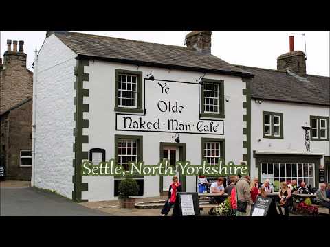
Settle, North Yorkshire
A short walk around the market town of Settle. The visit coincided with the annual Flowerpot festival held during July and August, when the town is decorated with various displays made out of flowerpots. How many can you see.
SWC Free Walk 139, Tadworth via Headley Heath and Box Hill Circular.16/9/12.
A zone 6 walk in Surrey of around 13 miles and costing the princely sum of £3 return!Starting out from Tadworth station, and with no actual walk instructions to follow, the walker navigates (such skills and a compass definitely needed on this walk! Adds to the excitement...) out of the town and into the open countryside, soon passing under the M25, and then into the village of Headley. Soon after, the walk crosses The National Trust's Headley Heath, a fine mix of heathland, woodland and chalk downland, with some great views. There's an option to climb White Hill, but this wasn't possible today due to the walker getting way-laid by an 'incident' near High Ashurst Outdoor Centre...
There's a climb to more fine views from Juniper Top prior to more forest walking for lunch at Box Hill.
After lunch, this walker chose to follow the North Downs Way (replicating Box Hill Circular Walk for a while), bypassing Box Hill village, all the way to Buckland Quarry/Hills. Thereafter, it's back over the M25, on to Walton Heath and its golf course before retracing steps over the common at Tadworth and back to the station.
A lovely walk on the fringes of London, though taking a little longer to reach than some other zone 6 walks. Surprisingly rural for the location.
As it currently stands, this 'map walk' definitely requires navigation skills; the presence of an outdoor centre in the forest is no coincidence...

#33 Walking Walton-on-the-Hill & Headley
While taking in a 4 Mile Walk between the Villages of Walton-on-the-Heath and Headley in Surrey, I also give a test run for my new GoPro Hero 6 Black. Please forgive some of the sound issues as at time of filming, I was still waiting for the adaptor jack to plug in the external mic which wasn't an issue on the GoPro Hero 4 Black but still, the GoPro 6 is a great camera to have with excellent stabilisation.Recorded - Monday 25th June 2018
--------------------------------------------------
Please Connect:
TWITER:
TWITER:
INSTAGRAM:
IMDB:
My Other YOUTUBE Channels:
MEV PRODUCTIONS:
SPIRAL PARANORMAL:
--------------------------------------------------
#Walking #Vlog #Countryside

The black country in the Snow 18th december 2010 Dudley BW version
black and white version of the snow on the 18 december 2010 in the town of Dudley, West Midlands. possible the deepest snow the area has had in 25 years, 10 - 12 cm deep and still i havent seen a snowman this year.you may tell that , ive tried to recreate the classic retrospective documentry style of the 1940's and 1960's in look and sound. which makes the place look rather depressing. too which many of the residents of the town would agree, the place is depressing. There is also a colour version. If you prefer watch this video in colour.
Thank you for watching
the Black Country Stalker. and please comment

Surrey under snow 2, 30.11.2010, Irani
Snow Caused by Atmospheric Traffic Jam, Epsom-Ashtead-UK
SWC Free Walk 138, Chilham Circular. 9/2/13.
This delightful 9.7 miler on the Kentish Downs incorporates a variety of scenery and provided welcome respite from muddier, lower level walks recently, though the brown stuff wasn't completely absent today.Shortly after leaving the station and crossing over The Stour, there's a steady ascent across fields and then along field margins, flitting between The Stour Valley Walk and other paths.
There's a nice section of woodland walking in Eggringe Wood, one of the muddier sections of the walk, before descending for a possible lunch break at the Sole Street hostelry, which was closed today. This walker chose to refuel with some delightful views across the Crundale Downs.
Refreshed, there's another section of woodland walking prior to a descent into Eggarton, and so on to Godmersham Park, the former home of Jane Austen's brother, Edward.
The finale is a walk across fields and then along a quiet B road into the pretty village of Chilham, with its Tudor buildings and stately home.
(The tit seen just prior to lunch is believed to be a Marsh, and not a Willow, though they are difficult to separate).
Near By Places
-
Addlestone
-
Albury
-
Ashtead
-
Bagshot
-
Banstead
-
Bletchingley
-
Brookwood
-
Busbridge
-
Camberley
-
Carshalton
-
Caterham
-
Chaldon
-
Chertsey
-
Chessington
-
Chobham
-
Cobham
-
Cranleigh
-
Dorking
-
Dormansland
-
Dunsfold
-
East Horsley
-
East Molesey
-
Egham
-
Englefield Green
-
Epsom
-
Esher
-
Farnham
-
Frensham
-
Frimley
-
Frimley Green
-
Godalming
-
Godstone
-
Grayshott
-
Great Bookham
-
Guildford
-
Hascombe
-
Haslemere
-
Headley
-
Hersham
-
Hindhead
-
Horley
-
Kingswood
-
Leatherhead
-
Lingfield
-
Long Ditton
-
Merstham
-
Milford
-
Mytchett
-
Newchapel
-
Norwood Hill
-
Nutfield
-
Ockley
-
Oxshott
-
Oxted
-
Pirbright
-
Redhill
-
Reigate
-
Shepperton
-
Staines
-
Sunbury-On-Thames
-
Tatsfield
-
Thames Ditton
-
Thursley
-
Tolworth
-
Tongham
-
Virginia Water
-
Walton-On-Thames
-
Warlingham
-
West Byfleet
-
West Horsley
-
West Molesey
-
Weybridge
-
Windlesham
-
Wisley
-
Woking
-
Woldingham