This website uses cookies to ensure you get the best experience on our website. Learn more
The Best Attractions In West Lorne


West Elgin is a municipality in Elgin County, Ontario, Canada. The township was created on January 1, 1998, through the amalgamation of the former township of Aldborough with the village of West Lorne.
Continue reading...
From Wikipedia, the free encyclopedia.
Continue reading...
From Wikipedia, the free encyclopedia.
The Best Attractions In West Lorne
-
2. Pinery Provincial Park Grand Bend
Pinery Provincial Park is a provincial park located on Lake Huron near Grand Bend, Ontario. It occupies an area of 25.32 square kilometres . It is a natural environment-class Provincial Park created to help preserve oak savannah and the beach dune ecology. It has 1,275 sites of which 404 have electrical hookups. These include the Yurt camping area and the group camping sites. The initial package of land for the park was purchased from the Canada Company in 1957. In 1966, the park saw a 433-acre addition, adding 200 campsites to the park's existing 1,075 to accommodate the growth of the park patronage, which had reached peaks of 1,500 campers per day, causing many to be packed into overflow areas. Visitors to Pinery Provincial Park may access free wireless internet at the Visitor Centre pro...
From Wikipedia, the free encyclopedia. -
3. Point Pelee National Park Leamington
Point Pelee National Park is a national park in Essex County in southwestern Ontario, Canada where it extends into Lake Erie. The word pelée is French for 'bald'. Point Pelee consists of a peninsula of land, mainly of marsh and woodland habitats, that tapers to a sharp point as it extends into Lake Erie. Middle Island, also part of Point Pelee National Park, was acquired in 2000 and is just north of the Canada–United States border in Lake Erie. Point Pelee is the southernmost point of mainland Canada, and is located on a foundation of glacial sand, silt and gravel that bites into Lake Erie. This spit of land is slightly more than seven kilometres long by 4.5 kilometres wide at its northern base. Established in 1918, Point Pelee was the first national park in Canada to be established for...
From Wikipedia, the free encyclopedia. -
4. Grand Bend Beach Grand Bend
Grand Bend is a community located on the shores of Lake Huron in Southwestern Ontario, Canada. It is part of the Municipality of Lambton Shores in Lambton County.
From Wikipedia, the free encyclopedia. -
7. Grand River Rafting Company Paris
The Grand Tour is a British motoring television series for Amazon Video, presented by Jeremy Clarkson, Richard Hammond, and James May, and produced by Andy Wilman.The four agreed to produce the series following their departures from the BBC series Top Gear with an initial agreement of 36 episodes over three years. Episodes are released weekly to those with Amazon Prime Video accounts, repeats of the first series began airing on traditional broadcasters in late 2017. As of December 2016 the show was made available to an additional 195 countries and various territories. Studio audience segments for the first series were filmed in the travelling tent between 17 July and 11 December 2016 in various countries, while for the second series the tent was stationed permanently in the Cotswolds. Seri...
From Wikipedia, the free encyclopedia.


West Lorne Videos

Sauble Falls to Kincardine - Ontario Bike Tour #2 - Day 6 of 10
This video summarizes Day 6 of my 10 day solo bicycle trip along the shores of Lake Simcoe and Lake Huron in Southern Ontario, Canada. All of the clips in the video were filmed on Wednesday July 25, 2018.In this video I mentioned my 2014 bike tour of the Bruce Peninsula. Unfortunately I don't have videos from that trip, however I have a photo album on my website which describes it in pretty good detail:
Starting from Sauble Falls Provincial Park I rode west on Sauble Falls Rd which changes names to Lakeshore Blvd at Lake Huron and took me into Sauble Beach. Sauble Beach is the second longest freshwater beach in Canada. When I reached Shore Rd, I jogged over to 2nd Ave S and continued south following the shoreline. Eventually this road merges with County Rd 13 which is a busy road with a bike lane. This land is all owned by the Saugeen First Nation. Eventually I turned right onto Eckford Ave, Blanchfield Rd, and Shore Rd. I briefly rode west along South Rankin St and then crossed the Saugeen River on Albert St. This brought me into the community of Southampton which is part of the municipality known as Saugeen Shores. Just off the shore of South Hampton theres an Island called Chantry Island. I made a right when I got to High St and then turned left at Huron St. This street eventually changes names to Miramichi Bay Rd and North Shore Rd. There are also sections of this route where there is a nice shoreline multi-use trail which I used. Eventually I reached the harbour of Port Elgin, where I headed inland along Market St to Goderich St. I stopped for a quick breakfast/lunch at JC's Just Good Food and also visited the Port Elgin Farmer's Market. I continued riding south along Goderich St out of Port Elgin until I reached concession rd 4 where I headed west. I turned onto Lake Range Rd which took me past MacGregor Point Provincial Park. When I reached Concession Rd 8 I jogged west and continued SW on B&C Side Rd. I again jogged west at Bruce Rd 33 and continued on Tie Rd which took me past the Bruce Nuclear Generating Station. From there I followed Concession Rd 2, Albert Rd, Victoria St, Upper Lorne Beach Rd and Bruce County Road 23 (B Line) into the town of Kincardine. Within Kincardine I explored SW along Queen St to Queen's Lookout, then up Durham Market Street to Princes Street. Next I rode down to the lake along Harbour St past Walker House and the Kincardine Lighthouse and out onto the north pier.
Strava for Day 6:
The bike I used for this trip is a New York made Linear Recumbent Bike which I believe is from around 2004. I carried my gear in 2 Giant Waterproof Panniers, and mounted my tent and sleeping pad on the top of the rack.
For more details about my gear check out this video:
I hope you enjoyed this video. Please COMMENT and subscribe!
Thanks for watching.

West Lorne Ontario, Canada - At the 2011 Catus, Cattle and Cowboys Day
Cactus, Cattle and Cowboys Festival in West Lorne Ontario Canada on June 16th 2011
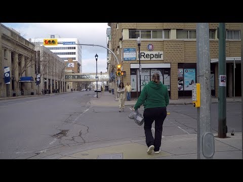
Walking in Regina Canada. City Life in Saskatchewan's Capital. Walk to Downtown Area.
You can sense that we are in the capital of Saskatchewan from the beginning of the video. Regina has a population of a bit under 200,000.Music by Free Jazz Vancouver (Mark Quigley & Michael Quigley).
Walking in Downtown REGINA Canada. City Life. Saskatchewan's Capital City.
Walking in certain parts of downtown in Regina Saskatchewan can feel a bit lonely. Our starting point is at City Hall. I liked the big steel-wireish elephant at 3:56. All cities need art.Music by Mark Quigley.

Life is Beautiful in Elgin County Ontario
A place where kilometres of pristine shorelines meet soft sandy beaches, rolling country hills, lush green forest trails, and picturesque towns and villages. Life is undeniably beautiful in Elgin County Ontario.
Summer Adventures - Travel Alberta, Canada
Create your own authentic experience in Alberta. From aerial tours to rodeos, waterfall hikes to music festivals, summer offers endless possibilities.For more information about things to do in Alberta visit:
Artist: Andrea Wettstein

City of Surrey, Vancouver British Columbia in Canada
City of Surrey, The City of Surrey, British Columbia
West Coast of Vancouver Island, Ucluelet BC
Ucluelet is located at the western edge of Barkley Sound, 288 kilometres northwest of the British Columbia provincial capital, Victoria, on the outer west coast of Vancouver Island.The closest city is Port Alberni approximately 100 km to the east. The District of Tofino is 40 km northwest of Ucluelet on Highway 4.
In between Tofino and Ucluelet is the Long Beach unit of the Pacific Rim National Park Reserve. Barkley Sound lies southeast of Ucluelet and is a marine area that features the Broken Islands Group unit of the Pacific Rim National Park Reserve. The fishing and scientific research community of Bamfield lies on its farther shore.

Driving in Regina Canada. Saskatchewan Province. Strip Malls on Albert Street.
Regina in the province of Saskatchewan has some of the most impressive pot holes I've driven on in my life.Music by Free Jazz Vancouver (Mark Quigley & Michael Quigley).

Cleveland Dam Recreation area, a great excursion
Cleveland Dam Park is really wonderful excursion. The Park is just past the Capilano Suspension Bridge, so if you're heading that way, do yourself a favor and stop by the park. The view is excellent from the dam with plenty of hiking and exploration. Distributed by Tubemogul.Near By Places
-
Ajax
-
Alexandria
-
Algonquin Highlands
-
Algonquin Park Region
-
Algonquin Provincial Park
-
Alvinston
-
Amherstburg
-
Angus
-
Armstrong Station
-
Arnprior
-
Atikokan
-
Aurora
-
Aylmer
-
Balderson
-
Bancroft
-
Barrie
-
Barry's Bay
-
Bay of Quinte
-
Bayham
-
Beachville
-
Beaverton
-
Belleville
-
Blandford-Blenheim
-
Bonnechere
-
Borden
-
Bourget
-
Bowmanville
-
Bradford West Gwillimbury
-
Brampton
-
Brantford
-
Brighton
-
Brockville
-
Bruce County
-
Burlington
-
Calabogie
-
Caledon
-
Caledonia
-
Camlachie
-
Carleton Place
-
Casselman
-
Castleton
-
Cayuga
-
Centre Wellington
-
Chatham-Kent
-
Clearview Township
-
Cobourg
-
Colborne
-
Coldwater
-
Collingwood
-
Combermere
-
Cornwall
-
Courtice
-
Curran
-
Deep River
-
Deseronto
-
Douro-Dummer
-
Drayton
-
Dunnville
-
Duntroon
-
Dunvegan
-
East Gwillimbury
-
East Hawkesbury
-
Eganville
-
Embrun
-
Emo
-
Enniskillen
-
Erin
-
Essex
-
Fisherville
-
Fort Erie
-
Fort Frances
-
Gananoque
-
Georgian Bay
-
Georgina
-
Geraldton
-
Godfrey
-
Grafton
-
Grand Valley
-
Greenbank
-
Grey County
-
Grimsby
-
Guelph
-
Haliburton
-
Halton Hills
-
Hamilton
-
Harcourt
-
Havelock
-
Hawkesbury
-
Highlands East
-
Horseshoe Valley
-
Huron County
-
Ingersoll
-
Ingleside
-
Innerkip
-
Innisfil
-
Iroquois
-
Janetville
-
Jarvis
-
Kakabeka Falls
-
Kawartha Lakes
-
Kendal
-
Kenora District
-
Kettleby
-
King City
-
Kingston
-
Kingsville
-
Lake St. Peter
-
Lakeshore
-
Lambton Shores
-
Lanark
-
Lancaster
-
Lansdowne
-
LaSalle
-
Leamington
-
Lennox and Addington County
-
Lincoln
-
Listowel
-
London
-
Long Sault
-
Lucan
-
Maberly
-
Madoc
-
Maitland
-
Mallorytown
-
Manilla
-
Mansfield
-
Markham
-
Marmora
-
Maynooth
-
McDonald's Corners
-
Merrickville
-
Middlesex Centre
-
Midland
-
Millbrook
-
Milton
-
Minden
-
Minto
-
Mississauga
-
Mississippi Mills
-
Mitchell
-
Mono
-
Mooretown
-
Moraviantown
-
Morrisburg
-
Morriston
-
Mount Brydges
-
Mount Forest
-
Mulmur
-
Municipality of Trent Lakes
-
Muskoka District
-
Nakina
-
New Tecumseth
-
Newcastle
-
Newmarket
-
Niagara Falls
-
Niagara-on-the-Lake
-
Nobleton
-
Norfolk County
-
North Frontenac
-
North Grenville
-
North Kawartha
-
North Seguin
-
North Stormont
-
Northeastern Ontario
-
Norwood
-
Oakville
-
Ohsweken
-
Oil Springs
-
Ontario's Highlands
-
Ontario's Thousand Islands
-
Orangeville
-
Orillia
-
Ormsby
-
Oro Station
-
Oro-Medonte
-
Orono
-
Oshawa
-
Otonabee-South Monaghan
-
Ottawa
-
Otterville
-
Oxtongue Lake
-
Paris
-
Parkhill
-
Pelee Island
-
Pelham
-
Pembroke
-
Penetanguishene
-
Perth
-
Petawawa
-
Peterborough
-
Petrolia
-
Pickering
-
Plantagenet
-
Point Edward
-
Port Colborne
-
Port Elmsley
-
Port Hope
-
Port McNicoll
-
Port Perry
-
Port Stanley
-
Prescott
-
Prince Edward County
-
Puslinch
-
Putnam
-
Quinte West
-
Rainy River
-
Rama
-
Red Rock
-
Region of Waterloo
-
Renfrew
-
Richmond Hill
-
Rideau Lakes
-
Rockland
-
Rockport
-
Rockwood
-
Rosemont
-
Roseneath
-
Rossport
-
Russell
-
Saint Anns
-
Saint Thomas
-
Sarnia
-
Schomberg
-
Scotland
-
Seagrave
-
Seeley's Bay
-
Selwyn Township
-
Severn
-
Severn Bridge
-
Shakespeare
-
Shannonville
-
Sharbot Lake
-
Shelburne
-
Singhampton
-
Smiths Falls
-
Sombra
-
South Frontenac
-
Sparta
-
Spencerville
-
Springfield
-
Springwater
-
St-Albert
-
St. Catharines
-
St. Marys
-
Stirling
-
Stonecliffe
-
Stratford
-
Strathroy
-
Talbotville
-
Tecumseh
-
The Great Waterway
-
Thorndale
-
Thornton
-
Thorold
-
Thunder Bay District
-
Tillsonburg
-
Tiny
-
Toronto
-
Township of Whitewater Region
-
Trent Hills
-
Tweed
-
Uxbridge
-
Vankleek Hill
-
Vaughan
-
Victoria Harbour
-
Wainfleet
-
Wallacetown
-
Wardsville
-
Wasaga Beach
-
Washago
-
Waubaushene
-
Welland
-
Wellandport
-
Wendover
-
Whitby
-
Whitchurch-Stouffville
-
Whitney
-
Williamstown
-
Winchester
-
Windsor
-
Wolfe Island
-
Woodstock